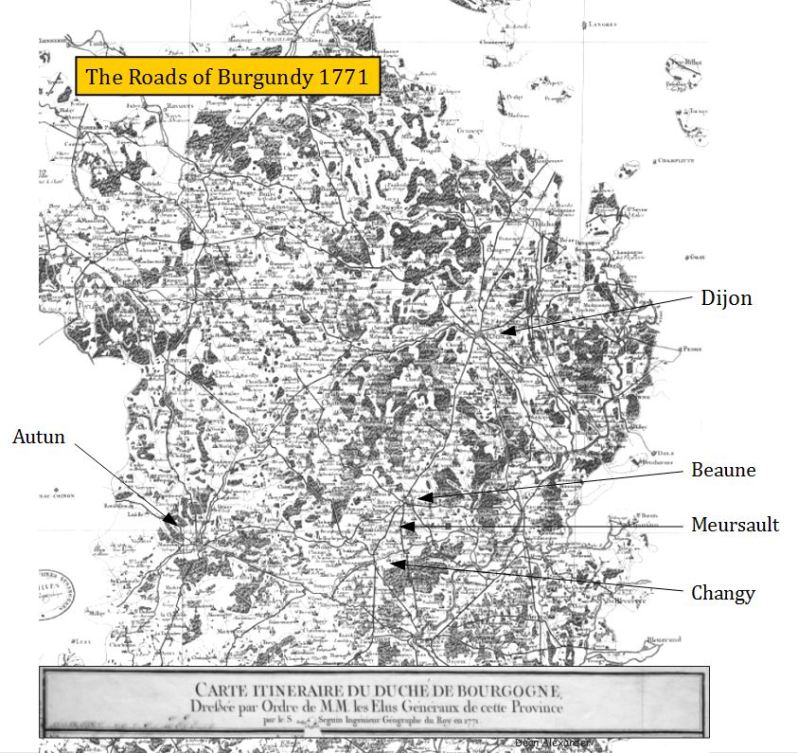
Today I found a map of the roads of Burgundy that was produced by the order of the élus of the etats généraux of Burgundy in 1771. Presumably this was done once they felt their road construction had been finally completed. Considering that it commenced in 1715, this was a very long process. As roads were to be built through a region, the peasants of that area were ordered to report for corvée, and provide their labor freely. This as I wrote in the article which can be read here, this tremendous suffering among the peasantry, which included most of those who farmed plots of vines on the Côte-d’Or.
Most of the names of villages and cities are illegible. So I have labeled the ones the few that I could make out. By manipulating the contrast and brightness, the roads however are somewhat easier to see. You can click to enlarge this image.
The roads across Burgundy in 1771. The map, which is labeled as “Carte itinéraire du duché de Bourgogne” is held by the National Library of France
In the early years of the 18th century, France would commence building a system of a national highway system, which when finished over a half a century later, would be the finest in Europe. The province of Burgundy had been at the vanguard of these road building efforts and quickly found reward for its efforts, in the vastly improved connectivity with other economies across northern Europe. It was not long before commissioned agents, known as “voyageurs”, were canvassing Europe for willing markets for Burgundy’s finest product, wine. Then, with contracts in hand, caravans of wagons were dispatched on road from Dijon, heavily loaded with casks of wine from negotiants cellars. Some of these caravans went westward to Paris, but many made their way north, either to trading ports along the Atlantic, or turning eastward toward the hungry German markets. On their return trip to Burgundy, the wagons came back loaded with all manner of goods, notably “fabrics, canvas, and cash” (Bazin 2002). As the reputation of Burgundian wine grew, so did both the wine’s value and almost overnight, fortunes were made.
There was a darker backdrop to this story, however. Despite the tremendous benefit these roads provided to the region, their construction had come at a heavy cost the peasantry. These farmers, both men, and women were pulled from their fields and vineyards, often during the critical times of planting and harvest, and forced build these roads without recompense. This duty, which was employed through much of the 18th century, was known as corvée royale; and it’s implementation caused tremendous hardship and widespread resentment within the peasantry. For some Burgundian peasantry, this resentment may have been short-lived, as the increased trade made the wine they produced far more valuable. This was especially true if their plot happened to in a famed vineyard or village. With such luck, their fortune, and future of their families may have changed completely. Others, however, were not so positively affected. If they did not farm grapes, or their plots were in lesser areas, their lives continued to be difficult. Most critically, with the coming revolution, it was these peasants whose future in Burgundy would become less secure. This begins the modern era of the Burgundian winemaker.
Nation-building 1715-1743
Once the nobles had finally submitted to the absolutist rule of the king, the stage was at long last set for the first major road building effort since the Romans had subjugated Gaul. But unlike the road constructed by the Romans, these roads would be designed for the connectivity of France, not to link a conquered province to the conqueror’s empire. The development of this highway system was such a key step in the nation building of France, that historian Julian Swann would write that its completion was to be King Louis XV’s greatest achievement (Swann 2003). While Louis XV was certainly was on board in completing this project, by 1757 he was spending 7 million livres (7 million pounds of silver) on road and bridge construction (Sée 1927), it could be argued that Swann may have mislaid credit for the highway system at the feet of young Louis.
The passing of the torch: the regency and the minority of Louis XV
Louis XIV in 1701by Hyacinthe Rigaud in the Louvre Museum
Kingship had passed from the 77-year-old Louis XIV (who had outlived both his son, as well as his grandson), to his 5-year-old great-grandson. Having inherited the throne himself while a young child, Louis was keen to the challenges his great-grandson would face.
Nearing his death, Louis XIV would name his nephew, Philippe II, who was the duc d’Orléans, to be regent. The regency was a position with king-like powers, charged with the duty of administering and safeguarding the kingdom until the young monarch would be old enough to reign himself. This was slated to occur in seven years time, in February of 1723, when Louis would turn 13.
Around this same period, the aging king would also choose André-Hercule de Fleury, the 67-year-old the bishop of Fréjus, to be his great-grandson’s tutor. Although the word tutor today would seem to be beneath the position of a nobleman and bishop, this was a very important position. His job would be to mentor and prepare the young prince to rule a powerful European power, and this could only be done by someone who knew something about leadership, law, and the politics of the royal court.
These two men, both handpicked by Louis XVI, would in their turn, administer the French State for the next twenty-five years. During this quarter century, France would become an even greater power on the world stage.
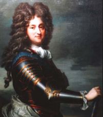
Philippe II, duc d’Orleans
Initially, the duc d’Orléans betrayed the trust that King Louis XIV had placed in naming him, by attempting to temper the absolutist state. Philippe II reversed several edicts such as noble’s the right of remonstrance which allowed the nobility to challenge and delay decrees of the crown. But more importantly, he replaced state ministers with councils made up of nobles, in a system referred to as Polysynody. By 1718, however, it had become clear that the Polysynody was mired by the conflicting interests between the various powerful ducs and comtés on the council, not to mention clashes of their egos. It also became apparent that the noble’s deep-seated self-interest, often, if not typically, overrode the interests of the nation. And as a final coup de grace, rampant absenteeism by nobles on the council, stymied its ability to function. After three years, Philippe II had come to accept that the councils consisting of noblemen, had been a failure, and in 1718 he restored the ministerial system which he had inherited.
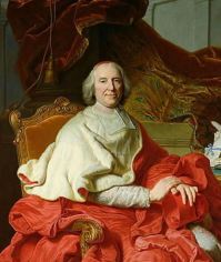
Cardinal André-Hercule de Fleury
In 1723, when Louis XV had gained his “legal majority” at age 13 and was now officially the reigning king, and unsurprisingly, he had little interest in politics. He desired that the duc to remain as regent, and although the duc did remain in the position, he would die that December, at the age of 49. With the position of first minister vacant, Louis would appoint Louis-Henri, duc de Bourbon-Condé to this role, but after three years he would replace him with his trusted tutor, André Hercule de Fleury, the bishop of Fréjus, to act essentially as his regent. Although a nobleman, and in a high position in the clergy, Hercule’s borne position was not equal to the others in the royal council. To balance this inequality, Louis XV, would make Hercule a cardinal 1726. Additionally, Louis appointed him as first minister, a title that Hercule would not use. Much like the strong hands of the cardinals Richelieu and Mazarin, before him, Andre-Hercule provided stable, authoritarian rule over France until his death in 1743 at age 90. It would not be until 1743 that Louis XV would truly assume the role of king.
Forced labor of the peasantry and road building
The influential French political writer, Alexis-Charles-Henri Clérel de Tocqueville (1805-1859), wrote at length about the corvée in his book L’Ancien Régime et la Révolution.* He wrote that before the death of Louis XIV, the roadswere either maintained by the state, or by the nobles whose estates the roads passed through. This meant, by any true measure, that the roads were virtually not maintained at all. “Around this time,” de Tocqueville penned, the roads “began to be repaired with the aid of the corvée alone, that is, at the sole expense of the peasantry.” De Tocqueville lays this application of the corvée, utilizing the forced labor of the peasantry, in order to build the roads, at the feet of Controller-General Philibert Orry. In 1737, claimed de Tocqueville, Orry applied the corvée “to all of France”.** To better frame this statement, however, it is well documented that it was Jean-Baptiste Colbert who first enlisted the peasantry for the corvéeroyale in the mid-1600’s.
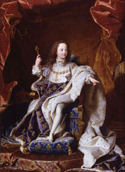
Les Jeune Roi, Louis XV
It must be assumed, however, that the plans to expand the road system had already been laid out Louis XIV ministers, since it was in 1715, the year that the king died, that the élus of Burgundy*** had already commenced their road construction in Burgundy (Swann 2003). The budget at that time was 60,000 livres per year, but these funds would prove to be enough since it would only need to cover the cost of the construction materials because by utilizing the corvée royale, labor would be essentially free. This construction apparently continued despite the ministerial shake-ups in Versailles, that occurred during the first years of Philippe II’s regency. The Burgundians must have been particularly motivated, as they appear to have led road building efforts in France by perhaps as much as two decades. Indeed, Voltaire wrote in 1751 before the construction, that “the high roads were almost impassable.” For the landlocked economy of Burgundy, it was realized that prosperity could only come to the region if far better roads could be built.
An increase in trade commenced almost immediately, if the establishment of the first wine trading firms in 1720 (M. Marey and Champy) were any indication. Encouraged by this success, the élus had continued to increase investments into provincial roads and bridge construction until it had reached 100,000 livres per year in 1757 (Swann 2003). Whether they had been pressured to make the road improvements by Versailles, as Swann writes, or they self-motivated, as I believe, the élus had thrown the weight of the provincial government into the project.
(*) It is important to note that de Tocqueville’s writings about the ancien régime were neatly colored by the intellectual thought and politics of his time, as well as by his own innovative thoughts and perceptions. As indicated by his noble title, (de Tocqueville is his title, not his name) he was of an old Norman family of noblesse d’épée, which escaped the guillotine by escaping to England. The family returned to France with the reign ofNapoléon and was restored to their nobility under the Bourbon restoration. That said, he despised the return of France to a monarchy, in which a Bourbon king was restored to the throne for 18 years, between 1830 and 1848.
(**) Jean-Baptiste Colbert, King Louis XIV’s Minister of Finance, was actually the first minister to institute the corvée royal in the mid-1600’s, although it was only implemented to build roads within central France and did not extend to any of the provinces.
(***) the élus were the full-time council which governed the province (pays d’état) of Burgundy, following guidance outlined by sessions of the états généraux. The états généraux was the convening of representatives of the three ‘estates’: the nobility, the clergy, and the commoners (commoner representatives were most likely comprised of the bourgeoisie).
Subverting the intention of the corvée
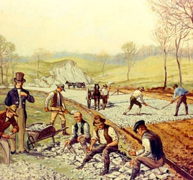
This painting depicts macadamized road construction which would not come until later in the early to mid-1800’s.
The corvée had begun as part of the feudal seigneurial tenure agreement, which required the peasant to perform a certain number of hours of corvée per year. While many are quick to say this work was given without receiving pay, in actuality, it was a payment by the peasant, to the seigneur, for the ongoing possession of the plot that they farmed. The corvée was initiated to maintain the lord’s communal properties, however large. These included roads, bridges, churches, ditches for water runoff, all which might be wiped away by a storm or had simply been degraded by the passing of years.
In earlier times, security was a very important aspect of the seigneurial agreement and the through the corvée, the peasants maintained the stronghold (castles/chateau or other fortifications) while it was the lord, and his nobles, whose profession was soldiering, did the actual fighting.
In times of danger, be it from mercenaries or other invaders, the local population could retreat within the walls of the chateau, where the lord would protect them. There, a store of wheat would be kept, and the lord’s ovens would produce bread for those that he protected. As such, the seigneur held rights to possess ovens (often referred to as four banal ovens), and the lord charged banalités for their use. The same held true for wine presses and grist mills, which only the lord had a right to own; there were banalités for their use as well. The lords often provided the horses, or oxen, as well as plows which made farming more efficient, for it was in the interest of both parties that production is as high as possible. Without the seigneur’s investment in these items, most peasants could never have afforded them.* There was a mutual dependence of noble and peasant, for one could not exist without the other, and as such, the ancient compact between noble and peasant continued for centuries. The peasants would farm the land with the materials provided by the seigneur, and it was the noble’s responsibility would protect and secure his realm, and his people. As such, the use of corvée in France was generally rare and light, when compared to corvées elsewhere in the world, such as Germany. (de Tocqueville 1851)
As the security of France was slowly assured by the end of the 1600’s, it is easy to see how, slowly over time, the corvée morphed into more of a civic duty, as an obligation of the village had as a whole. Although in name these were the lord’s lands, they were in actuality became the village commons. At some point, the villages became what is termed as having “corporate” identities, owned communal lands, and could be sued in judicial courts. There was a real sense that the villagers were “in it together”(Sée 1927).
(*) There is an indication in de Tocqueville’s writings in “The Old Régime and the Revolution”, that wealthier commoners, who did not fall into one of the many exemptions, may have been allowed to send their horses and oxen to work in their place. Exact details of this are not clear.
The birth of the corvée royale
Ancient Regime- the three estates. Political cartoon 1789
So, when Jean-Baptiste Colbert, King Louis XIV’s Minister of Finance, initially confiscated the corvée for national projects in the mid-1600’s, it was a true perversion of seigneurial dues. It is ironic, that by this time, the seigneurialcorvée was now rarely exploited by the nobility in the 18th century (de Tocqueville 1851). It wasn’t long into the 18th century that Controller-General Philibert Orry, whose position as bâtiments du roi (“the king’s buildings”) expanded the corvée from exclusively road building to a wide array of government projects. After 1737, it was used for many military and state constructions, as well as the most hated duty of providing the transport of military goods and supplies particularly in wartime (de Tocqueville 1851). This duty required the use of personal oxen and horses, no doubt many of which were maimed or died on the road. This work was paid for but at impossibly inadequate rates. (Carlyle 1902)
The greatest resentment came from the timing of this backbreaking and often dangerous work, which was typically conducted in the spring and fall, avoiding the heavier summer rains, coinciding precisely with the times necessary to plant and harvest (Swann 2002).
The consequence of refusing to work the royal corvée was arrest. And, according to de Tocqueville, the peasantry was constantly being arrested for various reasons: “due to the corvée, the militia, begging, crime, a thousand other circumstances.” “Armed with the right to imprison recalcitrants at will, or send marshals to fetch them.” (de Tocqueville 1851 p.186) authorities implemented a harsh rule over the people. That said, the governmental infrastructure was limited in size, so controlling the populace was a bit like “whac-a-mole”, and insurrections and riots were rampant.
Note: It is important to understand when reading de Tocqueville however that he had a particular liberal ax to grind when writing about society. Regardless whether what he says is true or not, his bias can be seen in the following two sentences: De Tocqueville wrote that the ‘intendants’* found it “useful to refuse to employ peasants in repairing the roads of their own villages, in order that they be reserved for only the great highways…” and then de Tocqueville comments that was a “strange idea that it was suitable to have the poorest, and those who were least likely to travel, pay for the roads, this idea, even though novel, entrenched itself so naturally in the minds of those who benefited from it, that soon they could no longer be done any differently.”
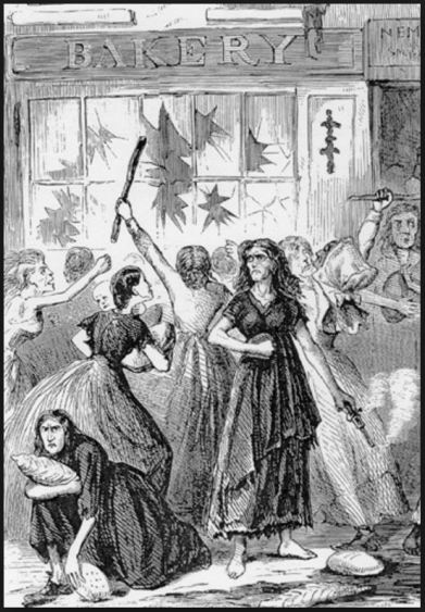
The economic impact of corvée, and the food riots 1693-1853
Food Riots 18th Century France
France, being an agricultural economy, must have acutely felt the burden of this demand upon its peasantry. There is some corollary evidence of this. It is written that the corvée left peasants unable to plant or harvest crops, which may have regionally affected the food supply, and the price of food. There is little doubt this affected the future ability of individual farmers to buy seed, pay the tithe, pay tailles (taxes), to buy wood for heating over the winter, and to feed their families. It is not clear that the corvée was widespread enough to impact the price of grain and other foods to rise, but all through this period there were widespread “food riots”.
The economic numbers do not support a correlation between the food riots and high food prices at a national level (Rotberg 2000), so we might also assume there was not a correlation between the corvée and high food prices. However, there may well have been regional price fluctuations that were behind the riots, and there may have been a correlation between the regional application of the corvée and the food riots. While this is unknowable given the incomplete information available now, over 250 years later, we do know there was tremendous resentment surrounding the corvée, and there were riots relating to food scarcity during the same period.
These riots were short in duration, but they did involve large numbers of people (Rotberg 2000). Each event was unique, and not organized, or part of a collective conscience. Each riot, depending on the region, seems to have consisted of a homogeneous segment of France’s most impoverished societies, the agricultural peasantry in some riots, and urban poor, or the industrial workers, in others. One such instance occurred along the Saône and in Macon in 1709, when peasants forced grain shipments to be halted.** In Troyes in 1740, (in the Champagne region just north of the Burgundy border), 600-700 industrial workers protesting thebailliof the bailiff (a bailiff was essentially a sheriff) for the lack of bread. After protesting, the workers invaded houses suspected of containing grain (Bouton 1993). Roteberg lists that food riots occurred in the following years: 1693/94, 1698, 1709/10, 1725, 1739/40, 1749, 1752, 1768, 1770, 1775 (the year of theFlour War), 1788/89, 1793, 1799, and these continued on through half of the 19th century until the last occurred in 1853/54.
Historian Daniel Roche wrote that the intendant ofDauphineremarked at the time, most disorders began with “the people’s misery” (Roche 1998). In earlier times, these riots were flamed by the nobility to attempt to shake the authority of the king. But after the death of Louis the XIV, the nobles were no longer involved in such subversion. Now the “diffuse, sporadic, and scattered protest movements erupted in the rural areas, less often, in the cites” (Roche 1998). You may notice this observation is slightly at odds with Bouton, who wrote of various segments of the poor participated in each individual riot, but it is clear that unlike the rebellions fermented by the nobility against the crown (usuallyabout taxes – Roche 1998), uprisings would now comprise solely the poor, that as Roche notes, are best explained by social class distinctions.
This might be interpreted as that the feudal relationship between the noble and the peasant had broken down. Previously, the noble provided security, land and equipment for a peasantry who provided labor. As the nobles contribution lessened, because the security element had been eliminated, there was now an inequity within this relationship. The nobility was now living off of the peasantry, yet contributing virtually nothing to the peasantry in return.
(**) It is notable that the food riots of winter of 1709/10, was the year following “The Great Winter” of 1708/1709 where the average temperature rested at 9 degrees below zero for weeks, and there were tremendous crop failures across Europe. These food riots occurred after a more normal harvest.
Protecting the taille and addressing the burden of the corvée
Riots and unrest, as well as the constant application of the corvée, alldiminished constant flow of tailles (taxes) into the king’s treasury. It is easy to see that there was a constant balancing act that the intendants must have had to address, as the application of the corvée directly lessened the amount of taxes that could be collected. From de Tocqueville: “In 1751 a receiver was apprehensive lest “the expense to which the peasantry was put for the repairs of the roads, would incapacitate them from paying the taille.” Throughout this time period, the intendants will be seen, repeatedly, standing against nobility for the rights of the commoner, referring cases to judicial courts (known as during the ancien régimeas parlements) (Root 1992).
Political Cartoon, France Late 18th Century
Behind the scenes, the motivation began with preserving the revenue stream to the king, but one senses that the intendants, truly felt an obligation of fairness and good governance. An example of this comes from intendant Monsieur Ducluzel, of Tours (240 km southwest of Paris). In defending his decade-long disregard of the Minister of Marine’s demands for peasant labor, Ducluzel wrote in December of 1775, that he defied the requests based on the abuses of the corvée, to both men and animals. The conditions of the work that such corvée involved can be garnered from this snippet of his letter:“the cattle are often lamed by drawing heavy logs over roads as bad as the weather in which this service is usually required of them.” (de Tocqueville 1851)
There were those in Burgundy’s provincial assembly (the États-Généraux) whowere not unaware, or unsympathetic to the abuses of the corvée. In 1739, after many years of heavy corvée implementation, there were finally calls in by assembly members to limit the number of days worked and exemptions during periods where planting and harvest were taking place (Swann 2002). Swann writes that one alcade, (a mayor with judicial powers), advanced the need to “lighten a yolk that the peoples…find extremely difficult to support.” The weight of the alcade’s statement, was biblical, referring to Kings 12.4 “Your father made our yoke heavy. Now, therefore, lighten the hard service of your father and his heavy yoke on us, and we will serve you.” * Given the deeply devout culture of the French at that time, and that a third of the États-Généraux was made up of the clergy, there is no doubt that these words resonated with many members of the assembly. What is not clear to what effect these efforts to reform the estates corvée requirements were successful. In either case, the need for the heavy use of forced labor subsided after the roadways had been completed (Swann 2003).
But despite these efforts by some to reform the corvée, it is notable that the corvée still was in place in Burgundy in 1769. This 54 year period represents two full generations of the peasantry who had been conscripted to labor upon the province’s roads. It is clear that there was a real division of opinions regarding the use of the corvée, with impassioned critics referring to it as “a real evil in itself.” Some suggested that a system of payment should be instituted, as it had been in other provinces such as Limoges,** Swann writes that “the reaction was at best lukewarm”.
(*) here from the King James bible, although the French during that period were likely using the Port Royal bible)
(**) It is important to note that some regions never adopted the corvée, but used contractors to perform the labor. Languedoc (where there was already a history of agrarian revolt) and Limoges are two such examples.
Attempted reforms to the corvée under Louis XVI 1774-1789
There were those who fought to end the corvée system, such as the intendant of Limoges, Anne-Robert-Jacques Turgot. Turgot held the powerful position of contrôleur général under the newly crowned king, Louis XVI, from 1774 to 1776. Among his more innovative, even revolutionary programs, he had attempted to end the corvée, as well as suggesting the abolition of privilege. Needless to say, both of which were vehemently opposed by the majority of the nobility. The radical nature Turgot’s proposals are attested to by the brevity of his tenure. However, Turgot’s ideas would persist and flourish among the intelligentsia in this Age of Enlightenment and spread among the bourgeoisie. Toward the end of the decade, these ideas would be addressed again by the King and his ministers.
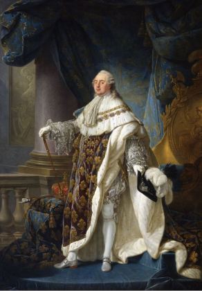
Antoine-François Callet – Louis XVI, roi de France et de Navarre (1754-1793), revêtu du grand costume royal en 1779: Source Wikipedia
In 1779, king Louis XVI would, in response to calls from the bourgeoisie “capitalists, merchants, manufacturers, and other businessmen or financiers” who were “…resolutely bent on reform” (de Tocqueville 1851), make a grand suggestion that he would lessen the load of the royal corvée on the peasantry. This was le Siècle des Lumières, and repression was to be scorned; thus Louis XVI, the final Bourbon to sit on the throne, would seemingly loosen the yoke of the peasantry. The king would make this speech announcing the end of the corvée.
“With the exception of a few provinces (pays d’états), nearly all the roads of the kingdom have been made gratuitously by the poorest portion of our subjects. The whole burden has fallen upon those who have no property but their labor, and whose interest in the roads is very slender; the landowners, who are really interested in the matter—for their property increases in value in proportion to the improvement in the roads—are privileged exempts. By compelling the poor to keep the roads in repair, to give their time and their labor for nothing, we have deprived them of their only safeguard against poverty and hunger, in order to make them toil for the benefit of the rich.” King Louis XVI, 1779
This great pronouncement amounted to little more than lip service, however. A few months later, writes de Tocqueville, the corvée was resumed. The nobility and the monarchy had work that needed to be done, and they couldn’t imagine another way to achieve it (de Tocqueville 1851). As such, in most of the country, the corvée labored on until the revolution began in 1789.
Conclusion
For some peasants who were fortunate enough to have tenant plots in top crus in Burgundy, the trade expansion that these new roads provided had brought an unforeseen prosperity. This money allowed them to take on plots from other peasants who were struggling, and to hire day laborers. In this way, the peasant could manage far more acreage than they could farm alone. As their wealth and position increased, these peasants were known as fermiers (farmers), which had a strong affinity to the traditional French gentleman’s position which had long been the sole position of the seigneur, the lord. This was an unheard of time of economic mobility in Burgundy, with this rudimentary capitalization occurring in the fields. Additionally, new faces were appearing on the Cote, as exceptionally wealthy bourgeoisie from Dijon and Paris were beginning to purchase valuable vineyard plots in the Côte-d’Or. These two groups, along with the nobility which would either survive the revolution or gain nobility after the revolution, would form the basis of the families who farm the vineyards of Burgundy today.
But for other peasants, whose backbreaking work built the “highways” of France, received little, if any benefit from the highways. They did not travel, and their Gamay, or wines from lesser known appellations, did not fetch the kind of money as those that farmed a plot of Chambertin, or Volnay, which was gaining in popularity and value as their fame spread across Europe. These peasants would find that neither their fortunes, nor their future would improve, and most would eventually lose their small holdings once the security of the seigneurial tenure was broken by the coming revolution.
(*) The états généraux was the provincial convention of representatives from the three estates, the nobility, the clergy, and the commoners (who were typically bourgeoisie) which every three years convened to debate the direction of Burgundy for the following three years. The élus was appointed council tasked to fulfill the administration of those goals. There were two other important positions to be cognoscente of, the Governor of the province who was always a great lord, and as well there was the intendant, who was a royal civil servant. Both of which were royally appointed. The governor lived at Versailles, always courting the favor of the king for personal and provincial business, while the intendant lived in the province, in this case, Dijon, and ensured the province was run in the interest of the king, reviewing court cases, tax collection, as well as regional and municipal issues.
The Old Regime and the Revolution, Alexis de Tocqueville, trans John Bonner (New York: Harper & Brothers, 1856) Modern Translator: George Gerald Reisman
The Works of Voltaire, Vol. XII (Age of Louis XIV) Voltaire, (1751)
Social Mobility and Modernization: A Journal of Interdisciplinary History Reader, Robert I. RotbergMIT Press, 2000
The Flour War: Gender, Class, and Community in Late Ancien Régime French Society, Cynthia Bouton, Penn State Press, 1993
Peasants and King in Burgundy: Agrarian Foundations of French Absolutism, Hilton Root, University of California Press, 1992
The French Revolution: A History in Three Parts I. The Bastille; II. The Constitution; III. The Guillotine, Volume 1, Thomas Carlyle G.P. Putnam, 1902
France in the EnlightenmentDaniel RocheHarvard University Press, 1998
Throughout history, the four departments of Burgundy have existed in various states geographical isolation; partitioned from western France, by the mountain ranges of the Central Massif and the Morvan. For twelve centuries, only three woefully inadequate roads linked Burgundy to western France, and those, having been built by the Romans in around the year 20 BC, were in a state of disintegration. Whether lost to flooding or landslide, or its materials having been scavenged for new construction, in places, these roads ceased to exist altogether. Travel to and from Burgundy became increasingly slow, difficult, and dangerous.
This road system was never intended to support an independent France, and as such, their route selection, and the intellectual philosophy behind their design were ill-suited for reliance that the Gauls would place upon them. Each aspect of their design would leave a lasting impact on the of future development of trade, communication, and ultimately the economy of France. This underdeveloped and crumbling infrastructure would leave Burgundy in a state of quasi-isolation, forcing it to develop independently for centuries, and delay the unification for France for a millennium.
To some readers, this ancient topic will seem unimportant, and seemingly unrelated to winemakers of today, but the geopolitical separation of Burgundy from central France was quite significant on both a regional and national level, and significantly shaped the identity of the winemakers of the 18th and 19th century. For the wine scholar, these are roads less traveled.
(*) This is true of the areas of the Rhone Valley and Provence as well.
Haut-Folin is tallest of the Morvan’s three highest peaks, at 902 meters. Against this backdrop, only a few poor roads penetrated the densely wooded Morvan Massif. Lying directly between Paris and Beaune, the Morvan is a northern extension of the Central Massif. Although not terribly tall at its peak 900 meters, the 70 kilometers long Morvan has a 35 kilometers girth, which provided more than enough deterrent to easy trade and travel to or from western France. photo: Wikipedia
Natural trade barriers: massifs, and valleys
While good roads and bridges cut with seeming ease through these regions today, the Central Massif and the Morvan, divided eastern and western France for centuries. Moving northward along the backside of the 1020 kilometer long Central Massif, sits Lyon; and just beyond the city, as the northern tip of the Central Massif falls away, a gap between the mountains develops before Morvan rises up again in the north. Because this area is hilly, defined its boundaries is not straight forward but is the gap is a fairly wide area of at least 50 to 75 square kilometers, .
Militarily, these are the kinds of gaps that armies seek to strike their enemy, but in the past two thousand years, no major advances seemed to have launched by any army through this gap. Why was this? A possible explanation is that this gap is covered by irregular hills and multi-directional valleys, through which the headwaters of the Loire and other rivers form. Many of these headwaters are rivers in their own right, including the Allier, Arroux, Dore, Loire, Nievre, and Sioule Rivers, and each would have created their own fording challenges. Secondly, the valleys may have been swampy until they were drained in the late 18th and early 19th centuries. This would have made the movement of equipment substantially difficult.
Northward from this gap, one will encounter the heavily wooded hills of Morvan Massif. This too stood as yet another obstacle to travel. Although the total elevation of the Morvan is not overly high, with its highest peaks being roughly 1000 meters, it can be rugged, densely wooded, and has an imposing breadth of 35 kilometers. Along the eastern foothills of the Morvan, is where the vineyards of the Côte d’Or are located.
For a more than twelve hundred years, since the times of Roman Gaul, the road system of France decayed more than it improved. The major routes remained those of Roman origin. It wasn’t until the early 1700’s, that road construction was given any priority, and that the natural barriers of trade to the west were finally lifted.
Via Agrippa: the first well-established roads in Eastern France
The first Roman routes, out of simplicity, skirted the Central Massif. To the Massif’s south, the road hugged the Mediterranean coastline as it moves westward. At Arelate (Arles), which became an important Roman port and trading city, the Via Domita ran toward the Iberian Penisula, where it met with the Via Aquitania, which drove northwest toward Burdigala (Bordeaux) on the Atlantic coast. To move northward from Arelate, the road system of the Via Agrippa began. Constructed for movement of legions to conqueror and control the unsettled regions east of the Central Massif, Roman leaders decided to establishLugdunum (Lyon) as the hub of the expansive Via Agrippa road network. Archaeologists Ulrich Erdmann writes that the “geography of Burgundy was advantageous to the development of a strong infrastructure with busy roads from Lyon, the capital of the province, to Paris and the Channel ports, and to the Rhine.” (Ulrich Erdmann 2004) Because of this well-constructed road system, this was certainly the case during Roman times. And much later, the better sections of the road would continue to serve the basic economic needs of the region, right up until the revolution.
The Rise of Lugdunum
That the Roman engineers decided that Via Agrippa shouldradiate from Lugdunum (Lyon), made the city a very important trading hub. Lyon would link Rome to nearly all of its European provinces, including those in Switzerland, Germany, Northern France, as well as being the most direct route to its most far-flung northern European possessions,including the Netherlands, Belgium, and Britain. It is important to note, that the decision to choose Lyon as the hub of this road system, would impact Burgundy for centuries after the fall of Rome. This road was economic thoroughfare Burgundy would require to maintain its independence over such a long period of time.
In the best of conditions, trade in ancient times was slow, moving at the pace of a draft horse under a heavy load. Couriers and unburdened travelers and may have moved more swiftly, but these long distances required patience. To ease these troubles, Romans built small, well-appointed towns along the route to act as rest stations along the way, catering to the needs of the well-heeled traveler, and others.
Roman Gaul was generally peaceful and stable for centuries, and in fact, legions were generally not stationed there after 15 BC. (Woolf 2000) Around 300 years after Gaul’s submission to Rome, every freeman of Gaul was offered citizenship (212 AD). This was not a special dispensation since it was granted to all lands within the empire, but Gaul was widely considered to be the most acquiescent and accepting of Roman rule.(Erdmann 2004)
The most important route, at least in regards to Burgundy’s connectivity to the rest of Europe, was the main, north-south artery of the Via Agrippa. This road headed north to Dijon, through Langres, and ultimately to the port city of Cologne on the Belgian coast. This was the road which would become instrumental in Burgundy’s wine trade, forever onward.
Peutinger map: the only map of the Roman roads in Gaul
The conclusion that Lyon-Cologne was the most vital route is based partially on the fact that this road is one we know the most about. It appears far more frequently in literature than any of the other Burgundian roads, and that is true of writings from antiquity, until well after the French revolution. This repeated appearance in writings may have to do with its being the road to Langres, which even today remains an important religious center. Langres had the distinction of being the seat of the Bishop of Roman Catholic church, as well as home to several Catholic religious orders. But this road also appears often this road as a major trading artery. That this can not be said about any other regional road, leads one to draw the conclusion that it was the primary route in and out of Burgundy. We might also assume it was the best-maintained road within Burgundy.
Two other, presumably importantroads headed directly westward from Lyon. The first was a route that zigzagged over barren sections the Massif. This spur of the Via Agrippa eventually made its way to Clermont-Ferrand on the reverse side of the Central Massif, then ultimately on to Saintes in southwestern France. This route has been somewhat chronicled over the past two thousand years, but principally as part of the pilgrimage of le Chemin Saint-Jacques. Little of this Roman roadway remains, and its exact route is uncertain. A second spur of the Via Agrippa departed westward from Chalon. This route is referred to as the Lyon-Boulogne, although once it arrives in the Loire Valley it bifurcated, with one branch heading to Saintes, and the other to Boulogne. Unfortunately, we know very little about its route, as much of its roadway has been lost. Over the centuries, the stone, and other road building materials were removed for other uses, and dirt has covered much of the rest. Additionally, little is written about the Lyon-Boulogne, andmostour knowledge regarding its existence comes from an ancient Roman map which was discovered in a library in Wormes, Germany in the late 1400’s.
Roman route selection
Since this road traveled through a forest, the high, raised roadway was likely built as a defensive platform to help legionnaires defend against ambush. This raised roadway would give a stretched out column of soldiers a chance to survive against a more concentrated force attacking from their flank.
Roman roads were as part of a larger military conquest strategy. As such, upland routes were chosen for the defensive advantage hills provided, and whenever possible track was selected which were devoid of forestation. Roman columns traveling along these routes were more able to repulse attacks where sight lines were longer. Along these highland routes, way stations were situated on hilltops, as they were far easier to defend.
Conversely, Roman roads avoided valleys, and dense forests, (Planhol, Claval 1994) as both of these terrains presented a tactical disadvantage of not being able to bring the “cohorts to bear.” (Heather 2010) While these overland routes provided security for columns of soldiers and their baggage trains, these overland Roman military roads may have proved difficult enough to deter less disciplined travelers.
But avoiding forested routes may have been more challenging than one might imagine. While today one fifth of France is timber land, consisting of roughly 25% oak trees, when Caesar arrived with his legions in Gaul in 58 BC, it is estimated that two-thirds of France were covered in forests, primarily of oak trees interspersed with thickets. (Thirgood 1971) Wide belts of sacred forests created the natural “frontier zones” which separated the various Gaulish tribes, which only the Druids were allowed to enter. According to J. V. Thirgood, a professor of forestry at the University of British Columbia, the forests held a “psychological dread” for the legionnaires, involving forest warfare and mysticism.
Building roads in Britain, artist unknown, 1956
Additionally, the need to find solid ground upon which to build roads was of equal importance. Before the construction of drainage systems, provided by the construction of France’s innumerable canals (ie. Canaldu Centre opened in 1792), many of France’s valleys and plains were riddled with marshes. (Grabmayer 2009) This may have made these valley areas between the larger Loire and Saône Valleys unsuited for road construction, not to mention it was likely to have been covered in dense forests. Further, the many rivers that traverse the region would have required the construction several of large and costly bridges.
As much as road construction’s primary purpose was to allow Rome to project its power, its ability to facilitate trade was an expected byproduct of great importance. The roads were an artery of wealth, raw materials, and other valuables, which would economically feed Rome. Both legions and merchants traversed the roads from Gaul to the Italian peninsula, carrying with them all manner of treasure and goods.Caravans were loaded with from gold and silver to less glamorous ores such as lead and tin. They were loaded prized wines from Burgundy which were said to rival the best of the legendary Falernian wines, as well as casks (a Gallic invention) of wine the Rhone, as well as material goods, such prized Samian pottery. There was also a significant movement of grain, which included wheat, barley, and rye, all being transported from France to the Apennine peninsula.
Confusingly, the generic word for ‘grain’ in Latin the is the word “corn”. However, because in English “corn” only refers the vegetable which is indigenous the Americas, some writers have mistakenly understood that corn was grown in Gaul, and traded to the Romans. It obviously was not, since it was not ‘discovered’ by Europeans until sometime after 1492.
Roads dictated by geometrical theorem
Ordered, but inefficient for trade?
Examples of calculating distances by triangulation and Thales Theorem as used by the Romans. Drawings: Giovanni Pomodoro 1603
Historian Greg Woolf, argues that efficiency and connectivity of these roads were undermined by the Roman’s limited geographical knowledge of France, and that centering its hub on the city of Ludunum (Lyon) was somewhat arbitrary. (Woolf 2000)
This may have been true, but there was at least one other factor at play: the Roman ideology that the intellect must triumph over the random vagaries of nature. As such, the incorporation of Euclidean and Pythagorean theories was widely employed in many aspects of Roman construction, including roads.
Pythagorean theories were widely employed in many aspects of Roman construction.
The Roman designers conceptualized their roads as a Euclidean geometric equation: thus a road was “a surface is that which has length and breadth only”. The design of any “solid“, is matrix of point, line, and surface, and differs significantly the “solid” object it represents. (de Laguna 1922) Whatever difficulties of these theoretical ideals posed in applying to the actual, physical geography, was left for the on-site surveyors and builders to resolve. Surmounting the peaks, rivers, gorges, as well as marshy valleys, forced those who managed the construction to adjust as necessary. (Legion VIII Augusta) Doubtlessly, there was pressure to complete the job as it was designed, and this may have led to the Roman reputation for overcoming obstacles, rather than building around them.
Having dedicated themselves to build roads to a Euclidean planar, rectilinear model, there are many examples of this in their road construction across the Roman Empire. Stretches of the road will persist for dozens of kilometers, in an unflinchingly straight line. These roads hold straight and true, over a variety of terrains, even when no direct line-of-sight was possible. The most extreme example of this is the Roman road from Bavay to Tongeren (in Belgium), which continues uninterrupted in its straight path for 70 kilometers or 43.5 miles (Gallo, Bishop 2006). This, reasoned the Romans, would allow columns of legionnaires to arrive at a far-flung location in the most expedient, and least exhausted fashion.
To accomplish this feat of building long, dead straight stretches of road, Roman surveyors made visual sightings (of up to six miles) at night, by using fires. Where line-of-sight was not possible, surveyors attained sighting from hilltop to hilltop and utilizing theorems of similar triangles, enabling them to maintain their road’s undeviating course, with remarkable precision (Gallo, Bishop 2006).
No doubt, the Romans over thought their roads, in that It is easy to see how this might prove problematic, in bypassing cities, or not connecting cities with did not fit into their intellectual sense of organization, and might delay a Roman legion’s arrival to a strategic location.
The consequence of Roman road design on a post-Roman France
Just as Gaulish tribes did not coalesce as a single body until the Romans artificially did so by force, once the Romans were gone, France once again splintered into its regional tribes once the Rome fell. No doubt, regional rulers, such as the Frankish King Clovis I, who triumphed over the last Roman military commander in Gaul, would have found the organizational structure of these roads frustrating. It is clear they inhibited movement of goods and communication in almost any direction that wasn’t en route to Rome. For this reason, Roman roads greatly dictated the regional trading partners. For example, travel from Reims, north of Paris to points southwest of Paris, such as Chartes, was extremely circuitous and would have discouraged trading and communication between these two areas within central France. One has to wonder if this de facto subdivision of France, was actually by Roman design, with the intent of keeping populations divergent, and unable to unify, thus making possible rebellions less viable.
By the Middle Ages, the roads of the Via Agrippa were in poor condition despite their immaculate construction. The efficient infrastructure necessary to maintain them had been lost well before the fall of the Roman Empire, which had been in a long period of decline.**
*King Clovis I, who would triumph over Syagrius, the last Roman military command in Gaul, who had held out a decade after Rome itself had fallen. (**) This would finally happen when Rome’s own mercenary armies, consisting largely soldiers of the Germanic Visigoth tribes, breached the walls of Rome in 476 A.D.
I have overlaid the Morvan and Central Massif on a map of the Via Agrippa derived from The Tabula Peutingeriana, also known as the Peutinger map. Peutinger is a medieval copy of a Roman road map from about the year 300 CE. The mapping was done mainly utilizing the research of Richard Talbert. To see the original map http://www.omnesviae.org/
Roads and travel in the Middles Ages
To write so extensively of the design and construction of the Via Agrippa is not to imply that roads were not built during the Middle Ages. But many of these roads were poorly constructed and degraded quickly. This meant that travel upon them became difficult not long after they were built, due to the marginal effort and low-grade materials generally committed to European road construction during the Middle Ages. Too often, little more technique was employed than clearing enough of the brush and trees so that carts could pass. Dust was a problem in the summer, and with periods of heavy rainfall, these rutted roads become deeply muddied, and often becoming impassable.
More important roads, perhaps as those which linked important holdings of the crown, cities with Duchés, or withinComtés, were built to higher standards. For these roads, workers used lime-infused dirts, like marl or fullers’ earth. (Friedman, Figg 2013) Lime (calcium) can have the capacity to stabilize wet earth by disrupting the alignment of the platelets in clay. This change in soil structure allows the soil to drain better.
These calcium-rich materials were apparently valuable, however, and were sometimes pilfered right from the center of the roadway. The result was that thieves created very large potholes, which, depending on their size and location, could seriously impede travel. Worse, after heavy rains, these pits would fill with water. With murky water obscuring their depth, these potholes became traps for the unaware traveler. Drownings did occur. (Friedman, Figg 2013)
Road fatalities were fairly common over the centuries, occurring when wagons or carts crashed or overturned. (Grabmayer 2009) The Encyclopedia of “Trade, Travel, and Exploration in the Middle Ages”, almost humorously refers to these as “traffic accidents”, and both Friedman & Figg’s text, and Grabmayer’s paper note that numerous such deaths appear in “coroner” records.
Accidents were caused by the carts being flipped, spooked draft animals as the Friedman & Figg cite. Without a doubt, poor cart construction, wear, and fatigue of the cart or wagon, in conjunction with overloading and poor weight distribution, also played a part in these accidents. But they would have been compounded exponentially by travel on these poor roads.
Roads of cultures
How roads were built, and how they were used, both represented a vast difference in culture between the Romans and the Gallic people. Paved Roman roads* were slippery for animals when it rained, and in general were hard on the hoofs of unshod animals. The Roman response was to find a solution. Their answer was fit horses and oxen with what was referred to as a hipposandal: special sandals were constructed from iron plates, and these plates were tied to the animals hooves by leather straps (Bakels 2009), Of course, the medieval Frenchman had no such sandals, and may not have even been interested in obtaining them. As a habit, Gallic travelers tended to avoid these sections of road, particularly when utilizing hoofed animals. So instead of using the roads as intended, the Gauls drove their carts on the footpaths which ran parallel to the center roadway. (Grabmayer 2000) This caused other traffic, particularly those on foot, to create new impromptu paths, which also ran parallel to the Roman road. The practice of using multiple parallel paths to the old Roman roads expanded considerably as the Via Agrippa continued to deteriorate. and becoming increasingly difficult to navigate even for those on foot.
Christian Pilgrimage began well before the fall of Rome and continues even today. Many of these routes are still used. More about pilgrimage and to see the original map, goto dappledthings.org/
Johann Grabmeyer writes that across a plain on which a Roman road traversed, as many as one hundred, more or less parallel paths might exist. Grabmayer does not cite this source, but the awareness that ancient historians and authors were prone to exaggeration, might be appropriate to keep in mind here. In any case, the point is clear, where the citizens of Ancient Rome had been ordered, purposeful, and methodical, the Frenchmen of the middle ages often sought their own road.
In another point of distinction, the Roman approach to road construction was to tackle obstacles head-on. By utilizing their superior engineering skills, and probably with the heavy use of slave labor, Roman road builders, built over, or removed impediments, whereas their Gallic counterparts of medieval France typically chose to avoid obstacles altogether. For instance, as Roman bridges eventually washed away due to a combination of neglect and flooding, the medieval nobleman rarely concluded that the bridge should be rebuilt, which would incur a major expense. Instead, it was typically decided that the road would perform a detour to an easier crossing point. (Grabmayer 2000) Unlike the Roman roads which had been built a prescribed width, and constructed in a specific manner to withstand both heavy traffic and inclement weather,
Also pointing to these cultural differences, as medieval roads were forced to cross overland routes, where obstacles are many and options to deviate are few, the many paths created ad hoc by travelers often become one path which became narrow, deeply rutted and increasingly risky. This was very different from the Roman roads which moved over similar terrain, as all Roman roads were built a prescribed width and constructed a specific manner to withstand both heavy traffic and inclement weather over a long period of time, with minimal maintenance being required.
*only some Roman roads were paved.
Travelers attacked by Brigands 1670, Nicolaes Pieterszoon Berchem
The rise of brigands
The dangers of travel in the 14th and 15th centuries were elevated substantially due to the marked increase in banditry. Dmitry Shlapentokh writes that earlier in the Middle Ages, weapons, warfare, and violence had been the exclusive domain of the nobles. This was by design, the entire existence of the noblesse de l’épée (nobles of the sword) was predicated on the protection of his lands, and thus his people. But it was precisely this long association of violence with social superiority and a higher social standing, which would prove to have very negative consequences.
As the Middle Ages came to a close, major socio-economic changes were occurring, not the least of which was that The Hundred Years War had democratized warfare. Violence was no longer the strict domaine of the nobles. Weapons, which not only had the common man been prohibited from owning, but were far too expensive to procure, widely now available and inexpensive after generations of war. The sword, the weapon most equated to that of the noble, accordingly became the preferred weapon the bandit. Not only was the sword effective, but it symbolized both power and social prestige, as did, unfortunately, the weapon’s use. (Shlapentokh 2008)
Chronic war, the weak ineffective authority of the nobility, unreliable law enforcement, all led to a lack of security and a period of extreme uncertainty. For over three centuries, bandits robbed and murdered in a widespread fashion, making both travel and trade very dangerous. Still, merchants and travelers persisted. Banding together in caravans, they either armed themselves, or would hire armed escorts, to attempts to discourage attacks and make safe passage.
Corduroy Roads have been constructed for thousands of years, to make wet marshy valleys passable. The period of time that they are serviceable depends on the environmental conditions the rows logs (which lay horizontally across the roadway) encounter, and the weight and frequency of traffic that the road experiences. Archaeologists have unearthed corduroy roads that are 1000 years old.
Deterrents to road construction
While one might assume that centuries of living under Roman rule might have instilled the idea that good roads were a key factor in the projection of power, Gallic rulers never appeared to grasp this concept. The was little effort to improve the connectivity of their cities and points of trade and create the ability to travel in all but the worst weather conditions. According to Hugh Chisholm’s surprisingly in-depth 1910 edition of Encyclopedia Britannica, that, although various Gallic monarchs in post Roman-Gaul attempted to maintain the “administrative machinery of the Romans”, that it proved to be “too delicate to be handled by the barbarians”. This statement, however, rings somewhat hollow in its dismissive nature, as many of the administrative and municipal positions had been held by upper-class Gaulish people, for at least a century or more. As such, it is assumed by many historians that Roman thought, and Roman tradition had been interwoven into at least the upper class of Roman-Gallo society. These were not barbarians.
Louis-François-Armand de Vignerot du Plessis (1696-1788) was famed for his debauchery. Each of the following titles represents lands and people which were “his”. Duke of Fronsac then Duc de Richelieu (1715), Prince of Mortagne, Pont-Courlay marquis, earl of Cosnac, Baron Barbezieux, Baron Cozes and baron of Saujon, marshal, and peer of France. A powerful man such as this factionalized the power base and had to be controlled by the crown.
It is likely that the greatest obstacle to systematic road construction was the divisive nature of the noblessedel’épée (Nobles of the Sword). From the time Viking invasions in the 9th and 10th centuries, power in France would be decentralized, with the king and kingdom playing a weak economic and political role. The ducs and comtés would preside quite independently, as sovereigns over their own lands. The farther from Paris the locale, the more the nobles were apt to chaff at the authority of the king. Rivalries between nobles could be fierce, and open warfare occasionally occurred between what were essentially small countries.*
Antagonism between neighboring nobles could create impassible trade barriers for merchants. Even the borders between etats (estates) were open, the nobility presented substantial financial deterrents to trade. High tolls were imposed upon merchants by each Comté (County) or Duché along their route. Other deterrents included the right of preemption, meaning a noble had the first right to buy the trader’s wares at a “beneficial” price, (Middleton 2005), as well as taxes which may have been imposed by nobles upon the final sale.
For those who understood the economic and political benefits of an effective road system, the decentralized power base within France created a complex, three-part chicken or the egg scenario. In order to build a national road system, the king needed enough economic and political clout to strengthen and centralize the government. To fill the treasury, and gain that political and economic power, robust trade would be required. Yet the lack of lack of cooperation between provincial nobles derailed both trade any hope of constructing a national road system.
(*) National borders were not as they are today. While technically the King of France presided over all of the various lands within France, the actual extent of this unity can be seen in the fact that some powerful nobles controlled Duchés and Comtés within the King’s area of control, and as well as one or more Duché and Comté outside of France. Marriages were arranged for the consolidation of regional power, forging alliances, or even truces, with neighboring Duchés or Comtés. This was done en lieu of having any ability to accomplish any substantive diplomacy.
Did France’s agricultural underpinnings lead to nobles to derail trade?
France’s struggle with encouraging trade may have had its roots in the country’s agricultural underpinnings. For the entirety of Gallic history, up until the 1700’s, farming had been the engine of the economy. Seigneurial agricultural lands had provided the food for the cities and employed its rural population, which may have numbered as many 20 million peasants by the end of the 18th century.* While this may not have been a success story, the nobles, even those who had only nominal wealth, were both economically and socially tied to this system. For them, this system was very successful.
The noble classes were completely centrist in their focus. Their own activities of generating income from their estates, and achieving military glory on the battlefield. Whereas they looked upon Bourgeoisie activity of trade with “disdain”. (Stilwell 2005) As such, Nobles would heavily toll the trade which crossed their lands and tax those who traded there. Whether the activities of social-climbing Bourgeoisie and their economic activities were regarded as a threat to the nobles way of life is not clear, but nobles did not allow overland trade to be easy.
French kings, who were essentially the penultimate noble, seemed to share the attitude that trade was definitively not noble. If one were to extend that premise, undoubtedly it would have been viewed as being beneath the needs of France.
Jean-Baptiste Colbert: one hundred years too soon
Jean-Baptiste Colbert presents his plans to le roi, Louis XIV
As the first true theories of economics would be developed until the le Siècle des Lumières (the Enlightenment), few at the time realized the positive impact trade would have on both economic, and political power for those that held it. But Jean-Baptiste Colbert, king Louis XIV’s powerful minister of finances, harnessing trade for the power and glory of France was a nearly singular focus. While some have written that Colbert was was not an innovator, borrowing his ideas from other men, but he was one of the first to employ what amounted to an economic plan, and to do it on a vast scale. Colbert worked in concert with the king in the attempt to wrestle power from the nobility and to centralize the government into an absolutist monarchy. One aspect this was to subjugate the nobles by forcing them to rescind tolls on road travel from industrial regions to the ports. He reduced taxes upon the Third Estate (most notably the bourgeoisie) who owned much of France’s industry as well as this merchant shipping. Far from aiming to slashing and nearly eliminating taxes like modern fiscal conservatives, he aimed at ultimately maximizing them. He is famed for his quote about determining the perfect level of taxation. He said:
“The art of taxation consists in so plucking the goose as to obtain the largest possible amount of feathers with the smallest possible amount of hissing”.
In order to actually get goods from the industrial centers to the ports, Colbert recognized that the roads within central France were in desperate need improvement. Being a fiscally conservative, however, this was to done with the least possible expense to the treasury; so Colbert revived the feudal compulsory requirement of the corvée. The corvée had traditionally required the peasantry to give their time for civic construction projects as part of their seigneurial dues, but Colbert now instituted this on a national level. The journée de travail, or “days of work” were deeply resented by the peasantry for obvious reasons, but in addition the corvée took them out of their fields at critical harvest times. Trade did increase, however, as goods flowed to the ships and harbors.**
Although Colbert presided over his trade policies for over 27 years, and he did truly make a meaningful improvement to France’s road system, as well as accelerate Frances development as a colonial power, economist Richard W. Fulmer writes that his trade reforms were only partially successful. Before his death, Colbert would advocate that France make a ‘quick’, military strike against Holland, in order to break that countries dominance on international trade. As this Rumsfeldian debacle dragged into full on war, Colbert would lose the ear of the King. The war was quickly draining the treasury, pressuring, once again, for the king to raise taxes. Although the sequence & timing regarding the repeal of Colbert’s signature trade reforms is not clear, tolls and regional trade tariffs were being re-instituted in the years surrounding his death in 1683.
Further, criticisms of Colbert were that his infrastructure improvements were limited in their scope, linking only the port cities to industrial centers. None of these new roads, nor relief of the tolls on trade extended outside the center of France. Whether this was an issue of Colbert only attempting what he felt could be accomplished, considering all of the provincial nobility had not yet been subjugated by the king, or if his sole interest in the export of French goods in the international area, is not entirely clear. But the limited programs France did not in any way encourage internal communication or trade. Moreover, he failed to establish any lasting culture trade within France. At the end of Louis XIV’s reign, 30 years after Colbert’s death, not only had all tolls re-established, but they had doubled.
(*) The earliest census at the end of the 17th century were more estimates than counts, but the entire country was judged to be 19 million to 19.5 million people. Some estimates of rural population are given at 80%, but I have not found supporting documentation for this. By the time of the revolution, population had grown substantially to around 27 million. (D. B. Grigg 1980) (**) Colbert, was so successful and so driven, King Louis gave him many state positions, including the Secretary of Naval Affairs. From this pulpit, he ordered harbors and shipyards, and a massive program to build a powerful navy to project France’s power, half a world away.
Breaking the 1,200-year cycle
A Seaport, detail from port of Marseille, 1754, Claude-Joseph Vernet
Unlike overland trade routes which were constricted by heavy tolls and taxes, sea trade had no restrictions beyond the number of merchant ships that could be built. The merchant elites* the need for lumber was extraordinary. So much so, that for many years the proceeds from the royal forests amounted to a full a quarter of the income gained by the royal treasury.(Thirgood 1971) The bourgeoisie, with their seaborne trade, allowed France to flourished as a colonial power, and because France was able to grow as a colonial power, sea trade could continue to expand. Colonial cotton and sugar trade, along with the trader’s French involvement in the triangular African slave trade, was extremely lucrative, and “grew at twice the rate of other external commerce”. (Boulle 1972)
The growth of seaborne merchant trade achieved a successful formula in resolving the “chicken or the egg” dilemma that plagued overland trade. Its success came because at no point did it directly involve the nobility.
Ironically the economic power gained by the expanding sea trade would ultimately release the shackles that had bound trade within the French interior. This happened because it accelerated the French economy enough that it would finally give the French kings the economic and political power necessary to achieve an absolutist state. This, in turn, would loosen the bonds which had restricted overland trade for more than a thousand years. Tolls would be lifted, and road building would finally commence in the early years of the 1700’s.
(*) The term bourgeoisie (the french term for the business class) is handled gently by historians, given usurpation of the term by Karl Marx in the 19th century. Historians who write about the revolution do use the word bourgeoisie, but those writing about bourgeoisie in the sea trade are called merchant elite, in order to not give their writings the appearance of having a political bent.
Up Next: Isolation part 2.1 The Birth of Modern Burgundy: Road Construction after 1715
Reference Sources for Burgundy: History of the Vignerons: The Villages parts I – IV
New sources for Part 2
The Fall of the Roman Empire: A New History, Peter Heather, Pan Macmillan, 2010
Encyclopedia Britannica Eleventh Edition Vol XXVI ed.Hugh Chisholm, Encyclopedia Britannica Company, 1910
Burgundy as part of the Roman empire, Ulrich Erdmann, http://artbourgogne.free.fr/romanburgundy/ 2004
A Historical Geography of France, Xavier de Planhol, Paul Claval, Cambridge University Press, 1994
Roman Surveying, originally published as Elementos de Ingenieria Romana, Isaac Moreno Gallo, Terragona 2004, translated by Brian R. Bishop, Traianvs 2006
The Historical Significance of Oak, J. V. Thirgood, paper, Faculty of Forestry, University of British Columbia
The Western European Loess Belt: Agrarian History, 5300 BC – AD 1000, Corrie C. Bakels, Springer Science & Business Media, 2009
Societal Breakdown and the Rise of the Early Modern State in Europe, Dmitry Shlapentokh, Palgrave Macmillan, 2008
Pilgrimage, Streets, and Traffic from a Cultural Historical Point of View, Johannes Grabmayer (University of Klagenfurt) June 2009
Becoming Roman: The Origins of Provincial Civilization in Gaul, Greg Woolf Cambridge University Press, 2000
Trade, Travel, and Exploration in the Middle Ages: An Encyclopedia, John Block Friedman, Kristen Mossler Figg, Routledge, 2013
Point, Line, and Surface, as Sets of Solids, Theodore de Laguna The Journal of Philosophy, 1922
Histoire du vin de Bourgogne, Jean-François Bazin, Editions Jean-paul Gisserot 2002
Economic and Social Conditions in France During the Eighteenth Century, Henri Sée Professor, University of Rennes 1927
Early medieval port customs, tolls and controls on foreign trade, Neil Middleton, Blackwell Publishing Ltd 2005
Population Growth and Agrarian Change: A Historical Perspective D.B. Grigg, CUP Archive, 1980
Communities of Grain: Rural Rebellion in Comparative PerspectiveVictor V. Magagna Cornell University Press 1991
Infant and Child Mortality in Eighteenth Century France: A Function of Income? Hajime Hadeishi, Bureau of Economics Federal Trade Commission, cliometrics.org 2010
Harvest Failures, Jennifer Llewellyn and Steve Thompson, 2015 Alphahistory.com
The Peasantry in the French RevolutionP. M. Jones, Cambridge University Press, 1988
The Vile and the Noble: On the Relation between Natural and Social Classifications in the French Wine World, Marion Fourcade, Sociological Quarterly 2012
Aristocracy, Antiquity, and History: An Essay on Classicism in Political Thought, A. A. M. Kinneging Transaction Publishers, 1997
Encyclopedia of theEnlightenmentBy Michel Delon, Routledge 2013
Provincial Power and Absolute Monarchy: The Estates General of Burgundy 1661–1790Julian Swann, Cambridge University Press 2003
History and Climate: Memories of the Future? Phil D. Jones, A.E.J. Ogilvie, T.D. Davies, K.R. Briffa Springer Science & Business Media, Apr 17, 2013
The Decline of Childhood Mortality Kenneth Hill. Department of Population Dynamics School of Hygiene and Public Health Johns Hopkins University 1990
The Discovery of France: A Historical Geography Graham Robb W. W. Norton & Company, 2008

 There was a darker backdrop to this story, however. Despite the tremendous benefit these roads provided to the region, their construction had come at a heavy cost the peasantry. These farmers, both men, and women were pulled from their fields and vineyards, often during the critical times of planting and harvest, and forced build these roads without recompense. This duty, which was employed through much of the 18th century, was known as corvée royale; and it’s implementation caused tremendous hardship and widespread resentment within the peasantry. For some Burgundian peasantry, this resentment may have been short-lived, as the increased trade made the wine they produced far more valuable. This was especially true if their plot happened to in a famed vineyard or village. With such luck, their fortune, and future of their families may have changed completely. Others, however, were not so positively affected. If they did not farm grapes, or their plots were in lesser areas, their lives continued to be difficult. Most critically, with the coming revolution, it was these peasants whose future in Burgundy would become less secure. This begins the modern era of the Burgundian winemaker.

 For some peasants who were fortunate enough to have tenant plots in top crus in Burgundy, the trade expansion that these new roads provided had brought an unforeseen prosperity. This money allowed them to take on plots from other peasants who were struggling, and to hire day laborers. In this way, the peasant could manage far more acreage than they could farm alone. As their wealth and position increased, these peasants were known as fermiers (farmers), which had a strong affinity to the traditional French gentleman’s position which had long been the sole position of the seigneur, the lord. This was an unheard of time of economic mobility in Burgundy, with this rudimentary capitalization occurring in the fields. Additionally, new faces were appearing on the Cote, as exceptionally wealthy bourgeoisie from Dijon and Paris were beginning to purchase valuable vineyard plots in the Côte-d’Or. These two groups, along with the nobility which would either survive the revolution or gain nobility after the revolution, would form the basis of the families who farm the vineyards of Burgundy today.
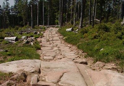


 To write so extensively of the design and construction of the Via Agrippa is not to imply that roads were not built during the Middle Ages. But many of these roads were poorly constructed and degraded quickly. This meant that travel upon them became difficult not long after they were built, due to the marginal effort and low-grade materials generally committed to European road construction during the Middle Ages. Too often, little more technique was employed than clearing enough of the brush and trees so that carts could pass. Dust was a problem in the summer, and with periods of heavy rainfall, these rutted roads become deeply muddied, and often becoming impassable.
 More important roads, perhaps as those which linked important holdings of the crown, cities with Duchés, or within Comtés, were built to higher standards. For these roads, workers used lime-infused dirts, like marl or fullers’ earth. (Friedman, Figg 2013) Lime (calcium) can have the capacity to stabilize wet earth by


