History of the Vigneron: Languages Part I: Patois de bourguignon

View of Paris by Pieter Casteels II (fl. 1673–1700)

A thousand years of patois

by Dean Alexander

It is ironic that history speaks so little about language, because other than extreme weather, the issues of communication, miscommunication, and the lack of communication, have likely shaped history more any other single factor. Indeed, these issues of communication are often difficult to pinpoint and their consequences are often lost to history. However, this does not excuse histories which take slight note that on the eve of 1789’s French Revolution, eighty-eight percent of the population of France could not hold a conversation in French, nor did not know any French at all (slmc.uottawa.ca). Nor is it sufficiently impressed that there were dozens of different patois spoken across France.

Tower of BabelMany histories gloss over the issue of language with no more than an occasional reference to ‘terms’ which were “in the patois of the region. This leaves the impression that patois was no more than a colorful piece of slang, rather than itself being a distinct language or dialect. Such casual references do not convey any difficulty of communication within a population which had spoken an estimated six to seven hundred dialects (10th century), derived from three distinct mother tongues (slmc.uottawa.ca). Another (rather poor) estimate, was provided in a 1794 report by the revolutionary bishop of Blois, Henri Grégoire. He wrote that with “thirty different patois, we are still, as far as language goes, at the Tower of Babel“.  That the bishop underestimated the number of dialects so grievously, suggests how little he really knew about these languages and the people who spoke them. Some modern scholars estimate there were as many as fourteen patois in Burgundy alone.

Whatever the number of patois, it is staggering that percentage of the population which did not speak French, and it invites a number of questions when considering the history of the vigneron. What was the history of language within Burgundy, and why was the French language so slow to be adopted there (and across the country)? How did the monarchy effectively overcome linguist differences? When did the français language arrive in the Côte d’Or, and what was its societal impact? What do we know about the regional Burgundian language; and lastly, does the Burgundian patois survive today? 

Note: for the remainder of this article, I will refer to the language of French by its French name, français. The primary reason for this is français was simply just one of many languages spoken in France.  A secondary reason for this spelling is all of the other language names have no English equivalent, it seems natural that the French language should be represented in the same format. I reserve the right to use the word ‘French’ to represent the language, when refers to its current day usage, or it allows me to avoid an awkward sentence construction. Also challenging was the decision whether or not to capitalize all of the languages and titles. In English we capitalize everything, but not-so-much in French. I opted for the later if the term was in français, but I did capitalize if it was an English usage. I’m sure I did plenty wrong on this account. Editing is not a strength of mine.

Part three of this article will deal with the development and history of français – it is integral to the French story, but secondary to the story of Burgundy. 


Language and the Côte d’Or during the ancien régime and beyond

The patois of Burgundy has traditionally been referred to by French writers as“bourguignon-morvandiau”.  That bourguignon comes from the same mother tongue as français, the langue d’oïl, does not mean that communication was easy between those who were purely bourguignophones, and those who were purely Francophones.  How difficult was this communication? An indication may lie in the fact that someone who spoke both français and a patois was said to be bi-lingual.

Along with hundreds of words which were decidedly different from français, some of which can be viewed here, the pronunciation of the words common to both français and bourguignon-morvandiau could itself cause one to have to listen carefully. Speakers of bourguignon rolled their “r“s liberally when compared to that of the French speaker, and the “a”, “eu”, and “to” sounds are very marked, or exaggerated, in their pronunciation. The patios spoken from the Burgundy border north of Dijon, down through Nuits, and Beaune to the southernmost vineyard area of the Côte d’Or was a bourguignon dialect called chalonnaise (Léonard and Barot 2012).


Morvan
The Morvan

Patois bourguignon-morvandiau

The name “bourguignon-morvandiau” suggests that the language originated in the hills Morvan Massif, lies roughly 40 kilometers west of the Côte d’Or. This implication can be quite misleading, but the Morvan is really not a such a bad place to begin this story.

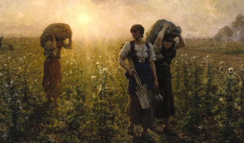
It is a rugged region of wooded peaks and high valleys. With the quasi-isolation, the terrain presented in terms of accessibility, in both communication and trade in and out of the Morvan, has always suffered. This has meant that the population, in addition to being quite poor, has been correspondingly under-educated. These factors have made this one of the last places where the ancient patois of Burgundy is still being spoken.

The Dorsale boisée is in brown, with Chateau Chinon pop. in 1876 was 2668, today pop. 2086.

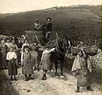
The Morvan’s quaint villages and small farms dot the region’s meadows or were cut from its forests in an era of uneven logging regulation. As logging intensified to meet the nations demands for lumber, the population of various villages swelled by as much as forty percent between the years of 1840 and 1900.* The region’s resources, which included cheap, unskilled labor, were, as vividly described by Jean-Léo Léonard & Gilles Barot, absorbed “ruthlessly by the belly of Paris”.

It was from this poor and bloated population, which identified itself by its humble patois, that the daughters of the Morvan were sent to Paris to work as nannies and nursemaids. And over the decades, as thousands of young Morvan girls had worked in the capital’s wealthiest homes, awareness of the patois bourguignon-morvandiau grew outside of the region. It was only a matter of time before bourguignon-morvandiau would become synonymous with the patois of burgundy.

Over the centuries, it has been abundantly clear that the peasants of the Morvan have clung to their language as an integral part of their identity. And although morvandiau has been a long-established written language, only a minority of its speakers ever learned to read or write it. That français has finally supplanted the regional patois as the primary language was spoken is significant, but it is representative of the regression of patois all across France.

The biggest threat to morvandiau is the Morvan’s increasingly diminishing population. In some of its larger villages, the population is a third or less in number than its 19th-century levels. Because of this, it is impossible for “morvandiau” to retain the dynamic vibrancy which it displayed in the past.

(*) from levels established by the census of 1793

(**) 1793 was the first census by the new revolutionary government

(***) The population change shows the boom and bust economy during this period. Moux-en-Morvan in 1793 population was 1089, in 1872 the population swelled to 1688, and today (2013) Moux-en-Morvan has 564 people who live there.  Montreuillon lies along a feeder canal to the Canal du Niverais, allowed good transport for logging operations.  In 1793 had a population of 855, and it grew to a peak population of 1272 in 1976, while today it has shrunk to only 286 inhabitants in 2013.


ijon skyline, source planetware.com
The Dijon skyline. photo: planetware.com

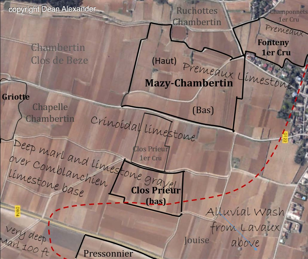
Dijon and the wine villages of the Côte d’Or

Approximately 40 kilometers east of the Morvan, lies the Burgundian provincial capital of Dijon. As the provincial seat of government, and as a major ecclesiastical and intellectual center, it was necessary to speak français by anyone of social position during the ancien régime. This was also true for commoners who aspired to gain wealth, or rise to a position of prominence.* As such, by the early 18th century (if not before), the bourgeoisie of Gevrey, Vosne, Nuits, and Beaune, would have all spoken français. This was a nécessité in order to conduct business with the right people in Dijon, Paris, or to meet with merchants of the great trading cities along the Atlantic coast.

The arrival of the français along the route des grand cru indicated that a new stratification was occurring at a societal level. There had always been a class difference between the nobility and the common man, but now, the knowledge of français created a new and important social demarcation between members within the third estate (Forrest 1991). There were now two major classes of commoner, a group which includes peasants, laborers, and artisans on one side and the educated bourgeoisie on the other. One could easily tell them apart, if not by the clothes that they wore, but by the language they spoke.

 (*) This timing would coincide with the drive by Versailles to subdue the nobility and attain an absolute monarchy.


Across the Saône River: the Gallo-Romance language of Franco-Provençal 

Franco-Provençal or Arpitan. Difficult intelligibility among dialects was noted in the early 18th century. Wikpedia
Franco-Provençal or Arpitan. Difficult intelligibility among dialects was noted in the early 18th century. Wikipedia

For centuries, the Côte d’Or sat at a crossroads of two mother languages of patois: Langue d’oïl and Franco-Provençal (also known as Arpitan). In much of the three Burgundian departments of Yonne, Nièvre, and the Côte d’Or, patois in which the langue d’oïl was primarily dominant. But as one moved south and within Nièvre, and east within the Côte d’Or, the words and pronunciation typical of franco-provençaux became increasingly strong.  This was particularly true along the banks of the Saône River, which bordered the department of FrancheComté.

In the department of SaôneetLoire, which is home to the vineyards of Rully, Bouzeron, Mâcon, and Pouilly-Fuissé, the patois there are said to be transitional, conveying varying degrees of both the Langue d’oïl and Franco-Provençal. Nearby, just across the Saône River, in the Franche-Comté, Franco-Provençal was the primary tongue.   In 1807, one French linguist, Jean-Louis Grillet, wrote that communication between various Franco-Provençal dialects was “difficult” (Wikipedia). This comment instructs us on other linguistic challenges that at one time certainly existed within Burgundy, and across the realm.

Dissecting the ‘langues des bourguignons’

To study the dialects of a century ago requires that patois were literate, meaning there was a written version of them. As  James R. Lehning writes that the patois of the Loire had “apparently deteriorated in the course of the nineteenth century.” And in the arrondissement of Roanne,” patois existed in only an “attenuated” form (Lehning 1995). This is to be expected, as the use of français extended its reach into rural communities. But if this was already happening in the 1800’s, it is relatively impossible for us to know the extent of the changes which had already been made to patios by this period, and how much communication had already improved.

References to the patois of Burgundy is typically viewed as a single dialect. An example of this is found on the website of a group self-titled as Défense et promotion des langues d’oïl, – which interprets Burgundian patois as being bourguignon-borvandiau.

The English language pages of Wikipedia names the Burgundian patois bifurcates Burgundian patois into two dialects. The first is morvandiau which they define as a base of the “d’oïl of central France, but with stronger Germanic influences than standard français” and is peppered with hollandaise terms. These were no doubt picked up in trading wine with the Dutch. The second regional patois identified by the French language Wikipedia is a hybrid oïl-franco-provençaux language, which it terms charolais-brionnais. This is the patois the SaôneetLoire, which lies on the southern border of Chassagne-Montrachet. While this is a more complete explanation, the reality is yet more complicated.

However, the French language version of Wikipedia (fr.wikipedia.com) breaks down the languages of the Morvan Massif itself as four dialects.*  Dialect breaks between areas of the Morvan show in pronunciations such as “ç’ost” vs. “y’ost” to say “there is”.  Other differences: in the northern part of the Morvan water is pronounced as “gaujer,” while in the south it becomes “gauyer.”  For a speaker of français, who would say“prendre l’eau”, either pronunciation would be unintelligible.

This is not the only explanation, however, as linguists often do not necessarily agree. Some regional sociolinguists have replaced the overarching morvandiau designation with 13 distinct regional dialects, that stretch across the four departments of Burgundy (Léonard, Barot 2012). The northern and western patois are primarily oïl with varying amounts of franco-provençaux influences, but as one moves southward, particularly into the department of SaôneetLoire, the langue franco-provençaux becomes increasingly dominate.

A less obvious, due to its distance from Burgundy, are the influences of the Occitan languages, once called lenga d’òc (or langue d’oc in French). Occitan, along with the langues d’oïl and franco-provençaux, are France’s holy trinity of Gallo-Romance languages. This Gallic-Roman mother tongue forms the basis of many patois stretching from Spain’s Pyrenean Val d’Aran in the west, across the Languedoc, to Calabria Italy in the east. Although its area of use is separated from Burgundy by the Central Massif and the Limousin forest, there are numerous occitan words and inflections present in several of the southern bourguignon patois.

(*) No additional information is given regarding these divisions, however.

map adapted from: Jean Léo Léonard & Gilles Barot (Langues de Bourgogne)

The following are the fourteen patois of Burgundy

  • Morvan-Autunois was the dialect spoken in north-western Morvan.
  • DB is the label given to long diagonal swath through the length of the province, running through the heart of the Morvan, and extending down into the department of Allier. This swath seems to run right through what is referred to as La Dorsale Boisée, the ‘Wooded Dorsal’ of the Morvan massif. This is a line of heavily wooded peaks (500m-900m) which makes up the spine of the mountain range (fr.wikipedia). To this day, there are very few roads through this region, and it is likely to be very sparsely populated. Léonard  & Barot give no other reference is given to DB in the text. Is DB an abbreviation for something, possibly “base de dispersion“? Basic dispersion, refers to is the measurement of the variability in the data. Or “base de données” meaning database? I can find no answer to this.
  • Bresse, BL and RV: Sitting along the banks of the Saône, these patois are primarily francoprovençal in nature. Each patois sits with very tight areas of use suggesting a rural, immobile peasant population, with little trade into or out of these regions. Like DB, there is no explanation for these apparently abbreviated BL and RV languages.  The nearby region of Savoy in the Franche-Comté has significantly influenced the coloring the Bressan character. These were patois which were retained longer than in other areas, probably due to an immobile peasantry. Despite the long history of these dialects, these patois have been strictly oral in use, with no written bresse language ever having been developed.  A phonetic version was sketched out in 2006 to attempt to record and retain the dialect. Bressian speakers today are accused to overemphasizing the uniqueness of their patois, in regards to others. Pronunciation shifts when moving from savoyard bresse in the north, to bresse louhannaise in the south, although the variance is not considered to be enough to “hinder mutual comprehension” (fr.wikipedia).
  • Bresse-chalonnaise was spoken east of Dijon. The name and regional position suggest this is a hybrid of Bresse patois and that of the chalonnaise.
  • Chalonnaise was spoken from the northern department of Haut Marnes, south through Dijon, and all through the Côte de Nuits into the Côte de Beaune. Perhaps somewhere near Chassagne,* the dialect was morphing to clunisois. 
  • Clunisois takes its name from the ancient Roman city, which lies on the southern-most portion of this patois‘ linguistic reach. The Patois is significantly francoprovençal in nature, the language which is spoken just across the Saône River. 
  • Mâconnais is the dialect that picks up south of Cluny, and to some extenis still being spoken within homes, in and around the city of Mâcon. Mâconnaise, like the Bressan areas which lie directly above it, is heavily influenced by the neighboring franco-provençaux. Mâcon, a city of 35,000, straddles both sides of the Saône River sits half in Saône-et-Loire, and half in Franche-Comté. Like chalonnaise, this is a patois with a long north-south area of use.  This is likely because a number good roads that ran parallel to the river, coupled with with river traffic, would have created continuity in the patois, over this elongated area. The shape of the area affected is determined by the direction of the movement of people and goods along these thoroughfares. 
  • Charolais dialect sits in a wide swath along south-eastern Burgundy east of the wine regions of the southern Côte Chalonnaise, and the dialects adjacent to the Mâconnais spoken there.  Charolais, according to charolais-brionnais.fr, is a language with a structure similar to the Oïl language yet laced with hints of Occitan (langue d’oc also lenga d’òc) and Latin. For example, the «a» sound replaces «e», while the «ts» is used instead of «ch». This region is noted for its massive coal mining operations in Montceau-les-Mines which pulled 2,000,000 tons from the ground per year, as well as its large iron, and steel industries based in the commune of Creusot. This industry was made possible by the opening of the Canal du Charollais (now known as Canal du Centre) in 1792.)
  • Brionnaise is typically associated with Charolais but is separated in the listing by Léonard and Barot.  The regional marketing efforts by charolais-brionnais.fr say that “efforts to promote the dialect are championed by local celebrities like Professor Mario Rossi, who in 2004 published an Etymological and Ethnological Dictionary of Brionnais dialects.” Note, that it is titled “Brionnais dialects“; plural.
  • Matour is named after a village which is in the hills south and a little west of Cluny. Termed as being in ‘Upper Cluny‘, Matour sits at crossroads between Charolais, Beaujolais, Cluny, and Macon. Like the other patois of nearby regions, this langue is transitional, part Oïl and part franco-provençaux.
  • Bourbonnaise: To the west and south of the Morvan, bourbonnaise was once spoken around the city of Nièvre (with a population today of 35,000). This area although technically part of Burgundy, it is separated from the Côte and Dijon by the Morvan. It a region which is influenced by nearby Allier, and patois of Langue d’oïl than the more Germanic franco-provençaux.
  • Roannais sit in the gap between the Morvan and the Central Massif, north of Lyon, along the southern Burgundian border with the departments of the Loire and the Rhone. Named for the department Roanne department of the Loire.
The roads across Burgundy in 1771. The map, which is labeled as "Carte itinéraire du duché de Bourgogne" is held by the National Library of France
The roads across Burgundy in 1771. The map, which is labeled as “Carte itinéraire du duché de Bourgogne” is held by the National Library of France

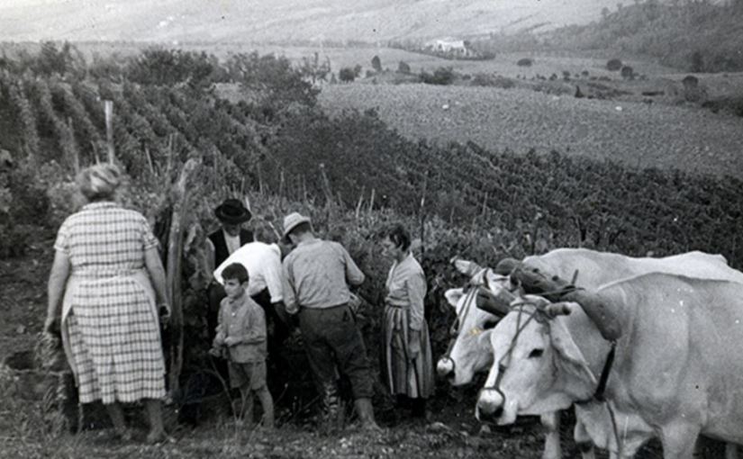
That there were multiple dialects, some of which were used within a very tight area, suggests that peasantry in these areas were relatively immobile. Intriguingly, a couple of patois had very long, vertical, north-south area of use, such as that of chalonnaise, which covered much of the department of the Côte d’Or. It is not a coincidence that this area of use should follow the path of the Burgundian wine trade, as it moves from Chassagne, up the path of the ancient the Via Agrippapast Dijon. The use of chalonnaise continued to the department’s northern border but is not clear if the dialect extended very far into the neighboring department of Haut Marnes.

MaconnaisThe economic situation of the chalonnaise speaking peasantry of the Côte d’Or, was not at all uniform. The very poor were likely to be immobile, while those with one or more holdings, particularly if one was in a renown cru, were likely wealthy enough to own a horse, and were able to travel to neighboring towns, perhaps to do business with their négociant, or their tonnelier (barrel maker), or to seek any other service or product that was not available in their own village. Those peasants who were able to travel, spread their sub-regional terms and pronunciations to other villages while bringing new ones back home. This process would have developed a uniform patois, that over time spread over a larger area of use.

The patois spoken within the SaôneetLoire are much more confined in their areas of use. The fact that patois of chalonnaise stops near the SaôneetLoire border, likely means that there was limited trade between these regions, both of which lay immediately south of Chassagne. Patois with such small regional footprint such as the industrial Charlolais and rural matour, suggests there was little trade done with the peasantry there. Again, any lack of trade suggests two things: that the region was quite poor, and that they lacked mobility. Despite the Canal du Centre (then known as the Canal du Charollais) having been built through these regions, the local paysans had little use for a commercial waterway. Even collectively, these small farmers had little or nothing to trade.  We also know that much of these areas south of the Côte d’Or was dominated by large farm properties, either capitalized, or private, which were controlled by less than one percent of the population, and this too created a population that was compartmentalized, as the small communities were separated from one another by very large farming estates.

(*) Unfortunately as is common with drawn maps, the two maps used are not of the same origin, and not accurate in configuration, lacking cities and other clearly identifiable markers. This makes precise identification of where these languages impossible. This imperfection of maps may be somewhat intentional since the authors of them might not want to be pinned down to a precise statement that ‘X’ language is spoken in ‘X’ location.


Up next: Part II, The war on Patois


References for  Français and patois Bourguignon, Parts I, II, & III


History of the French Language, https://slmc.uottawa.ca/?q=french_history

The Original Grand Crus of Burgundy, Charles Curtis, MW, Wine Alpha, 2014

Peasants into Frenchmen: The Modernization of Rural France 1870-1914. Eugen Weber, Stanford Univ. Press. 1976.

Schooling in Western Europe: A Social History, Mary Jo Maynes, Suny Press 1985

Regional Dynamics Burgundian Landscapes in Historical Perspectiveedited by Carole Crumle

Languages and the Military: Alliances, Occupation and Peace Building, edited by H. Footitt, M. Kelly, Springer, 2016

Collective Action in Winegrowing Regions: A Comparison of Burgundy and the Midi – David R. Weir July 1976

Language or Dialect Shift? Shifting, Fading and Revival of Burgundian Gallo-Romance Varieties, Jean Léo Léonard  & Gilles Barot, 2012

End or invention of Terroirs? Regionalism  in the marketing of French luxury goods: the example of Burgundy wines in the inter‐war years, working paper Gilles Laferté Institut National de la Recherche Agronomique

Negotiating Territoriality: Spatial Dialogues Between State and Tradition, Allan Charles Dawson, Laura Zanotti, Ismael Vaccaro, Routledge 2014

‘Insofar as the ruby wine seduces them’: Cultural Strategies for Selling Wines in Interwar Burgundy,” Philip Whalen, 2009

The Abbé Grégoire and the French Revolution: The Making of Modern Universalism, Alyssa Goldstein Sepinwall, University of California Press, 2005

From Savage to Citizen: The Invention of the Peasant in the French Enlightenment, Amy S. Wyngaard, University of Delaware Press, 2004

Reshaping France: Town, Country, and Region During the French Revolution, Alan I. Forrest, Manchester University Press, 1991

Le patois bourguignon, patrimoine en danger, Arnaud Racapé, France Bleu Bourgogne, 2015

Peasant and French: Cultural Contact in Rural France During the Nineteenth Century, James R. Lehning, Cambridge University Press, 1995


Burgundy: History of the Vignerons: part 2, roads less traveled

Via Agrippa
Via Agrippa, the Roman system of roads that were built throughout Gaul early in the first century.


Roads less traveled

By Dean Alexander

Villa Agrippa along the Lyon-Saintes roadway in west-central France. http://www.st-martin-de-jussac.fr/
The ancient Roman Via Agrippa along the Lyon-Saintes in west-central France. http://www.st-martin-de-jussac.fr/

Throughout history, the four departments of Burgundy have existed in various states geographical isolation; partitioned from western France, by the mountain ranges of the Central Massif and the Morvan. For twelve centuries, only three woefully inadequate roads linked Burgundy to western France, and those, having been built by the Romans in around the year 20 BC, were in a state of disintegration. Whether lost to flooding or landslide, or its materials having been scavenged for new construction, in places, these roads ceased to exist altogether. Travel to and from Burgundy became increasingly slow, difficult, and dangerous.

This road system was never intended to support an independent France, and as such, their route selection, and the intellectual philosophy behind their design were ill-suited for reliance that the Gauls would place upon them.  Each aspect of their design would leave a lasting impact on the of future development of trade, communication, and ultimately the economy of France. This underdeveloped and crumbling infrastructure would leave Burgundy in a state of quasi-isolation, forcing it to develop independently for centuries, and delay the unification for France for a millennium.

To some readers, this ancient topic will seem unimportant, and seemingly unrelated to winemakers of today, but the geopolitical separation of Burgundy from central France was quite significant on both a regional and national level, and significantly shaped the identity of the winemakers of the 18th and 19th century. For the wine scholar, these are roads less traveled.

(*) This is true of the areas of the Rhone Valley and Provence as well.

Haut-Folin is tallest of the Morvan's three highet peaks, at 902 meters. Against this backdrop, only a few poor roads penetrated the densely wooded Morvan Massif. Lying directly between Paris and Beaune, the Morvan is a northern extension of the Central Massif. Although not terrible tall at its peak 900 meters, the 70 kilometers long Morvan has a 35 kilometers girth, which provided more than enough deterrent to easy trade and travel to or from western France. photo: wikipedia
Haut-Folin is tallest of the Morvan’s three highest peaks, at 902 meters. Against this backdrop, only a few poor roads penetrated the densely wooded Morvan Massif. Lying directly between Paris and Beaune, the Morvan is a northern extension of the Central Massif. Although not terribly tall at its peak 900 meters, the 70 kilometers long Morvan has a 35 kilometers girth, which provided more than enough deterrent to easy trade and travel to or from western France. photo: Wikipedia

Natural trade barriers: massifs, and valleys

While good roads and bridges cut with seeming ease through these regions today, the Central Massif and the Morvan, divided eastern and western France for centuries. Moving northward along the backside of the 1020 kilometer long Central Massif, sits Lyon; and just beyond the city, as the northern tip of the Central Massif falls away, a gap between the mountains develops before Morvan rises up again in the north. Because this area is hilly, defined its boundaries is not straight forward but is the gap is a fairly wide area of at least 50 to 75 square kilometers, .

Militarily, these are the kinds of gaps that armies seek to strike their enemy, but in the past two thousand years, no major advances seemed to have launched by any army through this gap. Why was this? A possible explanation is that this gap is covered by irregular hills and multi-directional valleys, through which the headwaters of the Loire and other rivers form.  Many of these headwaters are rivers in their own right, including the Allier, Arroux, Dore, Loire, Nievre, and Sioule Rivers, and each would have created their own fording challenges. Secondly, the valleys may have been swampy until they were drained in the late 18th and early 19th centuries. This would have made the movement of equipment substantially difficult.

Northward from this gap, one will encounter the heavily wooded hills of Morvan Massif. This too stood as yet another obstacle to travel. Although the total elevation of the Morvan is not overly high, with its highest peaks being roughly 1000 meters, it can be rugged, densely wooded, and has an imposing breadth of 35 kilometers. Along the eastern foothills of the Morvan, is where the vineyards of the Côte d’Or are located.


For a more than twelve hundred years, since the times of Roman Gaul, the road system of France decayed more than it improved. The major routes remained those of Roman origin. It wasn’t until the early 1700’s, that road construction was given any priority, and that the natural barriers of trade to the west were finally lifted.


Via Agrippa: the first well-established roads in Eastern France

The first Roman routes, out of simplicity, skirted the Central Massif.  To the Massif’s south, the road hugged the Mediterranean coastline as it moves westward. At Arelate (Arles), which became an important Roman port and trading city, the Via Domita ran toward the Iberian Penisula, where it met with the Via Aquitania, which drove northwest toward Burdigala (Bordeaux) on the Atlantic coast. To move northward from Arelate, the road system of the Via Agrippa began.  Constructed for movement of legions to conqueror and control the unsettled regions east of the Central Massif, Roman leaders decided to establish Lugdunum (Lyon) as the hub of the expansive Via Agrippa road network. Archaeologists Ulrich Erdmann writes that the “geography of Burgundy was advantageous to the development of a strong infrastructure with busy roads from Lyon, the capital of the province, to Paris and the Channel ports, and to the Rhine.” (Ulrich Erdmann 2004) Because of this well-constructed road system, this was certainly the case during Roman times. And much later, the better sections of the road would continue to serve the basic economic needs of the region, right up until the revolution.

The Rise of Lugdunum

That the Roman engineers decided that Via Agrippa should radiate from Lugdunum (Lyon), made the city a very important trading hub. Lyon would link Rome to nearly all of its European provinces, including those in Switzerland, Germany, Northern France, as well as being the most direct route to its most far-flung northern European possessions, including the Netherlands, Belgium, and Britain. It is important to note, that the decision to choose Lyon as the hub of this road system, would impact Burgundy for centuries after the fall of Rome. This road was economic thoroughfare Burgundy would require to maintain its independence over such a long period of time.

In the best of conditions, trade in ancient times was slow, moving at the pace of a draft horse under a heavy load. Couriers and unburdened travelers and may have moved more swiftly, but these long distances required patience. To ease these troubles, Romans built small, well-appointed towns along the route to act as rest stations along the way, catering to the needs of the well-heeled traveler, and others.

Roman Gaul was generally peaceful and stable for centuries, and in fact, legions were generally not stationed there after 15 BC. (Woolf 2000)  Around 300 years after Gaul’s submission to Rome, every freeman of Gaul was offered citizenship (212 AD). This was not a special dispensation since it was granted to all lands within the empire, but Gaul was widely considered to be the most acquiescent and accepting of Roman rule.(Erdmann 2004)

The most important route, at least in regards to Burgundy’s connectivity to the rest of Europe, was the main, north-south artery of the Via Agrippa. This road headed north to Dijon, through Langres, and ultimately to the port city of Cologne on the Belgian coast. This was the road which would become instrumental in Burgundy’s wine trade, forever onward.

Peutinger map: the only map of the Roman roads in Gaul

The conclusion that Lyon-Cologne was the most vital route is based partially on the fact that this road is one we know the most about. It appears far more frequently in literature than any of the other Burgundian roads, and that is true of writings from antiquity, until well after the French revolution. This repeated appearance in writings may have to do with its being the road to Langres, which even today remains an important religious center.  Langres had the distinction of being the seat of the Bishop of Roman Catholic church, as well as home to several Catholic religious orders. But this road also appears often this road as a major trading artery. That this can not be said about any other regional road, leads one to draw the conclusion that it was the primary route in and out of Burgundy. We might also assume it was the best-maintained road within Burgundy.

Two other, presumably important roads headed directly westward from Lyon. The first was a route that zigzagged over barren sections the Massif. This spur of the Via Agrippa eventually made its way to Clermont-Ferrand on the reverse side of the Central Massif, then ultimately on to Saintes in southwestern France. This route has been somewhat chronicled over the past two thousand years, but principally as part of the pilgrimage of le Chemin Saint-Jacques. Little of this Roman roadway remains, and its exact route is uncertain. A second spur of the Via Agrippa departed westward from Chalon. This route is referred to as the Lyon-Boulogne, although once it arrives in the Loire Valley it bifurcated, with one branch heading to Saintes, and the other to Boulogne. Unfortunately, we know very little about its route, as much of its roadway has been lost. Over the centuries, the stone, and other road building materials were removed for other uses, and dirt has covered much of the rest. Additionally, little is written about the Lyon-Boulogne, and most our knowledge regarding its existence comes from an ancient Roman map which was discovered in a library in Wormes, Germany in the late 1400’s.

Roman route selection

Agger Road
Since this road traveled through a forest, the high, raised roadway was likely built as a defensive platform to help legionnaires defend against ambush. This raised roadway would give a stretched out column of soldiers a chance to survive against a more concentrated force attacking from their flank.

Roman roads were as part of a larger military conquest strategy. As such, upland routes were chosen for the defensive advantage hills provided, and whenever possible track was selected which were devoid of forestation. Roman columns traveling along these routes were more able to repulse attacks where sight lines were longer. Along these highland routes, way stations were situated on hilltops, as they were far easier to defend.

Conversely, Roman roads avoided valleys, and dense forests, (Planhol, Claval 1994) as both of these terrains presented a tactical disadvantage of not being able to bring the “cohorts to bear.” (Heather 2010) While these overland routes provided security for columns of soldiers and their baggage trains, these overland Roman military roads may have proved difficult enough to deter less disciplined travelers.

But avoiding forested routes may have been more challenging than one might imagine. While today one fifth of France is timber land, consisting of roughly 25% oak trees, when Caesar arrived with his legions in Gaul in 58 BC, it is estimated that two-thirds of France were covered in forests, primarily of oak trees interspersed with thickets. (Thirgood 1971) Wide belts of sacred forests created the natural “frontier zones” which separated the various Gaulish tribes, which only the Druids were allowed to enter. According to  J. V. Thirgood, a professor of forestry at the University of British Columbia, the forests held a “psychological dread” for the legionnaires, involving forest warfare and mysticism.

Building roads in Britain, artist unknown, 1956

Additionally, the need to find solid ground upon which to build roads was of equal importance. Before the construction of drainage systems, provided by the construction of France’s innumerable canals (ie. Canal du Centre opened in 1792), many of France’s valleys and plains were riddled with marshes. (Grabmayer 2009) This may have made these valley areas between the larger Loire and Saône Valleys unsuited for road construction, not to mention it was likely to have been covered in dense forests. Further, the many rivers that traverse the region would have required the construction several of large and costly bridges.

As much as road construction’s primary purpose was to allow Rome to project its power, its ability to facilitate trade was an expected byproduct of great importance. The roads were an artery of wealth, raw materials, and other valuables, which would economically feed Rome. Both legions and merchants traversed the roads from Gaul to the Italian peninsula, carrying with them all manner of treasure and goods. Caravans were loaded with from gold and silver to less glamorous ores such as lead and tin. They were loaded prized wines from Burgundy which were said to rival the best of the legendary Falernian wines, as well as casks (a Gallic invention) of wine the Rhone, as well as material goods, such prized Samian pottery. There was also a significant movement of grain, which included wheat, barley, and rye, all being transported from France to the Apennine peninsula.

Confusingly, the generic word for ‘grain’ in Latin the is the word “corn”. However, because in English “corn” only refers the vegetable which is indigenous the Americas, some writers have mistakenly understood that corn was grown in Gaul, and traded to the Romans. It obviously was not, since it was not ‘discovered’ by Europeans until sometime after 1492.

Roads dictated by geometrical theorem 

Ordered, but inefficient for trade? 

Examples of calculatiing distances by trianglation and Tales Theorem as used by the Romans. Drawings: Giovanni Pomodoro 1603
Examples of calculating distances by triangulation and Thales Theorem as used by the Romans. Drawings: Giovanni Pomodoro 1603

Historian Greg Woolf, argues that efficiency and connectivity of these roads were undermined by the Roman’s limited geographical knowledge of France, and that centering its hub on the city of Ludunum (Lyon) was somewhat arbitrary. (Woolf 2000)

This may have been true, but there was at least one other factor at play: the Roman ideology that the intellect must triumph over the random vagaries of nature. As such, the incorporation of Euclidean and Pythagorean theories was widely employed in many aspects of Roman construction, including roads.

Pythagorean theories were widely employed in many aspects of Roman construction.

The Roman designers conceptualized their roads as a Euclidean geometric equation: thus a road was “a surface is that which has length and breadth only”. The design of any “solid“, is matrix of point, line, and surface, and differs significantly the “solid” object it represents. (de Laguna 1922) Whatever difficulties of these theoretical ideals posed in applying to the actual, physical geography, was left for the on-site surveyors and builders to resolve. Surmounting the peaks, rivers, gorges, as well as marshy valleys, forced those who managed the construction to adjust as necessary. (Legion VIII Augusta)  Doubtlessly, there was pressure to complete the job as it was designed, and this may have led to the Roman reputation for overcoming obstacles, rather than building around them.

Having dedicated themselves to build roads to a Euclidean planar, rectilinear model, there are many examples of this in their road construction across the Roman Empire. Stretches of the road will persist for dozens of kilometers, in an unflinchingly straight line. These roads hold straight and true, over a variety of terrains, even when no direct line-of-sight was possible. The most extreme example of this is the Roman road from Bavay to Tongeren (in Belgium), which continues uninterrupted in its straight path for 70 kilometers or 43.5 miles (Gallo, Bishop 2006).  This, reasoned the Romans, would allow columns of legionnaires to arrive at a far-flung location in the most expedient, and least exhausted fashion.

To accomplish this feat of building long, dead straight stretches of road, Roman surveyors made visual sightings (of up to six miles) at night, by using fires. Where line-of-sight was not possible, surveyors attained sighting from hilltop to hilltop and utilizing theorems of similar triangles, enabling them to maintain their road’s undeviating course, with remarkable precision (Gallo, Bishop 2006).

No doubt, the Romans over thought their roads, in that  It is easy to see how this might prove problematic, in bypassing cities, or not connecting cities with did not fit into their intellectual sense of organization, and might delay a Roman legion’s arrival to a strategic location.

The consequence of Roman road design on a post-Roman France

Just as Gaulish tribes did not coalesce as a single body until the Romans artificially did so by force, once the Romans were gone, France once again splintered into its regional tribes once the Rome fell. No doubt, regional rulers, such as the Frankish King Clovis I, who triumphed over the last Roman military commander in Gaul, would have found the organizational structure of these roads frustrating. It is clear they inhibited movement of goods and communication in almost any direction that wasn’t en route to Rome. For this reason, Roman roads greatly dictated the regional trading partners. For example, travel from Reims, north of Paris to points southwest of Paris, such as Chartes, was extremely circuitous and would have discouraged trading and communication between these two areas within central France. One has to wonder if this de facto subdivision of France, was actually by Roman design, with the intent of keeping populations divergent, and unable to unify, thus making possible rebellions less viable.

By the Middle Ages, the roads of the Via Agrippa were in poor condition despite their immaculate construction. The efficient infrastructure necessary to maintain them had been lost well before the fall of the Roman Empire, which had been in a long period of decline.**

*King Clovis I, who would triumph over Syagrius, the last Roman military command in Gaul, who had held out a decade after Rome itself had fallen. (**) This would finally happen when Rome’s own mercenary armies, consisting largely soldiers of the Germanic Visigoth tribes, breached the walls of Rome in 476 A.D.

I have overlaid the Morvan and Central Massif on a map of the Via Agrippa derived from The Tabula Peutingeriana, also known as the Peutinger map. Peutinger is a medieval copy of a Roman road map from about the year 300 CE. The mapping was done mainly utilizing the research of Richard Talbert. To see the original map http://www.omnesviae.org/

Roads and travel in the Middles Ages

carriage in mud
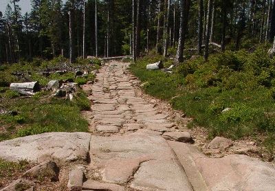
To write so extensively of the design and construction of the Via Agrippa is not to imply that roads were not built during the Middle Ages. But many of these roads were poorly constructed and degraded quickly. This meant that travel upon them became difficult not long after they were built, due to the marginal effort and low-grade materials generally committed to European road construction during the Middle Ages. Too often, little more technique was employed than clearing enough of the brush and trees so that carts could pass. Dust was a problem in the summer, and with periods of heavy rainfall, these rutted roads become deeply muddied, and often becoming impassable.

carriage crashMore important roads, perhaps as those which linked important holdings of the crown, cities with Duchés, or within Comtés, were built to higher standards. For these roads, workers used lime-infused dirts, like marl or fullers’ earth. (Friedman, Figg 2013) Lime (calcium) can have the capacity to stabilize wet earth by disrupting the alignment of the platelets in clay. This change in soil structure allows the soil to drain better.

These calcium-rich materials were apparently valuable, however, and were sometimes pilfered right from the center of the roadway. The result was that thieves created very large potholes, which, depending on their size and location, could seriously impede travel. Worse, after heavy rains, these pits would fill with water. With murky water obscuring their depth, these potholes became traps for the unaware traveler. Drownings did occur. (Friedman, Figg 2013)

Road fatalities were fairly common over the centuries, occurring when wagons or carts crashed or overturned. (Grabmayer 2009)  The Encyclopedia of “Trade, Travel, and Exploration in the Middle Ages”, almost humorously refers to these as “traffic accidents”, and both Friedman & Figg’s text, and Grabmayer’s paper note that numerous such deaths appear in “coroner” records.

Accidents were caused by the carts being flipped, spooked draft animals as the Friedman & Figg cite. Without a  doubt, poor cart construction, wear, and fatigue of the cart or wagon, in conjunction with overloading and poor weight distribution, also played a part in these accidents. But they would have been compounded exponentially by travel on these poor roads.

Roads of cultures

How roads were built, and how they were used, both represented a vast difference in culture between the Romans and the Gallic people. Paved Roman roads* were slippery for animals when it rained, and in general were hard on the hoofs of unshod animals. The Roman response was to find a solution. Their answer was fit horses and oxen with what was referred to as a hipposandal: special sandals were constructed from iron plates, and these plates were tied to the animals hooves by leather straps (Bakels 2009),  Of course, the medieval Frenchman had no such sandals, and may not have even been interested in obtaining them. As a habit, Gallic travelers tended to avoid these sections of road, particularly when utilizing hoofed animals. So instead of using the roads as intended, the Gauls drove their carts on the footpaths which ran parallel to the center roadway. (Grabmayer 2000) This caused other traffic, particularly those on foot, to create new impromptu paths, which also ran parallel to the Roman road. The practice of using multiple parallel paths to the old Roman roads expanded considerably as the Via Agrippa continued to deteriorate. and becoming increasingly difficult to navigate even for those on foot.

Christian Pilgrimage began well before the fall of Rome, and continues even today. Many of these routes are still used. More about pilgrimage and to see the original map, goto dappledthings.org/
Christian Pilgrimage began well before the fall of Rome and continues even today. Many of these routes are still used. More about pilgrimage and to see the original map, goto dappledthings.org/

Johann Grabmeyer writes that across a plain on which a Roman road traversed, as many as one hundred, more or less parallel paths might exist. Grabmayer does not cite this source, but the awareness that ancient historians and authors were prone to exaggeration, might be appropriate to keep in mind here. In any case, the point is clear, where the citizens of Ancient Rome had been ordered, purposeful, and methodical, the Frenchmen of the middle ages often sought their own road.

In another point of distinction, the Roman approach to road construction was to tackle obstacles head-on. By utilizing their superior engineering skills, and probably with the heavy use of slave labor, Roman road builders, built over, or removed impediments, whereas their Gallic counterparts of medieval France typically chose to avoid obstacles altogether. For instance, as Roman bridges eventually washed away due to a combination of neglect and flooding, the medieval nobleman rarely concluded that the bridge should be rebuilt, which would incur a major expense. Instead, it was typically decided that the road would perform a detour to an easier crossing point. (Grabmayer 2000) Unlike the Roman roads which had been built a prescribed width, and constructed in a specific manner to withstand both heavy traffic and inclement weather,

Also pointing to these cultural differences, as medieval roads were forced to cross overland routes, where obstacles are many and options to deviate are few, the many paths created ad hoc by travelers often become one path which became narrow, deeply rutted and increasingly risky. This was very different from the Roman roads which moved over similar terrain, as all Roman roads were built a prescribed width and constructed a specific manner to withstand both heavy traffic and inclement weather over a long period of time, with minimal maintenance being required.

*only some Roman roads were paved.

Travelers attacked by Brigands 1670, Nicolaes Pieterszoon Berchem

The rise of brigands

The dangers of travel in the 14th and 15th centuries were elevated substantially due to the marked increase in banditry.  Dmitry Shlapentokh writes that earlier in the Middle Ages, weapons, warfare, and violence had been the exclusive domain of the nobles. This was by design, the entire existence of the noblesse de l’épée (nobles of the sword) was predicated on the protection of his lands, and thus his people.  But it was precisely this long association of violence with social superiority and a higher social standing, which would prove to have very negative consequences.

As the Middle Ages came to a close, major socio-economic changes were occurring, not the least of which was that The Hundred Years War had democratized warfare. Violence was no longer the strict domaine of the nobles.  Weapons, which not only had the common man been prohibited from owning, but were far too expensive to procure, widely now available and inexpensive after generations of war. The sword, the weapon most equated to that of the noble, accordingly became the preferred weapon the bandit. Not only was the sword effective, but it symbolized both power and social prestige, as did, unfortunately, the weapon’s use. (Shlapentokh 2008)

Chronic war, the weak ineffective authority of the nobility, unreliable law enforcement, all led to a lack of security and a period of extreme uncertainty. For over three centuries, bandits robbed and murdered in a widespread fashion, making both travel and trade very dangerous. Still, merchants and travelers persisted. Banding together in caravans, they either armed themselves, or would hire armed escorts, to attempts to discourage attacks and make safe passage.

Aviary Photo_130982962587254885
Corduroy Roads have been constructed for thousands of years, to make wet marshy valleys passable. The period of time that they are serviceable depends on the environmental conditions the rows logs (which lay horizontally across the roadway) encounter, and the weight and frequency of traffic that the road experiences. Archaeologists have unearthed corduroy roads that are 1000 years old.

Deterrents to road construction

While one might assume that centuries of living under Roman rule might have instilled the idea that good roads were a key factor in the projection of power, Gallic rulers never appeared to grasp this concept. The was little effort to improve the connectivity of their cities and points of trade and create the ability to travel in all but the worst weather conditions. According to Hugh Chisholm’s surprisingly in-depth 1910 edition of Encyclopedia Britannica, that, although various Gallic monarchs in post Roman-Gaul attempted to maintain the “administrative machinery of the Romans”, that it proved to be “too delicate to be handled by the barbarians”.  This statement, however, rings somewhat hollow in its dismissive nature, as many of the administrative and municipal positions had been held by upper-class Gaulish people, for at least a century or more. As such, it is assumed by many historians that Roman thought, and Roman tradition had been interwoven into at least the upper class of Roman-Gallo society. These were not barbarians.

Louis-François-Armand de Vignerot du Plessis was famed for his debauchery. He controlled multiple Duchies, Marquis, and other land holdings making him very powerful during the 1700s. Each of the following titles represents a land that he "owned". Duke of Fronsac then Duc de Richelieu (1715), Prince of Mortagne, Pont-Courlay marquis, earl of Cosnac, Baron Barbezieux, Baron Cozes and baron of Saujon, marshal and peer of France
Louis-François-Armand de Vignerot du Plessis (1696-1788) was famed for his debauchery. Each of the following titles represents lands and people which were “his”. Duke of Fronsac then Duc de Richelieu (1715), Prince of Mortagne, Pont-Courlay marquis, earl of Cosnac, Baron Barbezieux, Baron Cozes and baron of Saujon, marshal, and peer of France. A powerful man such as this factionalized the power base and had to be controlled by the crown.

It is likely that the greatest obstacle to systematic road construction was the divisive nature of the noblesse de l’épée (Nobles of the Sword). From the time Viking invasions in the 9th and 10th centuries, power in France would be decentralized, with the king and kingdom playing a weak economic and political role. The ducs and comtés would preside quite independently, as sovereigns over their own lands. The farther from Paris the locale, the more the nobles were apt to chaff at the authority of the king. Rivalries between nobles could be fierce, and open warfare occasionally occurred between what were essentially small countries.*

Antagonism between neighboring nobles could create impassible trade barriers for merchants. Even the borders between etats (estates) were open, the nobility presented substantial financial deterrents to trade. High tolls were imposed upon merchants by each Comté (County) or Duché along their route. Other deterrents included the right of preemption, meaning a noble had the first right to buy the trader’s wares at a “beneficial” price, (Middleton 2005), as well as taxes which may have been imposed by nobles upon the final sale.

For those who understood the economic and political benefits of an effective road system, the decentralized power base within France created a complex, three-part chicken or the egg scenario. In order to build a national road system, the king needed enough economic and political clout to strengthen and centralize the government.  To fill the treasury, and gain that political and economic power, robust trade would be required. Yet the lack of lack of cooperation between provincial nobles derailed both trade any hope of constructing a national road system.

(*) National borders were not as they are today. While technically the King of France presided over all of the various lands within France, the actual extent of this unity can be seen in the fact that some powerful nobles controlled Duchés and Comtés within the King’s area of control, and as well as one or more Duché and Comté outside of France. Marriages were arranged for the consolidation of regional power, forging alliances, or even truces, with neighboring Duchés or Comtés. This was done en lieu of having any ability to accomplish any substantive diplomacy.

Did France’s agricultural underpinnings lead to nobles to derail trade?

France’s struggle with encouraging trade may have had its roots in the country’s agricultural underpinnings. For the entirety of Gallic history, up until the 1700’s, farming had been the engine of the economy. Seigneurial agricultural lands had provided the food for the cities and employed its rural population, which may have numbered as many 20 million peasants by the end of the 18th century.* While this may not have been a success story, the nobles, even those who had only nominal wealth, were both economically and socially tied to this system. For them, this system was very successful.

The noble classes were completely centrist in their focus. Their own activities of generating income from their estates, and achieving military glory on the battlefield.  Whereas they looked upon Bourgeoisie activity of trade with “disdain”. (Stilwell 2005) As such, Nobles would heavily toll the trade which crossed their lands and tax those who traded there. Whether the activities of social-climbing Bourgeoisie and their economic activities were regarded as a threat to the nobles way of life is not clear, but nobles did not allow overland trade to be easy.

French kings, who were essentially the penultimate noble, seemed to share the attitude that trade was definitively not noble. If one were to extend that premise, undoubtedly it would have been viewed as being beneath the needs of France.


Jean-Baptiste Colbert: one hundred years too soon

Jean-Baptiste Colbert presents his plans to le roi, Louis XIV

As the first true theories of economics would be developed until the le Siècle des Lumières (the Enlightenment), few at the time realized the positive impact trade would have on both economic, and political power for those that held it. But Jean-Baptiste Colbert, king Louis XIV’s powerful minister of finances, harnessing trade for the power and glory of France was a nearly singular focus. While some have written that Colbert was was not an innovator, borrowing his ideas from other men, but he was one of the first to employ what amounted to an economic plan, and to do it on a vast scale. Colbert worked in concert with the king in the attempt to wrestle power from the nobility and to centralize the government into an absolutist monarchy. One aspect this was to subjugate the nobles by forcing them to rescind tolls on road travel from industrial regions to the ports. He reduced taxes upon the Third Estate (most notably the bourgeoisie) who owned much of France’s industry as well as this merchant shipping. Far from aiming to slashing and nearly eliminating taxes like modern fiscal conservatives, he aimed at ultimately maximizing them. He is famed for his quote about determining the perfect level of taxation. He said:

“The art of taxation consists in so plucking the goose as to obtain the largest possible amount of feathers with the smallest possible amount of hissing”. 

In order to actually get goods from the industrial centers to the ports, Colbert recognized that the roads within central France were in desperate need improvement. Being a fiscally conservative, however, this was to done with the least possible expense to the treasury; so Colbert revived the feudal compulsory requirement of the corvée. The corvée had traditionally required the peasantry to give their time for civic construction projects as part of their seigneurial dues, but Colbert now instituted this on a national level.  The journée de travail, or “days of work” were deeply resented by the peasantry for obvious reasons, but in addition the corvée took them out of their fields at critical harvest times. Trade did increase, however, as goods flowed to the ships and harbors.**

Although Colbert presided over his trade policies for over 27 years, and he did truly make a meaningful improvement to France’s road system, as well as accelerate Frances development as a colonial power, economist  writes that his trade reforms were only partially successful.  Before his death, Colbert would advocate that France make a ‘quick’, military strike against Holland, in order to break that countries dominance on international trade. As this Rumsfeldian debacle dragged into full on war, Colbert would lose the ear of the King. The war was quickly draining the treasury, pressuring, once again, for the king to raise taxes.  Although the sequence & timing regarding the repeal of Colbert’s signature trade reforms is not clear, tolls and regional trade tariffs were being re-instituted in the years surrounding his death in 1683.

Further, criticisms of Colbert were that his infrastructure improvements were limited in their scope, linking only the port cities to industrial centers. None of these new roads, nor relief of the tolls on trade extended outside the center of France. Whether this was an issue of Colbert only attempting what he felt could be accomplished, considering all of the provincial nobility had not yet been subjugated by the king, or if his sole interest in the export of French goods in the international area, is not entirely clear. But the limited programs France did not in any way encourage internal communication or trade. Moreover, he failed to establish any lasting culture trade within France. At the end of Louis XIV’s reign, 30 years after Colbert’s death, not only had all tolls re-established, but they had doubled.

(*) The earliest census at the end of the 17th century were more estimates than counts, but the entire country was judged to be 19 million to 19.5 million people. Some estimates of rural population are given at 80%, but I have not found supporting documentation for this. By the time of the revolution, population had grown substantially to around 27 million.  (D. B. Grigg 1980)  (**) Colbert, was so successful and so driven, King Louis gave him many state positions, including the Secretary of Naval Affairs. From this pulpit, he ordered harbors and shipyards, and a massive program to build a powerful navy to project France’s power, half a world away.

Breaking the 1,200-year cycle

A Seaport, detail from port of Marseille, 1754, Claude-Joseph Vernet

Unlike overland trade routes which were constricted by heavy tolls and taxes, sea trade had no restrictions beyond the number of merchant ships that could be built. The merchant elites* the need for lumber was extraordinary.  So much so, that for many years the proceeds from the royal forests amounted to a full a quarter of the income gained by the royal treasury.(Thirgood 1971) The bourgeoisie, with their seaborne trade, allowed France to flourished as a colonial power, and because France was able to grow as a colonial power, sea trade could continue to expand. Colonial cotton and sugar trade, along with the trader’s French involvement in the triangular African slave trade, was extremely lucrative, and “grew at twice the rate of other external commerce”. (Boulle 1972)

The growth of seaborne merchant trade achieved a successful formula in resolving the “chicken or the egg” dilemma that plagued overland trade. Its success came because at no point did it directly involve the nobility.

Ironically the economic power gained by the expanding sea trade would ultimately release the shackles that had bound trade within the French interior. This happened because it accelerated the French economy enough that it would finally give the French kings the economic and political power necessary to achieve an absolutist state. This, in turn, would loosen the bonds which had restricted overland trade for more than a thousand years. Tolls would be lifted, and road building would finally commence in the early years of the 1700’s.

(*) The term bourgeoisie (the french term for the business class) is handled gently by historians, given usurpation of the term by Karl Marx in the 19th century. Historians who write about the revolution do use the word bourgeoisie, but those writing about bourgeoisie in the sea trade are called merchant elite, in order to not give their writings the appearance of having a political bent.


Up Next: Isolation part 2.1 The Birth of Modern Burgundy: Road Construction after 1715


Reference Sources for Burgundy: History of the Vignerons: The Villages parts I – IV

New sources for Part 2

The Fall of the Roman Empire: A New History, Peter Heather, Pan Macmillan2010

Encyclopedia Britannica Eleventh Edition Vol XXVI ed. Hugh Chisholm, Encyclopedia Britannica Company, 1910

Burgundy  as part of the Roman empire, Ulrich Erdmann, http://artbourgogne.free.fr/romanburgundy/ 2004

A Historical Geography of France, Xavier de Planhol, Paul Claval, Cambridge University Press, 1994

Roman Surveying, originally published as Elementos de Ingenieria Romana, Isaac Moreno Gallo, Terragona 2004, translated by Brian R. Bishop, Traianvs 2006

The Historical Significance of Oak, J. V. Thirgood, paper, Faculty of Forestry, University of British Columbia

The Western European Loess Belt: Agrarian History, 5300 BC – AD 1000, Corrie C. Bakels, Springer Science & Business Media, 2009

Societal Breakdown and the Rise of the Early Modern State in Europe,  Dmitry Shlapentokh, Palgrave Macmillan, 2008

Pilgrimage, Streets, and Traffic from a Cultural Historical Point of View,  Johannes Grabmayer (University of Klagenfurt) June 2009

Becoming Roman: The Origins of Provincial Civilization in Gaul, Greg Woolf Cambridge University Press, 2000

Trade, Travel, and Exploration in the Middle Ages: An EncyclopediaJohn Block Friedman, Kristen Mossler Figg,  Routledge,  2013

Point, Line, and Surface, as Sets of Solids, Theodore de Laguna The Journal of Philosophy, 1922

Histoire du vin de Bourgogne, Jean-François Bazin, Editions Jean-paul Gisserot 2002

Economic and Social Conditions in France During the Eighteenth Century, Henri Sée Professor, University of Rennes 1927

Early medieval port customs, tolls and controls on foreign trade, Neil Middleton, Blackwell Publishing Ltd 2005

Population Growth and Agrarian Change: A Historical Perspective D.B. Grigg, CUP Archive, 1980

Jean Baptiste Colbert, 1619-1683, Gonçalo L. Fonseca, New School for Social ResearchThe Schwartz Center for Economic Policy Analysis

Slave Trade, Commercial Organization and Industrial Growth in Eighteenth-Century Nantes, Revue française d’histoire d’outre-mer  PH Boulle – ‎1972


    *    *    *   *   *

La Côte-d’Or à vol d’oiseau: lettres écrites à M.L. Havin, après la récolte, Auguste Luchet 1858

Gevrey-Chambertin: notice historique, topographique et statistique, suivie de promenade à Fixin, by Henri Vienne 1850

Journal of a Tour through some of the vineyards of Spain and France, James Busby, Sydney 1833

Peasant Proprietors and other selected essays,  Lady Frances Parthenope Verney Longmans, Green, 1885 –

L’état de la recherche sur la vigne, le vin et les vignerons en Bourgogne au XVIIIe siècle, Benoit Garnot,  2008

The Peasants and the King in Burgundy, Hilton Root, University of California Press, 1992

Evolution du Métayage en France, L. Durousseau-Dugontie, Impr. Crauffon, 1905

Centre d’Histoire de la Vigne et du Vin, Charlotte Glain-Fromont,  Bulletin de liaison Bulletin 30 janv-fev 2012.pdf

 LES Climats du vignoble de Bourgogne Dossier de candidature à L’INSCRIPTION SUR LA LISTE DU PATRIMOINE MONDIAL DE L’UNESCO Janvier 2012

Communities of Grain: Rural Rebellion in Comparative Perspective Victor V. Magagna Cornell University Press 1991

Infant and Child Mortality in Eighteenth Century France: A Function of Income? Hajime Hadeishi,  Bureau of Economics Federal Trade Commission, cliometrics.org 2010

Harvest Failures, Jennifer Llewellyn and Steve Thompson, 2015 Alphahistory.com

Cattle and Dairy Farming Part 1 United States. Bureau of Foreign Commerce  U.S. Government Printing Office, 1888 –

The Peasantry in the French Revolution P. M. Jones, Cambridge University Press, 1988

The Vile and the Noble: On the Relation between Natural and Social Classifications in the French Wine World, Marion Fourcade,  Sociological Quarterly 2012

Aristocracy, Antiquity, and History: An Essay on Classicism in Political ThoughtA. A. M. Kinneging Transaction Publishers, 1997

Encyclopedia of the Enlightenment By Michel Delon, Routledge 2013

Provincial Power and Absolute Monarchy: The Estates General of Burgundy 1661–1790 Julian Swann, Cambridge University Press  2003

History and Climate: Memories of the Future? Phil D. Jones, A.E.J. Ogilvie, T.D. Davies, K.R. Briffa Springer Science & Business Media, Apr 17, 2013

The Decline of Childhood Mortality Kenneth Hill. Department of Population Dynamics School of Hygiene and Public Health Johns Hopkins University 1990

The Discovery of France: A Historical Geography Graham Robb W. W. Norton & Company2008

The Story of French Jean-Benoît Nadeau, ‎Julie Barlow, Macmillan 2008


Burgundy: The History of the Vignerons: The Villages part I

The wine villages of the Côte d’Or in the 18th Century

By Dean Alexander

PommardReflecting on it, I find it amazing that the descendants of so many old Burgundian families still farm the vineyards, and live in the same tiny villages of the gold coast as their ancestors. Many of these families have lived there for more than two centuries. The Roty’s of Gevrey-Chambertin arrived there in 1710, and have now lived in Gevrey for more than three centuries, and the Mongeard family arrived in Vosne in 1620, just shy of four centuries.

Consider further, for many generations, all but the most wealthy, rarely traveled much farther than the fields that they worked, none of which were very far away. They often did not know the families from two or three villages distant, because to get there, many of them would have had to walk. They lived and died in the houses in which they were raised, and that was often the same house that their mother or father was raised.(1) For most urbanites, this is kind of stationary life is unfathomable. But this long history of a family being precisely in a single place, for so many generations, can only be explained by these people having developed exceptionally strong emotional ties to their village, their family, and to their land.

While to outsiders, the daily life of the farmer can only describe as repetitious and mundane, in the long view, the changes that have occurred on the Côte can be fascinating. Over the span of the past two to three hundred years, these fermier families have had, along with a certain amount of luck, the ability to adjust and adapt at crucial times.

First and foremost, they were lucky. To have had built up enough assets to handle disasters as they came can be a matter of luck. Any ship can sink in the perfect storm. But beyond that, they tenacious, yet flexible enough to endure nature’s worst. Examples of adversity the families of the Côte would face included: multiple, several near-total harvest failures, and more than a couple vineyard losses due to vine killing winters, hail, and flooding. Then there were the major diseases such as mildew (oidium in 1854 and downy in 1887) not to mention phylloxera.

The image of a peasant girl resting, is from the Paris Salon circa 1893.
The image of a peasant girl resting is from the Paris Salon circa 1893.

The political and economic challenges were relentless, included the lengthy French Revolution, multiple governmental changes, and economic and the catastrophes of wars and occupation. Had these families not been lucky, not had assets when they needed them, and not made the right decisions at the right time, they would have left been forced to leave, as many did. (Garnot 2008) Most importantly, they had the ability to make the jump from being simple paysans, meaning the peasant-farmers, who only just subsisted on small plots land, to fermiers who not only owned the land they worked, and more importantly, owned enough land they needed to hire people to help work the land they owned.

Gone from the Gold Coast now are those paysans.  Their small plots absorbed by larger landholders and their labor replaced in the fields professional vineyard managers and workers and supplemented day laborers.

Throughout the late 19th and most of the 20th century, it was an idealized version of these very peasants, who had been economically pushed out of the Gold Coast, by which the French viewed their own national identity.  The French viewed itself as the peasant: a stout, strong, determined, rural proletariat, who farmed the land, feed the nation and were called to war. (Lehning 1995) It was generally felt that the peasants were the backbone of the country. As such, it was with a certainly irony, that much later, during the 1920 and 1930’s, the fermiers of the Côte would begin to market Burgundy and themselves as synonymous with the already existent folklore of the ‘peasant farmer’. (Whalen 2009) This would be their guarantee of quality, their simple honesty, steadfastness, and hard work.


print of Gevrey Chambertin from Dr Jules Lavalle's 1855 Histoire et Statistique de la Vigne de Grands Vins de la Côte-d'Or
print of Gevrey-Chambertin from Dr. Jules Lavalle’s 1855 Histoire et Statistique de la Vigne de Grands Vins de la Côte-d’Or

The growth of a village

In an isolated locale, like the wine villages of the Côte d’Or, a census is a very good barometer of the health of its economy. As the economy heats up, as financial folks like to say, the population increases. Conversely, as the economy slows, populations tend to contract accordingly. In 1793, toward the end of the Revolutionary period, the first census of the new republic was taken.  At this time, the population of Gevrey was only 1,193. Over the next two decades, Gevrey’s population would grow only incrementally until 1831, when it would begin to expand over the next 50 years.

Phylloxera, in its steady march across France, would finally reach the vineyards of the Côte d’Or in 1880. However, rather than the loss of production forcing the population to contract, -as those “in the margins” were indeed displaced by a lack of field work, new inhabitants were arriving, largely replacing their numbers. A whole new industry had sprung up surrounding the fighting of phylloxera. As that battle was gradually lost, these jobs would eventually be replaced by those who would plant the vineyards again. These were people who had trained in the new skills of grafting vinifera Pinot and Chardonnay vines to the hybrid American rootstock. This carousel of workers kept the number of people living in the village fairly constant, but generally, the fermiers, the landholding farmers, many whose family names we recognize today, remained.

The census of 1881 revealed a population of 1,868. Shortly after the turn of the century, economic instability, and low wine prices, and falling vineyard values, would cause the lowest number of inhabitants since the census had begun, with a mere 1,543.  Gevrey’s population would fall even further during the interwar years, for in 1936 Gevrey had a population only 1,486, the lowest it had been after one hundred years of growth. These were grim times, and the fermiers and concerned politicians sought new ways to produce and market wine independent of the negociants that had controlled the industry since the 1750’s. These efforts, coupled with the Europe’s general economic recovery after the Second World War, has sent the population dramatically upward, with new industries which supported the now profitable wine growers and bringing with them hundreds of new jobs. The censuses of 1962 and 1975 marked how dynamic the recovery had been. (census figures: fr.wikipedia.org)

Population of GevreyThe population of the larger town of Nuits-St-Georges, a center for negociant trade in the mid-1700‘s, has been more stable than Gevrey. Nuits expanded through pre-phylloxera times but then remaining fairly steady for almost a century between 1866 and 1954. The town’s population saw minor fluctuations of alternately adding and losing 100 to 400 people, through the end of the Second World War, but these changes were a much smaller percentage of the population than the swings seen in Gevrey-Chambertin. This is likely that because of the town’s size, there was far more business operating in Nuits-St-Georges beyond the direct cultivation of the vines. As an overview: in 1793 Nuits had 2,541 inhabitants. It peaked just before phylloxera 1881 at 3,727 people. Today, after steady growth since the end World War II, (3,285 in 1946), the population now sits at 5,516 in 2008. (fr.wikipedia.org)

Stepping farther back in time

The old villages, tranquil wine smaller villages of the Côte d’Or, with their narrow streets and quaint houses, are quite easy to envision two hundred fifty years ago, during the time of King Louis the XVI, for these are remain small, sleepy, villages. Vosne even today has a population of a mere 427 people, and only 307 people live in the nearby village of Chambolle. Even with the tourists that mill around and support the restaurants and inns of the old, more touristy section of Gevrey-Chambertin, this section of town could not be described as bustling. It would seem as though place must be quite unchanged over hundreds of years. In your mind’s eye, just exchange the slow trod of oxen pulling a cart along the graveled highway for the cars that now ply the paved RN74.  Upon the once cobbled streets of the better sections of the village, add in horses and the staccato of their hooves. Wood-smoke, billowing from the chimneys of a few dozen open hearths; the day crisp, with fall in the air, and the vision should be complete.

But things have changed in these villages. Perhaps the biggest paradigm shift took place when the vines of Pinot Noir won out over Gamay.

(*) larger is relative, but considering the value of the land, and the wine made from it, these are not poor men. (**)The increase of population in the larger towns and villages is best explained by more wealth is created by both vignerons and by the tourist industry, the there are more jobs available to service their needs today. 


French peasants depicted in "Fin du Travail" by Jules Breton (1887)
French peasants depicted in “Fin du Travail” by Jules Breton (1887)

Economic battle between of Pinot Noir and Gamay

Winter 1709For many centuries, there was an economic and ideological battle going on between those who were planting the vines that produced the more consistently ripening Gamay grape, and those who would have all vines in Burgundy planted only to Pinot Noir.

For some, the battle was societal. While certainly it was recognized that Gamay could produce a high-tonnage of fruit, while still maintaining acceptable quality (for the masses), the noblesse d’épée (noble of the sword), the noblesse de robe (magistrates and parliamentarians of Dijon), clergy officials, and most acutely, the invested haut bourgeoisie, felt the Gamay wines were coarse and undeserving vineyards of the Côte d’Or. Most importantly, they rightly felt Gamay pulled down the reputation of the Côte in general. Gamay certainly did not add to the noble reputation that the upper strata of society believed the region should be allowed to attain.  Social standing and reputation in the 18th century was hugely important to those in a position to affect it, and cannot be underestimated in the context of where some Gamay should and should not be planted in Burgundy.

For centuries there was a vocal pressure to eliminate Gamay, and although it was banished by Philip the Bold in 1395, peasants continued to grow on the slopes through the end of the 19th century. In Morey“Of the 160 hectares under vine,” Auguste Luchet wrote in 1858, “90 are planted to Gamay.” Later in the text, he would write: “Gevrey has about four hundred hectares of vineyards, half in Gamay and one in Pinol (Noirien) mixed with a little white.”

According to Marion Fourcade, an associate professor at UC Berkeley, there were “periodic local ordinances” eradicate Gamay in vineyards of the Côte d’Or. In her paper,“The Vile and the Noble” (2012), Fourcade briefly mentions that those who pushed to expunge Gamay alleged its cultivation promoted various unspecified “health dangers”. As an economic problem, Gamay’s critics charged that its cultivation contributed to an increase in the fraudulent bottling of Gamay as Pinot Noir, or alternately, it was accused that Gamay was illegitimately blended with Pinot Noir. This no doubt occurred. But, as previously believe in the preceding centuries, Gamay was, in general, unworthy of the region.

LavalleDr Jules Lavalle, in his 1855 book, “Histoire et Statistique de la Vigne de Grands Vins de la Côte-d’Or, which was revered by many, calls Gamay “common,” and “ordinary,” claiming Gamay had “invaded hilltops and flatlands all around”. (Forcade 2012)   “God knows how awfully active the vulgar plant has been in driving away the fine plant, and what progress it makes every day! Our ancestors would have been appalled!” As translated by Fourcade.  In Charles Curtis’s translation of Lavalle (in which I did not find the aforementioned quote) in his book the “Original Grand Crus of Burgundy”, Lavalle writes “The vines planted in Gamay cover more than 23,000 hectares,(1) which one meets under the name of plante Mâlain,  plante d’Arcenant plant de Bévy” Additionally Lavalle condemns that “The yield can often extend to 50 and even 60 hectoliters per hectare.”

The choice to plant Gamay was surely decided, however, not by the ideological mindset, or by social consciousness, but rather by the wealth of the vigneron. The poor farmer could simply not afford the high-stakes gamble of Pinot Noir presented, with its pitifully small production of 18 hectoliters per hectare (Lavalle 1855), and its inability to consistently ripen its fruit completely  The peasant could not afford a single failed vintage, that the high-risk Pinot Noir grapes delivered this result on a fairly consistent basis.*

Moreover, Pinot, with its thin skin was particularly prone to rot and disease, it was far more difficult to make into a competent wine. In some years, Pinot vines would produce a completely unsalable crop. The wealthy landowning farmer (a fermier – as opposed to a vigneron) could take such a gamble with virtual impunity, because when it the Pinot crop paid off, the dividends of producing a great wine, far outstripped the losses incurred by poor to very poor vintages. The incredible demand (and payday) for wines from great vineyards, in these great years, continues to this day.

(*) It is not without note that the little ice-age, (which dates are contested) is generally thought to have begun in the 1300’s, and ended around 1850. Additional weather variations occurred, with extremely low temperatures materializing with disastrous effect in 1660 1709, 1740 and 1794/1795 and the last in the year 1850.

Grains are still a major crop in the Cote d'Or
Grains are still a major crop in the Côte d’Or. Here, adjacent to vineyards that produce Bourgogne Rouge on the outskirts of Gevrey, wheat, rye, corn and barley are regularly planted and harvested. photo googlemaps.com

The paysan of the Côte, a poly-cultiveur

While we think of only vines on the slopes of the Côte d’Or, the vineyards of the early to mid 18th century, were typically a polyculture. It was common for the vines to share the slopes with animals, fruit trees, and vegetable plots, depending on the site. (Swann 2003) However, as the 18th century progressed, economics would begin to crowd out polyculture off of the slopes.

Below the vines of the great vineyard slopes, upon low-lying fields, grew all manner of foods, particularly grains. Rye which grew well on the poor soils of northern France, corn, wheat and barley were widely grown; and in personal gardens next to their houses, the peasants often grew vegetables. It is well documented that the lower third of Clos St-Jacques was planted to alfalfa until 1954, but it is likely that it had been home to many different crops over the centuries.

Very few ‘vignerons’ during the 18th century actually worked solely with the vine, and those that did, according to historian Benoit Garnot, were in decline in the 18th century. He laments bleakly that “the tired qualification ‘winemaker’ seems to be socially rewarding.” (Garnot 2008)

Busby wrote, in 1840, that in vignerons in Chambertin would rip out dying provignage vines (which only survived ten years or so), and let the land fallow while being planted to sainfoin, a cover crop that flourishes on calcareous (limestone) soils. Planting sainfoin had dual benefits: it not only would the crop rejuvenated the topsoil with an infusion of nitrogen but it also the sainfoin was a good feed for their grazing animals. Those vignerons that had a cow or two, had them tended by a communal herder who took them to field for the day and returned them to the owner at night.

Jean-François Millet (1814-1875), Vineyard laborer resting, 1869

The fall harvest season was unrelenting and well-reported as being extreme in the exhaustion it created.  By the end of August, all of the rye, which was an important crop in the poor soils of north-eastern France, and the summer wheat, had already been harvested. Also already harvested were the other major crops, which included barley, colza, which is also known as rape, or rapeseed, was grown for lubricants, and hemp  (not to be confused with its relative cannabis), was also grown for seed, oil, wax, resin, rope, cloth, pulp, paper and, in this north-eastern region. (U.S.Gov. Printing Office 1888) This would give the paysan a month for the grape harvest, before the planting of winter wheat, which would begin straight away in October, after pressing and barreling of the new wine.

Centuries of stagnant agricultural practices

It is widely accepted that during the ancien regime, few improvement in farming had come to France. The tasks of the cultiveur were done in the least expensive manner; just as their fathers and grandfathers, and as well their great-great grandfathers had farmed the same land.

To the English agronomist Arthur Young, who visited Burgundy and elsewhere in France on the eve of the revolution, the inefficiencies of French agriculture was “quite contemptible’. He was so critical of French farming methods as to say that even the large capitalist farms were “villainous cultivated’. As far as investing in capitalization farming given the French methods, he declared “If I had a large tract of this country, I think I should not be long in making a fortune’.(Swan 2003)

Change was painfully slow, despite attempts by Dijon to push the people to adopt them. The problem really came down to money, and the peasants had none to invest in the changes necessary. A Burgundian representative to the National Constituent Assembly, during the first stages of the Revolution, explained the failure of previous attempts at agricultural reform:

“Oh you who complain of the intractability of the peasant when he refuses to adopt your new ploughs, your new seed drills…your deep furrows, your doses of fertilizer that are four times greater than what he can afford, before tripling his expenses in the uncertain hope of a tripled harvest, begin by putting him in a state of being able to buy clogs for his children.”


wheat fields Van Gough

 Up Next: The Villagers of the 18th Century


Additional Notes:

(1) Life was short and death rates of children under the age of ten were high. Because of this, and the general lack of excess money homes traditionally multi-generational. There will be much more about life and death on the Gold Coast in upcoming chapters.

(2) Charles Curtis, in his book “The Original Grand Crus of Burgundy”, takes these hectare figures, printed in Lavalle, at face value, and proceeds to discuss how they might be accurate. However, I feel, that they are as just as likely, a misprint,  so far off from the hectares, as they exist today, even taking into consideration the loss of so much vineyard land, post-phylloxera, that was never replanted around Dijon. One might also view these figures to be considered a fabrication, as a call to action against the Gamay scourge. Words are weapons. Because there appears to be no other at the ready figures of Gamay and Pinot Noir acreage planted in the Cote d’Or to compare Lavalle’s figures with, I choose to bypass the issue altogether. It isn’t all that germane enough to the already too wide of a scope of these writings, to deal with something I can’t bring to an adequate conclusion about. There are other fish to fry.


Reference Sources for Burgundy: History of the Vignerons: The Villages parts I – IV 

La Côte-d’Or à vol d’oiseau: lettres écrites à M.L. Havin, après la récolte, Auguste Luchet 1858

Gevrey-Chambertin: notice historique, topographique et statistique, suivie de promenade à Fixin, by Henri Vienne 1850

Journal of a Tour through some of the vineyards of Spain and France, James Busby, Sydney 1833

Peasant Proprietors and other selected essays,  Lady Frances Parthenope Verney Longmans, Green, 1885 –

L’état de la recherche sur la vigne, le vin et les vignerons en Bourgogne au XVIIIe siècle, Benoit Garnot,  2008

The Peasants and the King in Burgundy, Hilton Root, University of California Press, 1992

Evolution du Métayage en France, L. Durousseau-Dugontie, Impr. Crauffon, 1905

Centre d’Histoire de la Vigne et du Vin, Charlotte Glain-Fromont,  Bulletin de liaison Bulletin 30 janv-fev 2012.pdf

 LES Climats du vignoble de Bourgogne Dossier de candidature à L’INSCRIPTION SUR LA LISTE DU PATRIMOINE MONDIAL DE L’UNESCO Janvier 2012

Communities of Grain: Rural Rebellion in Comparative Perspective Victor V. Magagna Cornell University Press 1991

Infant and Child Mortality in Eighteenth Century France: A Function of Income? Hajime Hadeishi,  Bureau of Economics Federal Trade Commission, cliometrics.org 2010

Harvest Failures, Jennifer Llewellyn and Steve Thompson, 2015 Alphahistory.com

Cattle and Dairy Farming Part 1 United States. Bureau of Foreign Commerce  U.S. Government Printing Office, 1888 –

The Peasantry in the French Revolution P. M. Jones, Cambridge University Press, 1988

Peasant and French: Cultural Contact in Rural France During the Nineteenth CenturyJames R. Lehning Cambridge University Press, 1995

Insofar as the ruby wine seduces them’: Cultural Strategies for Selling Wines in Interwar Burgundy,” Contemporary European History 18.1 Philip Whalen (2009)

The Vile and the Noble: On the Relation between Natural and Social Classifications in the French Wine World, Marion Fourcade,  Sociological Quarterly 2012

Aristocracy, Antiquity, and History: An Essay on Classicism in Political ThoughtA. A. M. Kinneging Transaction Publishers, 1997

Encyclopedia of the Enlightenment By Michel Delon, Routledge 2013

Provincial Power and Absolute Monarchy: The Estates General of Burgundy 1661–1790 Julian Swann, Cambridge University Press  2003

History and Climate: Memories of the Future? Phil D. Jones, A.E.J. Ogilvie, T.D. Davies, K.R. Briffa Springer Science & Business Media, Apr 17, 2013

The Decline of Childhood Mortality Kenneth Hill. Department of Population Dynamics School of Hygiene and Public Health Johns Hopkins University 1990

The Discovery of France: A Historical Geography Graham Robb W. W. Norton & Company2008

Burgundy: the History of the Vignerons, Preface

by Dean Alexander

The research for the series Understanding the Terroir of Burgundy led me to some very unexpected places, and that path was far longer and much more circuitous than I ever could have imagined when I first began. My trek of discovery led me to write in a “knee bone is connected to the leg bone” kind of way, and I found that the subject matter began directing me onto a decidedly historically driven path. I realized that I had a completely new series of articles before me: to piece together how the families lived and farmed the Côte d’Or lived before the dawn of the twentieth century.

Vineyard workers with oxenI immediately realized that this history of Côte d’Or would prove to be difficult extract. There is little that is written directly about life in the Burgundian villages. Clive Coates’ work detailing various famous properties ownership, is well established, but beyond that, little seems to be written. If this history has been written, and it is out there, it may not have been digitized, it probably is only in French,(1) but in any case, it has been exceptionally difficult to locate.

There are a number of reasons for this lack of information.

The first is Burgundy (as we are interested in the region as it pertains to the wine), comes a small ribbon of hillside in rural France. And despite Burgundies production of one of the world’s great luxury products, it was something of a rural backwater. National politics did not originate from Burgundy; it was not a financial center, nor did great historical events take place there.

While we generically referred to the wine of the Côte d’Or as Burgundy, in reality, Burgundy a much larger area covering four departments of rural France. In fact, the Côte d’Or was fairly isolated, with most of its trade moving upon the most improved roads, which were to the north. The wines were traded to the Netherlands, and then across the Channel to England, or to a lesser extent northwest to Paris. Even then, these roads were extremely poor by today’s standards. This trade in a single direction indicates that the Cote d’Or was pretty much the end of the line in terms of travel. Yes, there were roads to Jura and of course the Maconnaise, but those roads were poor, and those trade routes meant the wines of Burgundy would need to compete with the inexpensive wines of Beaujolais and Macon that Paris consumed in large quantities. This meant that along with a direction of trade, came an equally limited flow of information out of Burgundy, something that recorded history requires. This would continue until wider networks of roads and rail lines were developed in the mid to late 1800’s increased travel and trade elsewhere in France and elsewhere in Europe. All of these factors makes finding and compiling information about this narrow strip of land in the countryside of France all the more difficult.

The history of the vignerons of Burgundy may not be important in the context of the larger issues of the times, but to those of us Burgundy lovers with the rare ‘historian’ gene within our makeup, are curious about this place where the great wine has been made for centuries. There may only be one or two of us out there who doesn’t say “who cares?” Yet I continue undaunted.

This new, yet to be written, series of articles really began as I wrote about erosion in Vosne-Romanee Les Damaudesin Understanding the Terroir of Burgundy.  I was struck by so many questions regarding this place and the people who farmed it.  Who were these small landholders, and what happened to them? What was their life like? Was their life in the Côte d’Or different from other peasants in the rest of France?  Was there economic security? How did the Revolution affect the Côte d’Or these people? How was life different for the people who farmed these vineyards before and after the revolution? What happened to the local nobility? What was their relationship to the peasants that worked for them? What were the real effects of phylloxera in Burgundy? How did phylloxera and the economy effect vineyard ownership and the peasants of Burgundy?

What we do know is that the families that farm Burgundy today, are, for the most part, the same families that farmed Burgundy in the 1700’s. Their history forms the basis of the wines that they produce today, and that makes their history important. Most of the people who farmed these famous vineyards were virtually invisible even as they lived and others would only gain even a footnote in history after they bought a parcel of a world-renown vineyard. All told, this is a scant bit of information.

But this is a period of time (I will cover 150 years between 1750 and 1900) that should be revealed, and not forgotten to history. As it is, it virtually only exists today as footnotes in scholarly texts, in support of some other broader historical exploration. I set out on with a goal to collect these widely spread granules of information and assemble them into something meaningful. I want to illuminate the story of these people, who as individuals, that from the moment they died, there was no trace of their existence.

Searching for Burgundy-related history via the internet is itself problematic.  The word Burgundy, in a web search, is first most closely associated with the color, especially in terms fashion, and then it is most closely associated with the Duchy (kingdom) of Burgundy which ruled much of the French interior before the middle ages until 1525. This was at least 200 years before the period that I considered would be relevant to the vignerons of Burgundy today. Gradually I learned how to tease out pieces of information using the internet, and one tidbit of information would lead to a keyword, with which I could find more.

HistorianWithout the internet, google search, and control+F, this research would not be possible, particularly in the short amount of time as I have compiled it. I must also credit amazon, which puts substantive previews of thousands of scholarly books, each which might only have one or two mentions of Burgundy within their pages. This feature this allowed me to search for information with a simple find command.  Without this resource, to write something like this would require access to a major university library, and possibly years of free time. But even if I had access to the physical books, without a search function, it may have been very difficult to find the proverbial needle in a haystack.

Even with the internet’s incredible search power at my fingertips, I never did find a history of the people of the of the Côte d’Or. At this point, I have 10,000 words of notes compiled (roughly 22 pages in 12 point font), and I think I have a well-rounded enough set of information to begin writing about Burgundy. My hope is that I can paint a picture of what it was like for the families that have lived there since at least the beginning of the 18th century, if not long before.

The story of the vignerons of the  Cote d’Or develops against the backdrop of France as an emerging superpower. This is a national history that is remarkably character rich, full of intrigue, drama, betrayal, and of course war, revolution, and for a couple of years, the heavy use of the guillotine. Comparably, the history of the rural Côte d’Or is somewhat sleepy, but it is these series of stormy, almost operatic, political events of the national stage, looms as an important Burgundian back story. The happenings in Paris, like a giant roulette wheel, changed the cast of moneyed, powerful characters who owned the great vineyards, and to various extents, dictated the quality lives of those who lived there. The one constant was that the peasants and most of the lower-cased Bourgeoisie continued on like they had for centuries.


(1) I have done many searches for untapped information in French, but it has not yielded much more information than English scholarly writings have since presumably those sources have already been mined.


Upcoming:

Burgundy: l’Histoire des Vignerons, Part 1

.


Understanding the Terroir of Burgundy Part 4.3 Erosion and Rills: Studies in Vosne-Romanée and Monthélie

Erosion in Vosne Romanee

In the water’s path

Erosion comes in two forms: the seen and the unseen.

Rill erosion is the most obvious form of erosion and typically occurs in heavier downpours of more than 30 mm (1.2 inches) over a 24 hour period. They begin in spots where soil aggregates are weakened, and will collapse with weight and friction of the water above it, forming the aqueduct-like channels into which the runoff will funnel. Rills often generate in flow zones,  gathers in the depressions between rows. Here water can consolidate, growing in volume and velocity as moves with increasing rapidity down the hillside. With the water growing in mass and speed, larger and larger soil particles are pulled with it, releasing from both the bottom and sides of the rill, developing their typically U-shaped trough. As rills go unrepaired, they can grow substantially,  that can be difficult to control, if measures are not already in place to prevent them.

Sheet erosion (aka surface erosion) is a precursor to, and happens simultaneously with, rill erosion. In this case, rainwater runoff moves in sheets across the surface of the vineyard, but between and through the vines in places where rills won’t, or have not yet, formed. Surface runoff has a less concentrated volume of water than the runoff that travels through rills, so it yields a lower speeds and less velocity. Because of this limited velocity, the water of surface runoff is capable of carrying particles with a lower suspension velocity than rills are capable. These may include sands, but unless the downpour was heavy, would primarily include clays and silts. In less intense storms (< 20mm) surface runoff can cause sheet erosion, but these actions are considered slightly erosive, typically transporting finer materials in weak aggregates. From year to year, soil loss to sheet erosion goes largely unnoticed as the topsoil loss directly beneath the vines disappears down the hillside forever.

  • For an explanation of erosional factors and concepts click here for part 4.2
  • For history of erosion and vineyard restoration in Burgundy click here for Part 4.1
  • For the history of erosion and man in Burgundy click here for Part 4.


2006 Study of erosion in Vosne-Romanée, Aloxe-Corton, and Monthélie

Two sibling studies, preformed by the same research team, illustrates very well the processes of erosion (detailed in part 4.2), and how it affects the wine we drink. These are multi-discipline studies by conducted by the team of Amélie Quiquerez, Jean-Pierre Garcia, and Christophe Petit from the Université de Bourgogne, and Jérôme Brenot from Géosciences Université de Rennes.

The first of the two studies was published in the Bolletino della Società Geologica Italiania 2006, with contributions by Philippe Davy, Université de Rennes. Entitled “Soil erosion rates in Burgundian vineyards (link).” It examined the erosion rates in the villages of Vosne-Romanée, Aloxe-Corton, and Monthélie. I highly encourage you to look at these important studies to get their analysis, which in some ways is limited by the rigors of science which require the researcher to prove what they already know to be true. My overview of the information revealed by their study applies my own perspective and insights.

The researchers selected three steep, upper-hillside vineyards from which to gather data, all which carried essentially the same average grade, with a mean of 10.5% for Vosne and Aloxe-Corton, with Monthelie the steepest, with a mean slope of 10.7%.  Additional selection criteria were all three were they must meet these three (very traditional Burgundian) vineyard practices.

  1. The rows ran vertically down the hillside.
  2. None of the plots were allowed to have grass grow between the vines.
  3. Frequent plowing or tractor crossings (up to 15 times per year)

However, I note two marked differences between the vineyards. 

  1. How much the slope changed within the plot boundaries.
  2. The length of the slope. 
Vosne Damodes
Vosne Damaudes photo: google earth

The study’s most uniform slope was a vineyard in Vosne, with a fairly consistent 10% to 12% grade. It also had, by far, the longest slope studied, at 130 meters.(1)  This longer slope length, one might expect, would allow water to gain volume, speed, and velocity. These three factors all increase the runoff’s ability to carry larger and heavier particles with higher suspension velocities. Conversely, it was the only slope studied which had a murger (stone wall) at its base, slowing the runoff enough to allow sedimentation to occur, and it would appear to be the only plot with a level spot for sedimentation to rest. 

Although unnamed by the study’s author, I have concluded this vineyard is Les Damaudes on the Nuit-St-Georges border. Clues to its identity include a maximum elevation of 345 meters – the highest in Vosne, and uniform slope of 10-12%. Identifying the parcel location is possible as well, as only one location in Les Damaudes is long enough to fit the 130-meter plot length of this study. When subtracting in the dirt roads at the top and bottom of the vineyard, which are natural erosional breaks, the total length is 126 meters. This vineyard was studied in-depth, over a multi-year period, and spawned the two studies I will detail in this article.

The vineyard in Aloxe-Corton may contain a significantly steeper section than the vineyard in Vosne, with a 17% grade, but overall the Aloxe-Corton vineyard had the same average gradient as the plot in Vosne, at 10.5%. This indicates that part of that vineyard had to contain no more than a 5% grade. Additionally, this vineyard was the shortest plot at 53 meters, meaning as long as fast-moving runoff could not enter the plot freely from above, runoff should not be able to attain the same velocity as it might in Vosne. Because of this, we might anticipate erosion lower erosional levels. There is no specific information that might allow us to identify this vineyard. And while the author Jérôme Brenot included a photo and a brief reference to the grand cru vineyard of en Charlemagne (regarding rill erosion down to the limestone bedrock), the lieu-dits  of en Charlemagne is in neighboring PernandVergelesses, not Aloxe-Corton

Monthelie Clou du Chenes
The section of Monthélie studied is snug against the Volnay border. Here in 2012, some grass is now being allowed to grow between the vines. The vineyard above, La Pièce-Fitte, has one plot that is in pretty poor shape, with gaps between vines, and rills that because of the slight off camber row orientation cut right up against the vines, rather than directly between the rows. photo: googlemaps click to enlarge

The slope in the study with the steepest section, by far, was in Monthélie. The plot there reaches a maximum pitch of 24.5%, but the average gradient is only slightly greater at 10.7%, which again indicates much of the vineyard is gentile in its declivity. This vineyard, which would become a 1er cru shortly after the study was published, is the vineyard of Le Clou des Chênes,(2) and this parcel appears to share a border with Volnay’s ez Blanches vineyard. The study measured nearly twice the plot-wide erosion at 1.7 mm (± 0.5 mm year) as they did in either Vosne or Aloxe-Corton. However, in some locations within Le Clou des Chênes had far greater erosional levels: measuring as deep as 8.2 mm (± 0.5 mm) per year.

Notable is that the time under vine is much shorter, having been planted 32 years before the study. This makes the losses all the more alarming for these steeper slopes because the knowledge of how to resist erosion has improved so dramatically in the past twenty years.  

Data collection and methodology

This much erosion surely has had a tremendous influence on the character of the wines produced from these vines.

Determining these numbers involved a massive data collection effort, imputing vine measurements on a meter by meter scale. With 10,000 plants planted per hectare, this translates into thousands of data points are required to arrive at the final calculations.

Soil loss was determined by measuring the exposed main framework roots from the current soil level to the point of the graft cut. The graft is typically made 1 cm above the soil level at the time of planting, and with this measurement original soil level at the time of planting can be established (NEBOIT, 1983; GALET, 1993). By dividing this measurement by the number of years since planting, a relatively accurate average rate of erosion can be established. This method of using plants to give a historical record is called dendrogeomorphology, which is a geologic adaptation of dendrochronology, the study of trees and plants to determine the historical climatic record.

An unequal field of study

Photo: Jérôme Brenot et al

In the end, there was a single factor that differentiated these study vineyards: the road and the stone wall below the Les Damaudes vineyard in Vosne. Because of this road and wall, it also was the only vineyard that had an area at the base of the slope that was able to retain alluvial sediment. This proved to be an important last gasp defense regarding soil loss and allowed that sediment to be returned to the slope. With this material, workers could fill the rills in Vosne, that would grow into gullies down to the base rock in Aloxe-Corton and Monthélie.

The return of the sediment to fill the rills was preformed bi-annually in the Les Damaudes parcel. However, the owners of this vineyard were lucky rather than preventative. The wall was built as the headwall of the small clos that surrounds the vineyard below, and the access road that runs between the vineyards proved to provide the necessary flat collection area for the alluvium.

Inexplicably, the author chose to simply say that in Monthélie, the practice of returning  soil to the hillside had never been done, whereas in Vosne it had been practiced every two years. Strictly speaking this was true.  However when looking at satellite images of the vineyard, this statement appears somewhat disingenuous. In reality, the decision to plant the entire area Le Clou des Chênes in long rows without any roadways or other vineyard breaks, when coupled with the  parcel’s physical position on the hill, created a highly erodible vineyard in which no level “toe of the slope upon which might sediment gather. Returning sediment, that doesn’t exist, to the hillside is simply not possible. That does not excuse the vineyard owner from not removing vines to build a walls or taking other erosion prevention measures, but it also gives and indirectly assigns blame for this lack vineyard maintenance. The Aloxe-Corton parcel (where ever it was) is not mentioned as the owners never having returned alluvial sediment to the hillside, although this was apparently the case.

In 2006, the researchers took the adjacent photograph of Le Clou des Chênes, showing that rills had developed into gullies due to the lack of effective intervention by the grower. They also included photo looking up towards the Bois de Corton (which I have not included), with a rill/gully that extends down to the raw limestone base rock below.  In each photo, the vines roots can be clearly seen, having been exposed by the continuing erosion of these gullies. 

Study design: did the study reveal unexpected results?

In some ways, the wall below the parcel in Vosne was problematic to the study. The stone wall, and ability the return of the sediment by the grower directly impacted the amount of erosion recorded. The study’s author reports this in the write-up as: “by a factor of two”.  It not clear that the researchers anticipated this would be such a weighty factor when they formulated the study, since the focus of the study did not seem to take into account the effectiveness of wall in diminishing erosional forces. However the effect of the wall and the “anthropogenic factors” (meaning in these studies: the actions by man of returning the sediment to the hillside) certainly did have a dramatic effect on reducing the total soil lost, and the authors rightly took the opportunity to underscore the roll and value of murgers and clos as a primitive, but effective form of erosion control. (4)

But because of the wall (and the author’s eventual focus on it), other opportunities were lost. Since Les Damaudes in Vosne possessed the longest slope which also had the most consistent gradient, knowing how those factors affected erosion would have been instructional.  Had the erosion measurements been made before the anthropogenic resupply of the sediment to the slope, this information might have been gained. But since the measurements were taken after the rills were filled, ascertaining the impact of degree of slope and the length of the run can not be readily determined if the Vosne parcel is included in the analysis.

Further analysis of  meter by meter grid data, might answer some of these questions surrounding how much erosion is affected by increasing slope gradient and increasing slope length. Here the shorter Aloxe vineyard could have been compared to the top 53 meters of the steeper Monthélie vineyard. What were the erosional differences within these sections? What was the difference between erosion between the upper slopes and the lower slopes of the vineyards. Could these differences have been attributed to gradient or soil type? What were the soils left behind in the inter rows? Were they significantly different to the soils directly under the vines where the soil is more protected from rain strike and rill erosion? Then, if the full length of the Aloxe vineyard could be included, would there be greater erosion on the steeper sections where gravity has more effect? What about on the lower sections of the plot where increase water volume, speed and velocity might be expected to increase? It does not appear that these questions were asked by the study’s researchers in 2006.

It would be interesting if the data still exists and can be analyzed to examine those questions as well. It certainly would shed a more quantitative light on erosional forces on Burgundian hillside vineyards.

Study’s Opinion

In the opinion of the study, while in the short-term, erosion didn’t affect the vines production as long as the root system was not exposed, over time, the overall surface soil level declined despite the best efforts in Vosne to return the alluvial sediment to the hillside. At the time of the study, the most alarmed of growers had begun been attempting to restrict erosion by allowing grasses to grow between rows, shortening the length of rows and rebuilding walls. The authors suggest these processes be applied to all hillside vineyards.

The study of a single rain event in Vosne-Romanée

The second study released by this team in 2007 is far more detailed, focusing solely on the Damaudes vineyard. Entitled,Soil degradation caused by a high-intensity rainfall event (3) the paper details soil loss related to a single storm on June 11, 2004. This study is much more focused and is far more precise and instructional in its findings.

Vosne Damaudes erosion study
Click to enlarge.

The study’s centers on the erosional path, volume, and sediment type, as well as the net erosion levels measured in the vineyard after workers had returned sediment to the hillside, post-storm.

Soil analysis of the plot

The soils native to the vineyard are within this description from the text of the study. The prose is tight and dense so I will quote the author, Emmanuel Chevigny, here.

“The texture is rather homogeneous over the whole plot and is composed of 40% of clays and silts, 50% of gravels (2 mm to 10 mm) and a low sand and boulder content. The topsoils are ploughed (Mériaux et al., 1981). The argillaceous aggregates with polyhedral blunted to grained form are slightly structured. No pedogenetic segregation has been observed.”

The soil, as described, is a marl, with what I would think has a surprisingly high clay content for being this high on the slope. A better breakdown of clay and silt would be informative, because (as detailed in Part 2.1  and 2.2 regarding soil formation), clay is metamorphosed from limestone and other materials, and very fine in size, while silt is larger (between 0.0039 to 0.0625 mm), and not metamorphosed. Silts are often parented from quartz, which unlike limestone is not prone to chemical alteration, and thus will not produce clay minerals. The origin of this silt must have been transported from farther up-slope, having arrived in Les Damaudes through erosion.

The vineyard’s soil has a low sand content.

The author then writes about argillaceous aggregates, which are clay aggregates. In this sentence, they are writing about the type of soil structure found in the vineyard. Clays tend to form into blocky structures, where each clay units sides is the same shape or a cast of the aggregate next to it. In other words, when the blocky structures form, they are literally cast so that they fit together like a puzzle. Here he is saying that the edges of these casts of the aggregates have been blunted making them more grain like.  There is a soil type, classified as granular (grain-like), that is common to soils in grasslands with a high organic content, and Chevigny is clearly saying these are not granular soils.

Lastly, Chevigny notes that the researchers observed no pedogenetic segregation, meaning they could observe no identifiable soil creation nor the beginnings of soil horizons (sedimentary layering). This would lack of soil generation could be caused, in part, by plowing which disrupts soil horizons and encourages the erosion of weak young soils that have not developed into stronger aggregates. More on the concept of what soil is and pedogenesis later.

The gravel, or scree, which constitutes 45 percent of the vineyard’s soil makeup, (by definition) has slid into the vineyard by gravitational erosion, from higher on the hill. With the clearing of land and subsequent planting of the vines, this gravel has long ago been plowed into the clay-silt mixture. It is never mentioned by the study author, whether the scree is primarily limestone or not. Limestone is not a factor for these researchers, the particle size is squarely considered to be the issue.

By the numbers

While study revolves around the analysis of a tremendous amount of numerical data, to examine each piece of analysis is beyond the scope of this article, but their findings are none-the-less important and tells the story of erosion within a Burgundian vineyard very well. Below I’ve listed what I see as the most important changes to the hillside following this particularly heavy storm system:

  • Both rill and sheet erosion occurred, but rill erosion accounted for approximately 70% of all soil lost from the hillside.
  • A total of 13 rill erosion were noted, some forming a mere 30 meters from the upper plot boundary, that ran in straight lines down the slope, each time in the inter-rows.
  • Rills occurred across 59% of the inter-row area
  • The rills were U-shaped with strong vertical walls.
  • Estimated soil loss from the rills alone was 4.77 meters
  • A rill erosion for this rain event is estimated at 7.8 cubic meters (.275.5 cubic feet) and weighing roughly 6 metric tons (13,227 lbs)
  • An estimated 1.6 meters erosional material was deposited into 7 alluvial fans at the base of the plot.
  • The sedimentary fans consisted primarily of very fine sand to coarse sand that was between 63 μm (roughly the thickness of paper) to >2 mm. Only 10% of the fan sediment was silt clay fractions of less than 63 μm
  • Fan #4 had a total sediment area one-half of a meter cubed (.5m3).
  • The two rills that fed fan #4 had a total eroded area of .93m3  *
  • If 10% of the rill volume is sand, then 70 percent of the fan debris came from the rills while a remaining 30% must have come from surface erosion which fed into the rills and were deposited into the fans.
  • Topographic soil loss in inter-rows with rills was 3.9 mm, or 48 metric tons per hectare (105,800 lbs)  even after anthropogenic resupply of fan sediment to the hillside.
  • Mean (average) soil in non-rill effected vineyard area, was 1.4 mm, or 24 metric tons per hectare (52,900 lbs)

*1 cubic meter is equal to 1000 liters, or 6.29 oil barrels or 264 U.S. fluid gallons.

Storm size and frequency

Annual rainfall in the  Côte de Nuits is between 700 and 900 mm (27 inches to 34.4 inches) per year writes Chevigny, citing the Météo France weather service’s Atlas climatique de la Côte dOr 1994.*  The study also cites that storms with rainfall of more than 30 mm per day, occurred 10 times between 1991 and 2002. Nine of these rain event dropped between 30 and 50 mm, (1.1 inches to 2 inches) and a single storm dropped 63 mm (2.5 inches) of rain water per event/day. Based on this, we might expect that there have been 50 such events between planting and the 2006 study.

The storm event of June 11, 2004, was uniquely powerful because 40 mm fell in a two-hour period, which caused causing 3 times the annual erosion rate established by the 2006 study of 1 mm per year. Perhaps most importantly, the erosion of this single event is averaged into that 54 year period. This indicates that some years little erosion occurred. Because the study only includes storm records from 1991-2002, we can’t estimate the distribution of erosion over the span of these 54 years.

With global warming, storm intensity seems to be on the upswing in Burgundy, just as scientists have noted in other parts of the world. The severe hail events of 2012, 2013 and 2014, which centered over the hapless villages Pommard and Volnay, resulted in total crop loss for some growers.  In the Côte de Beaune, where precipitation and hail has recently been at its most extreme, has also been remarkably varied in its distribution. According to Jancis Robinson, in July of 2013, Volnay saw 57mm of rain (2.25 inches), while neighboring Monthelie only got 9.4mm. Needless to say, with this high degree of weather localization, these data figures are representative of the rainfall collection points only. There were likely areas of Monthelie that got much more rain, and areas Volnay that got much less rain than the data collection sites.  The massive storms of late November 2014 that saw 200-300 mm of rainfall along the Mediterranean coastline and into Austria, the Dijon saw 95 mm of rainfall over a 24 hour period. So, in terms of storms, it would appear that while the Côte d’Or gets regular, low volume rain events, it is by and large, relatively protected from major storm fronts.

*Current monthly statistics are can be found here, and the average rainfall in Dijon as of 2015 is 775 mm (30 inches) per year.

The sediment at the “toe of the slope” 

When examining sediment in the alluvial fans, researchers discovered that it was made up of 90% sand and 10% fine sediment. Fan number four, on which researchers focused their examination, contained nearly one meter of alluvial material. The fact that it contained little silt or clay, indicates that when the water became backed up at the stone wall, its movement did not slow enough for particles smaller than 63 μm (which includes all clays and silts) to fall out of suspension. This suggests there was a significant depth of water Then as the runoff began to gather enough volume to circumvent the murger, and continue downslope, it gained sufficient speed and velocity to quickly form rills in its path around the wall. The runoff carried virtually all particles smaller than fine sand out of the vineyard.

Study inconsistencies, and outdated or generic source material

Between the two articles, the explanation of soil and bedrock type differs. It is not clear why the authors of both studies would quote articles that are 35 to 45 years old, and that generic to the region rather than performing a shallow excavation themselves, in order to obtain information specific to that vineyard.

“The slopes are composed of Middle to Upper Jurassic limestones and marls (Mériaux et al, 1981) …“For example, the sandy-clayey screes (grèze litée) reach 3 meters on Comblanchien limestones in Vosne-Romanée.

In the second study they write:

“The hillslopes develop on Middle to Upper Jurassic limestones and marls, and are covered by colluvium soils of argillaceous-gravelly nature and formed by Weichselian cryoclastic deposits (grèze litées) reaching up to 3 m thick (Journaux, 1976).”

Writing of Comblanchien as a class of limestones is a red flag, as it is distinctly a singular type of limestone. Adding to the confusion is the soil percentages that at first appear to be attributed to the vineyard, are actually from the 1981 Mériaux et al study and generic to the  Côte d’Or. Later in the study, the percentage of sand is increased to >20% (from 10% sand and larger stones). 50% gravel content in the vineyard, which is cited in early in the text, is reduced to 45% later in the study write-up.


Computer modeling projects grain-size transition 

Computer projections of grain size changes after each major storm event.
Computer projections of grain size change after each major storm event. Click to enlarge

Because the researchers must begin their work with the soil percentages they observe, this 45% gravel, 40% clay/silt and 15% sand, was their starting point. It was quickly recognized that outgo of clay minerals, coupled with the simultaneous retention of sand would eventually change the vineyard make-up, so they developed a computer program to predict future changes in grain size distribution of the soil composition. Computer models showed after only 4-5 rain events of similar magnitude as the one in 2004, there would be significant changes to the soil makeup. The results of those projections are to the right.

Chevigny encapsulates their findings with this statement.

“…the results of our simulation clearly show that repeated rainfall events modify significantly and very rapidly surface soil grain-size distribution: after only a few events, the top soil has lost more than 30% of its fine material.”

The ultimate effect of this would be the loss of organic materials, nutrients and ultimately soil sustainability.

Study conclusion: vineyard practices enhance rill development and erosion

While the wall slows the net output of soil volume from exiting the plot, the most soils most viable for farming are being lost, while simultaneously, the soil texture and particle size are being irrevocably changed as the sand sediment is returned to the hillside, and disked back into the soil.

It is forwarded by the author, that this action, is part of the problem since rills continue to re-emerge in the same locations, year after year. They submit that ill propagation in the inter-rows is heightened by tilling and repeated passes tractors and foot traffic, and the regularity of rill spacing are evidence of this.  These practices, he writes causes decreased soil porosity (compaction) and restricts rainwater infiltration. Such wheeled ‘passage’ creates flow zones which increase the volume and velocity of runoff in a concentrated area, multiplying the quantity and size of material the runoff can carry. The evidence of these anthropologically created flow zones is the re-emergence of rills that return, repeatedly, in the same inter-rows, despite workers attempts to eliminate them by filling the rills and disking those areas.

It is clear the effort must be made to properly identify the flow zones and attempt to eliminate them but to do so is to understand their formation to begin with, and limit or eliminate that activity altogether.

For me, the results of the computer modeling and projections are not surprising. While this research team and Burgundian winemakers can only look forward to what is next, we have the opportunity to use this information to hypothesize what came before.  This will allow us to see the true arc of geomorphological progression in the vineyards, and thus how winemaking styles have and will continue to change in Burgundy.

Next UP:  Turning our understanding of the limestone Côte on its head


(1)  Vineyards typically are areas with no breaks or obstacles to slow or impede storm runoff, so longer vineyards tend to suffer more greatly from erosion. However, this was not identified as an erosional factor in the study write-up. The length of this Vosne vineyard was listed in the first study at 130 meters, while in the second study it was written as 126 meters.

(2)  Le Clou des Chênes’ increased prestige and vineyard value can be a tremendous incentive to better maintain a vineyard. The vines and vineyard appeared to be in good health in 2012, the last time googlemaps car drove up this stretch of road. Still, no murgers had been built as of that time.

(3) published by Emmanuel Chevigny of the Université de Bourgogne in 2007

Understanding the Terroir of Burgundy: Part 4 the history of erosion and man


Erosion and man

by Dean Alexander

Erosion has had a monumental impact on the character of the wines of Burgundy. It took several decades once the INAO began preventing exogenous soil additions (early 20th century), before growers slowly began to realize that they must change the way they work their fields. They could no longer hit reset, by bringing in new soil to fix what they had damaged through poor farming practices.  The vineyards have since responded positively; with increasingly healthier soils, and far better soil retention. The region is now producing the finest wines in its long history. But without a doubt, the erosional damage of the past has been so immense and irreparable, that we will never really know what the terroir of Burgundy might have been. 


How long ago this happened, will certainly surprise you.


The First Farmers

Plow were first widely used as agricultural neolithic man move into central France around 4,000 BC .
The plow: 4500 BC

With the recession of the Ice Age, the Neolithic hunter-gatherers of the region were now free to venture northward, allowing the arrival of agricultural Neolithic man in central France, 6,500 years ago. Around that time, the first plows were developed, and with the economy of effort it provided, more food could be produced. This in turn allowed the population to grow, greatly increasing the need for arable land.

As agriculture began to be adopted by Neolithic man, particularly after the development of the plow, erosion became a significant issue across Europe.To meet that demand, they burned to clear forests for pasture and fields. This was an expedient means of what would otherwise take years of work. The unintended consequences of burns to facilitate clearing, were often massive, fast-moving wildfires that swept though forested and grassland areas.

Without the protection of trees and grasses upon the hillsides, the erosion that ensued was monumental. There may have been more erosion in the 700 years Neolithic man farmed the land of central Europe, than in the preceding 35 million years since the Côte d’Or was formed, and perhaps more than all of the time since. Although through intervening centuries have seen the reforestation of the hillsides, the damage done by Neolithic man permanently changed the landscape of France.

What did Neolithic man look like? Click here.

The Middle Ages

William Shepard, Historical Atlas 1923
Tenant Farming example. William Shepard, Historical Atlas 1923

Since the Neolithic, two subsequent periods of deforestation occurred, each time followed by large-scale erosion. The least destructive of the two was the periods between the 12th and 15th century, which despite the black plague in the middle 1300s, saw a large population growth in France.

The king, or the Duke in Burgundy’s case (1), would grant large parcels of land from the royal demesne (domaine) to his nobility, who were considered the servants of the Duke. Known as seigneurs, the nobility, would then use the land to raise money to fund the Duchey. The seigneur granted strips of land to tenants (serfs) to farm in open fields. These fields where then were farmed communally by the inhabitants of the manor. Intermixed with the tenant parcels were the demesne of the seigneur, and the demesne of the church – all of the land which was worked by the surf communally as partial payment for their tenant rights.

The rights the tenants had to the land were very strong and generational. They could not be evicted from the land by the seigneur. Additionally, the tenants were able to accumulate rights to more than one strip of land, meant parcels could be scattered across the manor. A transfer of land rights typically happened when a tenant died and had no heirs. At that time another tenant would assume the right to work that parcel. This occurred on a massive scale in the wake of the black plague, which arrived in Lyon in 1348. Lyon, which was only 155 km, or 96 miles along the main highway, the Via Agrippa, from wine villages of the Cote d’Or. There is little doubt that the plague struck the Cote d’Or very hard.

Newcomers to the manor who had no land rights worked for tenants that had more land than they could work themselves. It is estimated that half the of the agricultural community consisted of landless serfs.

Farming with plow
From an early 15th century manuscript. The Granger Collection, New York

The manor model, with its communal farming, required everyone to adhere to the norms of the region, and this discouraged innovation and adoptions of new techniques, causing production per hectare to lag behind farms in England, Holland and elsewhere in the world. The farmer’s dependence on the communal sharing of prohibitively expensive horses and plows needed to farm the heavy clay soils of central Europe only reinforced the status quo.

The inefficiencies of farming under this system meant that as the population grew, it required that the economy remained primarily both rural and agrarian. The existing estates could not supply enough food if population grew mainly in urban centers, so population tended to grow in rural areas. More mouths to feed, and more able hands to employ, meant economic opportunity for the Duchy if new arable land could be developed from the forests.

Even though the open field system inherently discouraged innovation and suppressed productivity, the system proved to be so economically successful its existence eclipsed the time of feudalism. Right up to the revolution, the open field system to continue to fund well-heeled landowners in this very capitalist endeavor. But even then, to say the open field system was gone, might be an incomplete truth. The people may have then owned the land, but their situation had not greatly changed. In fact, until only recently, the wide-spread division of small parcels ensured the impoverishment of paysans across Bourgogne-Franche-Comté, with an obvious, strong parallel to the medieval tenant arrangement. Indeed, the old lord-tenant arrangement of métayage (sharecropping) would reemerge. post-1789 revolution, between those who owned the land, and laborers who would work it. In 1929 there were 200,000 Métayers in France, farming the same 11 percent of agricultural land. This was truly not so differently as had been the arrangement in 1729, or in 1529 for that matter.

As with a population that doubled in the 3 centuries after 1000 AD, the needs for timber and hardwood also increased. Wood was needed for construction, woodworking, iron smelting and metal working, not to mention fuel for heating.  All of these needs multiplied the pressures on deforestation. Although forest management had to various degrees been practiced, it tended to be exercised on forests on properties owned by the aristocracy and the church. Elsewhere, woods fell to the ax and saw.

erosion clear cutting
photo: http://ourplanet.infocentral.state.gov

18th century: The last major assault on terroir

A devastatingly cold 17th century followed, slowing the population growth and economies. The end of that century saw the failed harvest of 1693, when the death toll, according to David Huddart, and Tim Stott of Europeans is thought to have numbered in the millions. This period of economic lull set the stage for a final epoch of deforestation and erosion of France.

By the mid 18th century, the average temperature had risen enough to achieve food security. Once again, with food in their bellies, populations rebounded, and focus on innovation brought healthy economies. Industrial development ensued, bringing expansion and colonialism.  Massive fleets were built, from forests felled for the needed timber. As the population grew again, farming and pastureland expanded once again to support the needed food supplies. The open field system prevailed through this period, and given their inefficiencies, yet more land was needed to feed the population. To these pressure, the forests fell away, leading to erosion.

The protected hunting forests of the Aristocracy, and those belonging to the Church, alone stood untouched. While these forests were often noted as early forestry, it is somewhat disingenuous call this entitlement “forest husbandry”. Indeed, by the time of the French Revolution the royal forests had become a hated symbol of privilege.(2)

Unlike the medieval period that saw erosion primarily because of deforestation, this dawn of industrialization created many new erosional sources.  Iron works and foundries required mines and open pits to be dug to excavate ore, while limestone, prized for its hardness, was quarried across the country, including within the vineyard land of the Cote d’Or.

quarriesandbeyond.org


It was the wealth of the times that created a demand for Burgundy’s limestone. Thousands of large building projects: for the Church, wealthy private citizens, the aristocracy, for government buildings and public works, all of which required vast amounts of building materials. The high demand created such soar value for the “marble”. I had originally concluded when first writing this article, that the value of the limestone below, outsized the value of the grape production of that location, but I have since come to what I believe to be a more valid conclusion. I submit that the quarries dug in locations in which the limestone remained unfractured, examples of which can be seen in the climates of Meursault Perrières, Clos de Beze, Bonnes-Mares, and some submit, even Romanee-Conti, made those particular locations unsuitable for quality vine cultivation, unlike the superb plots which surrounded them.

It was used in its solid slab form for wall paneling and floors, but the rubble was also burned in special kilns to produce Quick lime (calcium oxide) which is the primary ingredient of both mortar and plaster. Softer limestones were often sought for the production of quicklime, as it was far easier to excavate the softer stone than the harder, unfractured stone which was required for floors and wall paneling.

The excavation of the limestone not only changed the substratum and topography of these vineyards, but greatly affected vineyard lands to either side of these projects, and with substantial impact to the vineyards below. This is where the overburden (the topsoil and useless rubble) was cast, in the most expeditious manner, downhill.

Meursault Perrieres quarry site175 years later, the disruption of such a quarry site to the terroir of the region is easily seen in the two vineyards of Les Perrières in Meursault, and Les Charmes, which lies just below. A large quarry was cut out of the hillside of MeursaultPerrières Dessous. The location of bulk of the excavation appears to now have been declassified from Les Perrières, as well as a wide strip above the exposed limestone wall.  The sub-plot of Clos des Perrières which is owned by Albert Grivault vineyard is just below the main area of excavation, but it was certainly was part of the quarry itself. The area directly behind the removal site would certainly have been utilized for temporary buildings, for staging or even storage of limestone before transport, a loading area for horse carts, and space for any other logistical needs a quarry would require.  The slope of this entire area was more or less leveled from it previous gradient. Clos des Perrières begins that the overburden would have been spread, although. The dirt roads of the regions were also impacted, by the transit of thousands of heavily loaded wagons, itself causing extensive erosion. And then it would rain.

The likely disposition of overburden and erosion from the quarry in Les Perrières, with finer sediment with higher suspension
The likely disposition of overburden and erosion from the quarry in Les Perrières, with finer sediment with higher turbidity / suspension velocity travels farther down-slope. The original map this diagram was taken from, and more information on Les Perrières can be found at clivecotes.com.  Click to enlarge

The sections of Les Charmes-Dessus, lying just below this quarry received the discharge of overburden, deepening the soil along this half mile of roadway. That this discharge and erosion onto Les Charmes Dessus, and no doubt Les Charmes Dessous, lying just below that, is without question. The soil depth was increased by the alluvial soils eroded from the quarry site, in addition to any normal erosional deposits that would have occurred, giving the vines more depth than they require, mimicking vineyards that are actually lower on the slope.  The wines from Meursault Charmes, are fairly commonly described as fat, without the vibrancy and minerality of Les Perrières, and often given the faint praise of being rather hedonistic.

Excavations by Thierry Matrot in 1990 in his parcel of MeursaultPerrières (parcel 15 in the map to the right) found roughly one foot of topsoil before striking the limestone base. Whereas, digging into his plot of Meursault-Charmes however proved to be far more work. Here a pit of 6 feet was dug before hitting the limestone substrata.(3) This indicates, a significant amount of limestone colluvium had developed in Charmes, that has mixed with transported clay to attain this six-foot depth of marl dominated soil.. I have not been able to determine the location of the Matrot’s plot (or plots) in Les Charmes. It is a large vineyard and without the dig location, this information doesn’t have nearly as much meaning as it would otherwise. It does illustrate the dramatic effect erosion has had on the vineyards of Burgundy and the character of the wines from each location.

 ~

Much more on the effect slope position and soil depth on the character of wine can be here for vineyards on the lower slopes, and here for vineyards on the upper slopes.


This diagram illustrates the changes in temperature in Northern Europe, as well as major historical in intellectual periods.

(1) The Burgundians were an Eastern Germanic tribe which likely crossed the Rhine in 406 AD, in a combined force with the Vandals, Alans and Suebi tribes. The Roman forces there had largely departed four years earlier to deal with Visigoth king, and sometimes Roman ally, Alaric, who would ultimately be an actor in the fall of Rome. But the crossing signaled the end of Roman rule Central Europe.

The Kingdom of the Burgundies, ruled the lands east of Paris, down to the Mediterranean with various boundaries. A series of smaller Duchy, including the Duchy of Burgundy, succeeded the Kingdom of Burgundies in 1032. The Duchy was relatively sovereign, but owed its allegiance to the French crown. The influence and power of the Duchy expanded greatly in 1384 with a union with the Hapsburgs. The house of Valois – Burgundy, the ruling family of the Duchy of Burgundy at the time, ultimately expanded its control of fiefs in Holland and the Netherlands, parts of northern France and Luxembourg.  In a bid to gain independence from France, 1477 Charles the Bold was killed in battle by a combined force of the Duke of Lorraine and a Swiss Confederacy. With no heir to Charles, and a weak hold on their power, the Valois were unable to prevent the Duchy from eventually being absorbed into France.

(2) Empire Forestry and the Origins of Environmentalism, Gregory Allen Barton (p.11) Cambridge University Press


Earth Environments: Past, Present, and Future, David Huddart, Tim Stott, John Wiley & Sons,, 2013

Class and State in Ancien Regime France: The Road to Modernity?

By David Parker

Understanding the Terroir of Burgundy: Part 2.1 From Limestone to Clay

© BiVB Latricieres
Latricieres under brewing storm clouds.  photo © BiVB

by Dean Alexander

The weathering of limestone: let it rain

flooding
Rain and Flooding

For the past 35 million years, rainwater has endlessly and relentlessly washed across the limestone escarpment. To varying degrees, the limestone will absorb water through its pores, but stone that has been damaged by ductile deformation is much more easily infiltrated. Faster still, water fills the cracks and fissures created by geologic strain, finding freshly broken calcium carbonate to wetten, and begin the process of chemical weathering called carbonation.

Rain rainwater, it seems is more than just H2o.  From the storm clouds above, H2o binds to with carbon dioxide (CO2) to form carbonic acid (H2CO3). And although carbonic acid is typically a mild acid when carried by the rainwater, it does slowly act as a solvent to the calcium carbonate (CaCO3) that holds the limestone together. This carbonation frees the carbonate from the calcium, and will metamorphose the calcium into calcium hydrogen bicarbonate Ca(HCO3)2, which technically only exists in solution. (1)  The material that remains behind once it is no longer bound by bonds of the stone, is whatever impurities that were in the stone when it formed. This could include clay, fossils, feldspar which is the most common mineral on earth), among many other possibilities.

Nature’s Highly Engineered, Deconstruction of Limestone

Calcium Bicarbonate photo credit: Frank Baron/Guardian
The calcium carbonate in limestone is made solvent by the carbonic acid in rainwater.  The calcium carbonate is metamorphosed into calcium hydrogen bicarbonate  or Ca(HCO3)2. Technically calcium bicarbonate exists only as a water solution. As long as enough CO2 remains in the water, calcium bicarbonate is stable. But once excess Co2 is released, calcium carbonate is dropped out of solution resulting in the scale like on the facet above. photo credit: Frank Baron/Guardian

Calcium carbonate is more soluble in colder temperatures.  If you aren’t paying attention, this, along with so many other pieces of information might seem fairly unrelated. But like everything else, it is an important piece of the puzzle. It is all part of nature’s finely detailed engineering, where every element directly is related to, and influences the next.

This fact that calcium is more soluble in colder temperatures folds beautifully together with the freeze-thaw fracturing of the limestone that I detailed in Limestone: Part 1.2. The acidic water enters the more porous limestone, where it then freezes. This exerts immense internal pressure on the rock, which causes it to split along the pores, can cause various types of fractures within the stone.  Then when the acidic ice within the rock begins to melt, it erodes the stone along the fissures, being aided by the cold temperatures. The more acidic the rainwater, the more minerals the groundwater can dissolve and be held in solution. Interestingly, because lime is alkaline (a base as opposed to acid) it naturally balances the ph of the water, and thus the soil, which is good for the health the vines.

Clay Development = great vineyards

Puligny excavation at Alex Gamble
An excavation of the village cru, Les Grands Champs by Alex Gamble and Francoise Vannier-Petit. According to Vannier-Petit’s analysis, below the first 30 centimeters of dark clay-loam soil, lies a fine-grained, yellow clay. In its most pure form it is typical of transported clay being less than 2 microns, before mixing with heavier soils of increasing size down to an 80 cm depth. Here it transitions to more loosened substratum of “angular gravel” of 2 mm in size, which she also terms “heterometric stones”, providing good drainage for the site. See more at alexgamble.com
Les Grands Champs
Visual observation: Les Grands Champs is located on the eastern edge of the village of Puligny. The land here is be quite flat, with less than a one percent grade.  It sits at the foot of the 1er cru Clavillions (where the road turns to head up hill). Folatieres lies just above that, the bottom of which is denoted by the by the plot being replanted.

Every Burgundy vineyard that is considered to be great has at least some clay and some limestone in their makeup. But that is not surprising since  clay, is the byproduct of the chemical weathering of stone. The silicate materials (essentially the building blocks almost all minerals) in the stone are metamorphosed into phyllosilicate minerals. Putting that more simply: after stone is eroded by acid, some of the weathered material (depending on what the stone was made of) is transformed into a material that will become clay – once it attracts the needed aluminum, oxygen, and water.

Clays first forms at the site (in situ) of the stone that is being weathered, and this typically is a form of surface weathering. This new material is a primary clay, and sometimes referred to as a residual clay. These primary clays tend to be grainy, lack smoothness, and do not typically have qualities that are described as plasticity. As primary clays are eroded, (typically by water) and are moved to reform in another location, they are called transported clays.

This transportation changes the clay’s properties; this is likely because the water carries the lighter, smaller gains together, away from the larger, coarser material that remains in the in situ location. When transported clay reforms, the reformation is called flocculation. This natural attraction that clays have toward homogeneous groupings, are due not only to their similar size but because they carry a net negative electrical charge, which the particles gain by adsorption. Adsorption is not to be confused with absorption, is like static-cling. Items are added, or adhered by an electrical charge, to the grains, not absorbed by the grains.

In flocculation, particles are attracted to one another, by their uniform size (typically very small, under 2 micrometers), and shape (tetrahedral and octahedral sheets). These phyllosilicate sheets organize themselves, layering one upon another, like loose pages of sheet music. Between these silicate sheets, aluminum ions and oxygen are sandwiched. These elements bind together to form a clay aggregate, even in the confluence of water. Clay formations can carry with them, varying mineral components such as calcium, titanium, potassium, sodium and iron and other minerals, making them available to the vines. To say that the chemistry of clay gets very complicated, very quickly, is an understatement.

Transported clay has plasticity, which primary clays do not. When a clay is very wet, beyond its liquid limit, (meaning the most water a clay structure can hold before it de-flocculates), the sheets slide apart, giving clay its slippery feeling. Any thick area of clay found at a location is likely to a be transported clay, as the adsorption characteristic of clay allows it to achieve significant mass.

Sand 0.02 – 2.00 mm in diameter
Silt 0.002 – 0.02 mm in diameter
Clay < 0.002 mm in diameterClay types

Francoise Vannier Petit at AlexGamble
Francoise Vannier Petit, inspects the yellow ocher-colored clay in Puligny-Montrachet, Les Grands Champs.  Clays get their pigmentation from various impurities. Brown clays get their color from partially hydrated iron-oxide called Goethite. This yellow ocher clay gets its color from hydrated iron-hydroxide, also known as limonite. Clay type, however, is not determined by its color, but instead by its chemical and material organization.
Different clay types can be found next to each other or layered on top of one another. This layering is called a stacking sequence. photo source: alexgamble.com

The type of clay that is produced from the weathering of rock depends on the what minerals make up the stone.  In the case of granite (the stone which existed in the Burgundy region, before the creation of limestone), is constructed of up to 65% feldspar, and a minimum of 20% quartz, along with some mica. While quartz will not chemically degrade in contact with the carbonic acid carried in rainwater, feldspar and mica will. Even though they originate from the same stone, these two minerals will metamorphose into two different of types clay, that belongs to two different clay family groupings. Feldspar weathers into Kaolinite clay minerals and mica weathers to an Illite clay mineral. These tend to be non-swelling clays. (3)

I probably spent twenty hours trying to figure out what kind of clay eroded from limestone, before I realized that it would depend on what impurities were mixed into the calcium carbonate when it was brewed up during the Jurassic period.  Limestone can produce any of the four families of clay.

Kandites (of which Kaolin(ite) is a subgroup), are the most common clay type, because feldspar, which is the world’s most common mineral, metamorphoses into it.

The other three clay groupings are smectite, illite, and chlorite.(4) Within these clay family groupings, there are 30 subtypes. As might be suggested by the example of the weathering of granite above, it is very common for different kinds clays reside adjacent to, or in layers with other clays. This layering of clay types is called a stacking sequence, and it can occur in either ordered or random sequences. Each are attracted to formations of its own type, by size weight, and electrical charge.

The Effect of  Weathered Limestone on Soil Quality

effect of lime on Clay

There are a number of significant benefits to the high levels of limestone in the soils of Burgundy. The world over, farmers make soil additions of agricultural lime (which is made from grinding limestone or chalk), in order to balance and strengthen their soils. These are additions that are unnecessary in Burgundy.  Soil salinity is increased by the calcium bicarbonate that is released by chemical weathering of limestone. This increase in soil salinity (which raises the pH) of the soil, is cited as a condition for the flocculation of the clay, allowing the phyllosilicates (clay minerals) to bind together into aggregates. But of course, citing a high ph is required for flocculation (as I have seen written by several authors) this is the chicken or the egg debate. The flocculation requires a low pH environment to occur because it creates that environment in process of its development.

Lime additions to agricultural lands are also beneficial in that it increases soil aeration, which in turn improves water penetration. The calcium loosened soils allow for better root penetration, and because of that root growth is improved. Additionally, agricultural lime strengthens vegetation’s cell walls, increases water and nitrogen intake, and aids in developing enzyme activity. Too much lime (and its accompanying salinity) in the soil, however, can be lethal to the vines, and various rootstock has been identified as being more resistant to the effects of high levels of limestone in the soil than others.

This loosening of soil by addition of lime/calcium carbonate is caused by the disruption of the alignment of the clay particles. Rather than doing a poor job paraphrasing an already excellent article from soilminerals.com, called “Cation Exchange Capacity,” which will I quote below.  To put the article in a frame of reference, it explains to farmers interested in organic and biodynamic farming, the proper mineral balance for healthy soils. These are conditions often exist naturally in the best sections of the slope in the Cote d’Or.

“Because Calcium tends to loosen soil and Magnesium tightens it, in a heavy clay soil you may want 70% or even 80% Calcium and 10% Magnesium; in a loose sandy soil 60% Ca and 20% Mg might be better because it will tighten up the soil and improve water retention. If together they add to 80%, with about 4% Potassium and 1-3% Sodium, that leaves 12-15% of the exchange capacity free for other elements, and an interesting thing happens. 4% or 5% of that CEC will be filled with other bases such as Copper and Zinc, Iron and Manganese, and the remainder will be occupied by exchangeable Hydrogen , H+. The pH of the soil will automatically stabilize at around 6.4 , which is the “perfect soil pH” not only for organic/biological agriculture, but is also the ideal pH of sap in a healthy plant, and the pH of saliva and urine in a healthy human.” soilminerals.com

Mud is the problem, lime is the solution
On construction sites, mud is a problem, and lime is the solution.

The industrial of use of limestone to control wet and unstable soil

The soil strengthening properties of lime is well known by the construction industry. It is used as a soil stabilizer in the construction of buildings and roadways, as well as being used to stabilize wet ground to improve the mobility of trucks and tractors. In the vineyard, soils with high levels of limestone provide the good porosity, soil structure, and drainage to clay soils, and as this construction advertisement depicts, the same for mud/dirt soils as well.

Lime is also the binding agent in cement. The first known use of lime in construction was 4000 BC when it was used for plastering the pyramids, and later the Romans extensively used lime in the preparation of mortar for various constructions. They found that mortars prepared from lime, sand, and water, would harden to a man-made limestone, with exposure to the carbon dioxide provided by the air. This, of course, sounds very familiar, knowing the formation and chemical weathering of stone.


 Next Up Soil Formation: Part 2.2, Soil, Slope and Erosion

NOTES

(1) I should note, that within the span of this short paragraph, carbon has seen several forms: in the air (in carbon dioxide CO2), as an acid (in carbonic acid CO3) carried by water, in stone as calcium carbonate CaCO3, as a mineral bi-product (as calcium bicarbonate Ca(HCO3)2 which exists in liquid solutions. This is all part of the carbon cycle, where carbon is regenerated in the air we breath, the water we drink, the earth we grow our food in.

(2) The fact that CO3 is now carried by water, is important in terms of vineyard development.

(3) Kaolinite clays are the type used in pottery.

(4) As Granite was the primary stone formation in the region prior to the development of limestone, it is likely that Kaolinite and Illites are the most common clay families in Burgundy today.

Preface to my upcoming article: “Understanding the Terroir of Burgundy”

(Opinion) and the ensuing quest for answers.

travel-france-pic-liberte
Wine literature champions the one half of one percent of the top vineyards, and the very top producers. What about the wine for the rest of us?

Despite the scores of books written about Burgundy, if you really break down what is being written specifically about each climate, the information can be pretty sparse. For a handful of the greatest vineyards, extraordinary efforts are made to explore the grandness of these few plots.(1)  However, these vineyards probably represent less than one half of one percent of Burgundy. Little coverage is given to the physicality of the rest of Burgundy’s sites, including many highly-regarded premier crus. Beyond listing most vineyard’s size, what the name means in French, sometimes an inane fact (like some wild bush used to grow in that spot) and who the top producers are, most crus don’t seem to warrant the effort. How does Puligny’s Les Combettes differ from Les Champs-Canet, which sits directly above it? It is not likely you find the answer by reading a book about Burgundy.

Of these vineyard entries, writers typically ignore the soil makeup and limestone below; the most primary elements of terroir. Perhaps this is due to a lack of information. (2) However, I have no doubt that if as much effort was given to researching these appellations as is given to tasting Armand Rousseau’s latest barrel samples, we’d have a lot more understanding about Burgundy than we do today. Typically when a comment regarding a particular vineyard’s soil is made by a wine writer, it is simply as a notation, with no connection to the style of wine that comes out of that vineyard. It sits there like a pregnant pause, as though it were quite important, but no explanation follows.  And that explanation is what I hope to supply by my upcoming article. I can’t do what the top wine writers can: go to Burgundy and walk the vineyards with the winemakers, talk to the professors at Lycée Viticole de Beaune. But I wanted these answers for myself; what it all that means the limestone and “marl” and clay, and what did for the wine. If I could. Did I dare?

While I am critical of the much of the wine writing produced – for its lack of deeper educational and intellectual content, I understand that wine writers must produce what consumers are willing to pay for. We are a consumer-driven society, and readers are really looking for buying guides wrapped up in a little bow of information. The capitals of 19th century Europe were famed for their starving intelligentsia, but no one wants to scrape-by in a land of plenty, regardless of how romantic. Wine writers write what the public wants.

The beginning

Way Too Geeky!
Way Too Geeky!

After more than a year of researching Burgundy vineyard information for the marketing part of my job, I thought I could do a quick write-up about the terroir of Burgundy. I had come to some interesting conclusions and felt I could write a piece with a unique perspective on vineyard orientation, slope, the general soil types determined by that, and how it all relates to a wine style.

It was all going along quickly and easily until I wanted to clarify a couple of points about geology. What had initially looked like a weekend project, has taken 9 months of daily work. This article has become something of a Leviathan, but the exploration has taken me to uncover some enlightening information, as the pieces started falling into place. The original piece first became two parts, and ironically, now it is four parts, each divided into articles of a more manageable size of 2,000 to 4,000 words. The result of this is untold hours of research and writing.

Unfortunately, sections of Part One have ended up being so technical that I no longer really know who will want to read it. Any hope of an audience is slim. Most wine professionals are so burnt by the end of the week, that they would rather paint their house than read about wine. However, this is a unique article that looks at the breadth of the factors that influence vine growth in Burgundy and ultimately influence wine character.

An example of a map showing the vineyards I'm highlighting, as well as the soil and limestone base it sits upon.
An example of a map I developed, showing the vineyards I’m highlighting, as well as the soil and limestone base it sits upon.

A Path of Discovery and Frustration

One of the first surprises was difficulty justifying the satellite images with some of the vineyard maps that I had been so diligently studying. Sometimes they just didn’t look like the same place. The vineyard maps often gave little sense of topography of the hillsides, despite paying particular attention to the elevation lines. I believe that the amount of slope in vineyards that are not terraced, like in Burgundy, is critically important to the profile of a wine.

What looked like roads on a map, at times were not, and in many places, there were entire sections which were shown as vineyard were actually unplanted, inhabited only by trees, scrub or rock. This I found to be very illuminating information regarding adjacent vineyard land, and how that might define a wine’s character. At times, the shapes and sizes of vineyards depicted on maps appeared to be different from the photos, perhaps changed to fit the artist’s needs.  After a while, I started making my own maps using Google Maps’ satellite images and adding the information that I found relevant to the needs of my job. Perhaps the most telling visual information has come by utilizing Google Maps’ street view, to see a vineyard and its slope, the topsoil, quickly and easily, and often from multiple angles. It is an amazing tool, I highly recommend using it in addition to maps when studying wine regions.

Am I a Skeptic or Just Paranoid?

Marl table. With one extreme being all clay and the other being all limestone, marl is a mix of both. Courtesy of wikipedia.
Marl table. With one extreme being all clay/mud and the other being all limestone, marl is a mix of both. Courtesy of wikipedia.

I noticed that the information I was reading, from multiple sources, wine writers, importers, etc, was all starting to seem repetitive, using similar wording, ideas, phrasing. Increasingly, the information seemed more and more borrowed, shallow and canned. For instance, it is common for a writer to state that a vineyard is “a mix of limestone and marl” or the vineyard is made up of “marly clay.” And then there was this from one of the definitive Burgundy reference books regarding the soils of Mazy-Chambertin: “there is a lot of marl mixed in the with the clay and limestone.”

Marl is generally defined as a mix of clay and limestone. When they refer to limestone in this fashion, they don’t mean solid stone, they mean rock that has been mechanically eroded, of varying sizes (from a fine sand to fairly large stones) that are mixed into the soil.  The ratio of these two major elements of marl can be a range of 35% of one, to 65% of the other. (3) The more I read, the more I question what I am reading. (4)

Below is an example kind of “soil information” that I’m talking about. At first blush, the passage below sounded like I’d found the holy grail of explaining what kind of soils for which Pinot and Chardonnay were best suited, but later I realized it was anything but.  The following was written by an authority on the subject.

_____________________________________________________________________

“• Pinot Noir flourishes on marl soils that are more yielding and porous, that tend towards limestone and which offer good drainage. It will produce light and sophisticated or powerful and full-bodied wines, depending on the proportion of limestone, stone content, and clay on the plot where it grows.”
“• Chardonnay prefers more clayey marly limestone soils from which it can develop sophisticated, elegant aromas in the future wine. The clay helps produce breadth in the mouth, characteristic of the
Bourgogne region’s great white wines.”

______________________________________________________________________

With the Pinot, he starts off well. Marl (a combination of clay and limestone in varying percentages) with very high levels of calcium carbonate (limestone) is has a correspondingly high-rate of infiltration by rainwater. And he is right again as he writes that the weight of the wine is dictated by the “proportion of limestone, stone content, and clay on the plot where it grows.” 

The problem occurs when he tries to differentiate the conditions in which Chardonnay thrives. “Chardonnay,” he writes, “prefers more clayey marly limestone soils from which it can develop sophisticated, elegant aromas in the future wine.” If we compare the soils and bedrocks of the finest Pinot and Chardonnay vineyards, there are tremendous commonalities, and both varietals seem to flourish on the same soils. Every aspect of what he said about Pinot equally applies to Chardonnay.  Second, as marls increase in their clay content (which is what he was trying to say with the utterly confusing description of “clayey marly limestone soils“), these denser soils, which typically occur at the curb of the slope, are still capable of excellent drainage. We will look at this in depth later, but for an immediate explanation see below (6),


To make this passage more accurate, he should have led with drainage. The porosity of the soil allows drainage: in other words, it has a causal effect of good drainage. It is not an axillary attribute as he suggests when he writes “and which offer good drainage.”

Secondly, it seems that the writer is suggesting that Chardonnay does not do as well as Pinot Noir in porous limestone dominated soils, and vice-versa. I believe vineyards like Les Perrières in Meursault, that have very poor, and very porous, limestone soils, with little clay content, contradicts that notion. Additionally, in Chassagne Montrachet, Chardonnay has replaced much of the  Pinot Noir on the upper slopes of the appellation, while Pinot Noir has remained in the heavier, clay-infused soils lower on the slope.

“Now every piece of information had to pass the smell test, and preferably it needed to be corroborated by another source, that clearly wasn’t of the same origin.”

Skeptic: everything must pass the smell test.
Skeptical, now everything must pass the smell test.

I plodded on with my inquiry. Now every piece of information had to pass the smell test, and preferably it needed to be corroborated by another source, that clearly wasn’t of the same origin. I had read enough to identify “family trees” of bad information, and I often believed that I could often identify the original source.  Just how easy it is to pass on incorrect information is illustrated by this next example. I found an error (in my opinion) in one Master of Wine’s book on Burgundy, saying that the “white marl” of a vineyard was found on the upper slope, producing a richer, fuller wine, and while the calcareous (limestone) soils were down below, and produced a lighter wine. It was an obvious mistake if you just thought about it for a second, as the forces of gravity and subsequent erosion drive clay to the lower-slopes where it reforms via flocculation. Later I would find the same information, but in more detail, in another Master of Wine’s article, again containing the same error.(6)  The source of the error was either a mistranslation of a conversation with a vigneron or a typo. While this is a simple mistake, having two of our most revered Master of Wines citing the same information can only confuse an already misunderstood subject, even further. I can envision a whole generation of Sommeliers reciting that the upper-slope of Les Caillerets produces heavier, more powerful wine than sections of Caillerets farther down the slope.

It was clear I wasn’t going to find the answers I was looking for in the English language Burgundy books I had access to. Ultimately my questions would become more and more specific, pushing my inquiry of terroir to an elemental level – delving into the construction of the earth and stone, and how it breaks down, and how it might influence the wine we ultimately drink. I still have a tremendous number of questions that will simply go unanswered for quite some time,(7) either due to the lack of research, or that this information is not available in an accessible, English-language format.(8) 

Part One of the article is the result of searching out, reading, and trying to understand small, maybe inconsequential details.  Since I’m putting it out there on the internet, I have made a concerted effort to attempt to get it right. Obviously not a geologist, so despite reading about clay and clay formation dozens of times, from dozens of sources, the complexity of the science makes it easy to over-simplify, to misunderstand it, and definitely, easy to misrepresent. Making this process more difficult, I could find no articles that (for instance) were specific to the clay and clay formations of Burgundy. (9)

It’s not sexy reading, but I’ve done my best to pull it all together into one place.  If nothing else, I hope this can be a jumping off point for others to research, and expand our cumulative understanding of terroir. 


===============================================================================

ADDITIONAL NOTES

(1) Even with the top vineyards, publications heavily link the greatness of the wine to the producer, rather than the vineyard. The mantra for the past 30 years has been: producer, producer, producer. While there is a historical reason for this producer-driven focus, I feel the vast improvements in viticulture and winemaking knowledge over the past two decades, coupled with the concurrent global warming, has changed the paradigm and significantly leveled the playing field between producers. There are now much smaller differentials in quality from the top producers and the lower level producers. I feel that the focus should now return to the vineyards of Burgundy, each with a distinct set of characteristics due to its orientation, slope, and soils. Nowhere else in the world is this kind of classification so rigorously defined. And because of that, nowhere else in the world is this kind of ‘study’ possible.

(2) The mapping of Limestone has never really been done before the geologist Francoise Vannier-Petit began her work a number of years ago. She has now mapped Pommard, Gevrey, Marsannay, and Maranges, for the trade associations that have been willing to pay for her services.

(3)  The fact that mud/mudstone (and this is substance is sometimes referred to as shale) is introduced as a term by Wikipedia, see table certainly confuses the issue, but they also indicate that this mud is a clay element.

(4) To give credit where credit is due: When I first started doing an overview of our producers, I had summarized this idea, (Pinot liked preferred limestone soils and Chardonnay preferred more clay-rich soils.) My boss, Dr. George Derbalian (with his background in failure analysis) looked at the statement and said, “I don’t know about that.” He asked where I had obtained this information, and when I couldn’t immediately produce the source, he warned: “You have to be very, very, careful about these things. As an importer, we have to be completely sure we are right when we say something. I would like to remove this sentence.” I thought he was being over-reactive at the time, and 100% accuracy wasn’t important for the marketing piece I was working on, but later, with much more research under my belt, I would revisit his words with far more respect.

(5) The word marl has a very poorly defined meaning because it is a very old word that was used somewhat indiscriminately. Wikipedia lists marl as a calcium carbonate-rich mud with varying amounts of clay and silt in their of the definition. To make matters more confusing Wikipedia’s definition of mud says it has clay in it. Is mud part of marl? Is clay part of mud? Does it really matter?

6) This is for two reasons: first, because of the shards limestone, in the soil, weathering of that material by rainwater produces an abundance of freed calcium. This is sometimes referred to as “active” limestone. This calcium, which is mixed by plowing with the clay, misaligns the platelets in clay causing the clay to lose its plasticity. This misalignment greatly increases the infiltration rate (IR) of water through the clay. So while clay alone has very poor IR’s, clay that has been mixed with calcium has much-improved drainage. The second reason that these richer marls, meaning an equal or higher percentage of clay than limestone in the mix, produces richer wines is there is more root space in the vineyards which our author is writing about, (ie le Montrachet and Batard-Montrachet). This occurs because of the location in which clay increases in the soil, happens in places where the slope is leveling off. These locations are where gravity has sent the hills colluvium. Here is where the hillside’s scree, sliding down, due to erosion or from man’s working the land, sits, and upon it, water runoff and gravity have sent the clay, eroded from the hillside above, to this same spot. This convergence of higher proportion of clay in the topsoil and limestone colluvium, together, provide a deep, rich soil that has excellent drainage for the level of slope. Of course, we will get into the science of this in much greater detail, later.

(7) The quote from the second Master of Wine’s write up of Les Cailleret. I have added the (er) to here to make the passage more clear. “Up at the top of the slope, there are outcrops of bare rock. He(re) we find mainly a white marl. This will give the wine weight. Lower down there is more surface soil and it is calcareous, producing a wine of steely elegance. A blend of the two, everyone says, makes the best wine.”

(8) The list of questions I have that don’t have answers seems limitless.  Here are my top questions with no answers at the present: 1) How pervasive is is the fracturing of limestone in the top crus, 2) what kind of limestone is it?  3) does the limestone there to fracture and is thus friable? 4) how much water do these limestones hold?  5) how much groundwater is available to the vines? 6) How does the groundwater circulate, and 7) how quickly through different types of soil?  8) Where are the faults in the various top climates, 8) are the faults often at the boundaries dividing limestone types? 9)  how deep are the drop-offs (covered by the topsoil) created by the various faultlines?

(9) The University, Lycée Viticole de Beaune is likely to be active in this kind of research, but so far I have not been able to access what might be available, and correct translation from French to English can be problematic if it isn’t done by the author who wrote it, and many times more so if using a translating program (software).

(10) Therefore I’m unable to discuss the types of primary clays, called kaolins which may have formed there, in situ, instead focusing on transported clay that has been derived from the erosion of limestone of the vineyards, called Chlorites.